Murray River - 2400km in 48 Days - Kate and Steve Dawson
This year (2021), well known Ultra Marathon paddlers Kate and Steve Dawson paddled 2400km down the Murray River from Bringenbrong Bridge at the edge of the Snowy Mountains to Goolwa on the coast of South Australia. It was to take 45-50 days of continuous paddling, starting on April 19th and finishing at the start of June.
Steve and Kate take up the story from here: We are raising funds for Coast Shelter because they provided support and safety for one of our friends when it seemed asking friends for help was impossible.
The difference they have made to so many people is just extraordinary and I know there are so many others that would benefit from their work. But they need more funding to make that happen. So please support their work by donating to my CrowdRaiser, as I know they will appreciate every cent received. And I will be very grateful for your contribution too!
[Ed: fundraising now closed - target was exceeded]
Trip Report - Contents
(hotlinks to specific days...)
Links
16 April 2021
Doing a bit of casual last minute reconnaissance at Bringenbrong Bridge which is the starting point for our next adventure. Food and fuel drops have been made at Torrumbarry and Mildura. Tomorrow is sorting out gear day. Sunday. We go.
17 April 2021
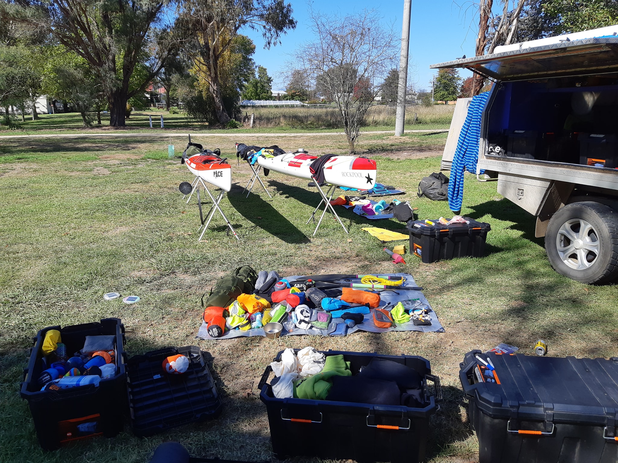
Above: Kayak Loading.
All of this crap has to go into two kayaks
48 days breakfast, and lunch
16 days dinner (The rest are waiting at Torrumbarry and Mildura)
Fuel for 16 days
Toilet paper for 16 days
Clothes for whatever the weather does between April 18th and June 2nd
Tent, sleeping bags, and other sundry stuff.
A couple of books each.
18 Apr 2021
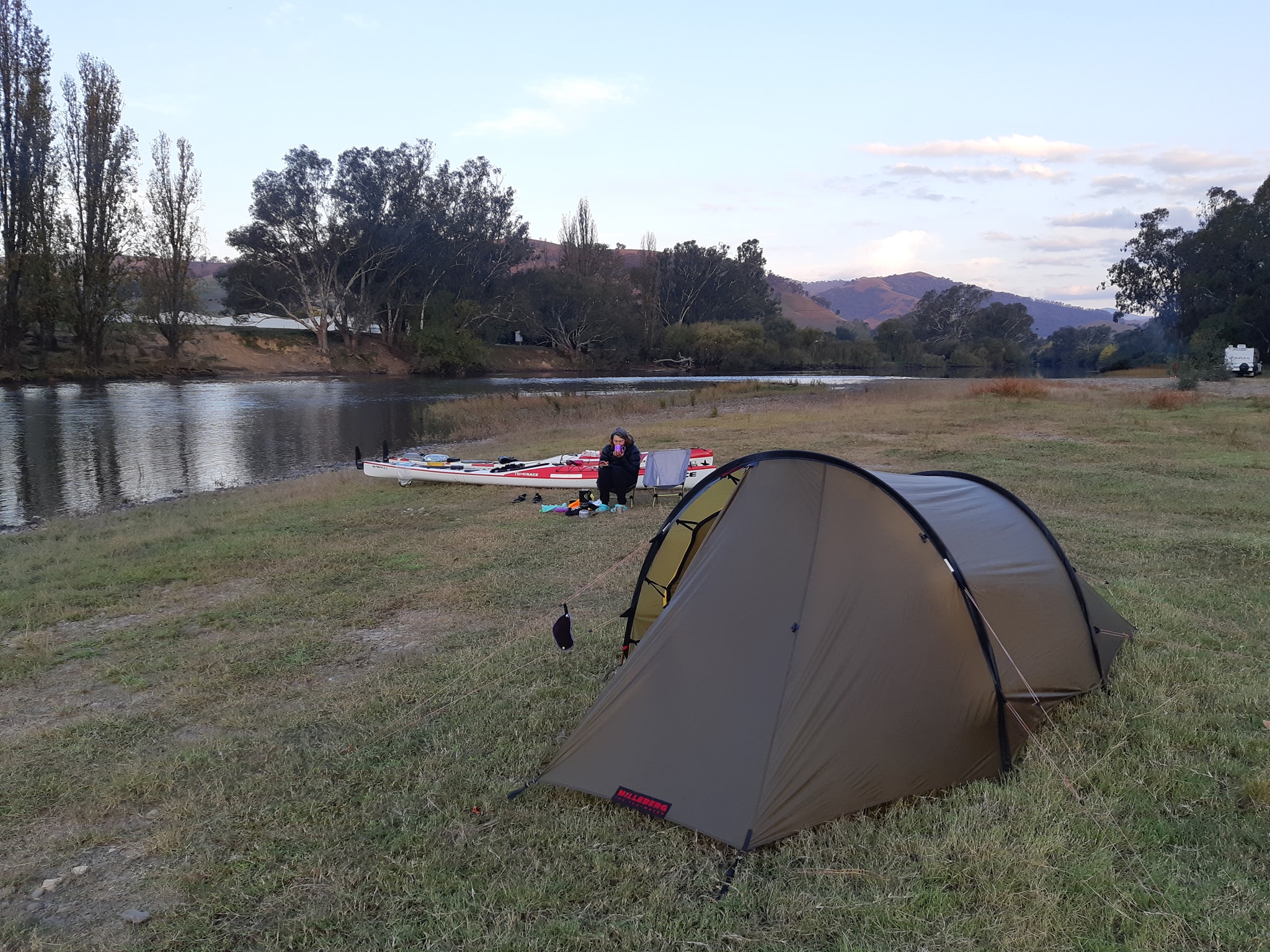
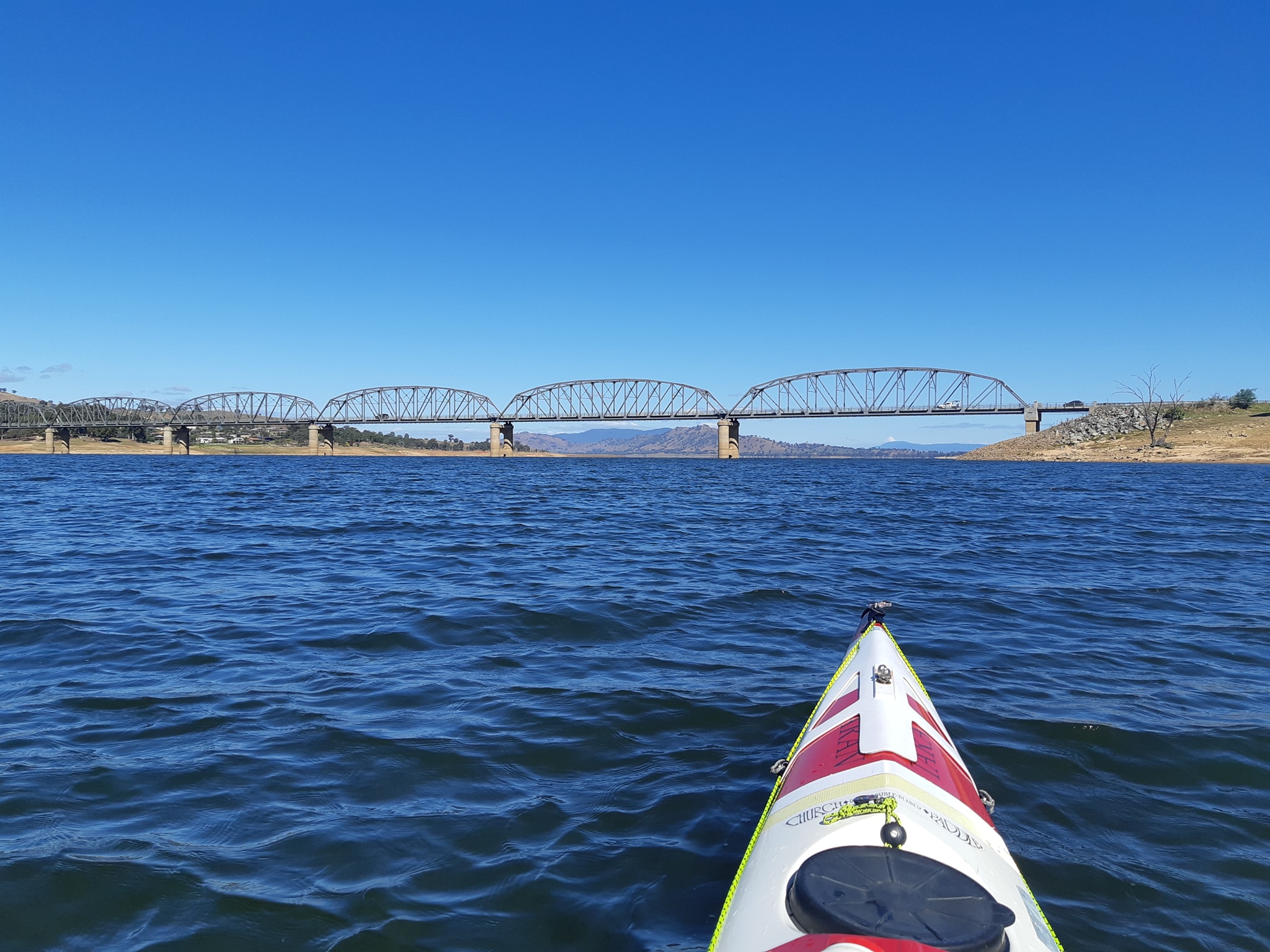
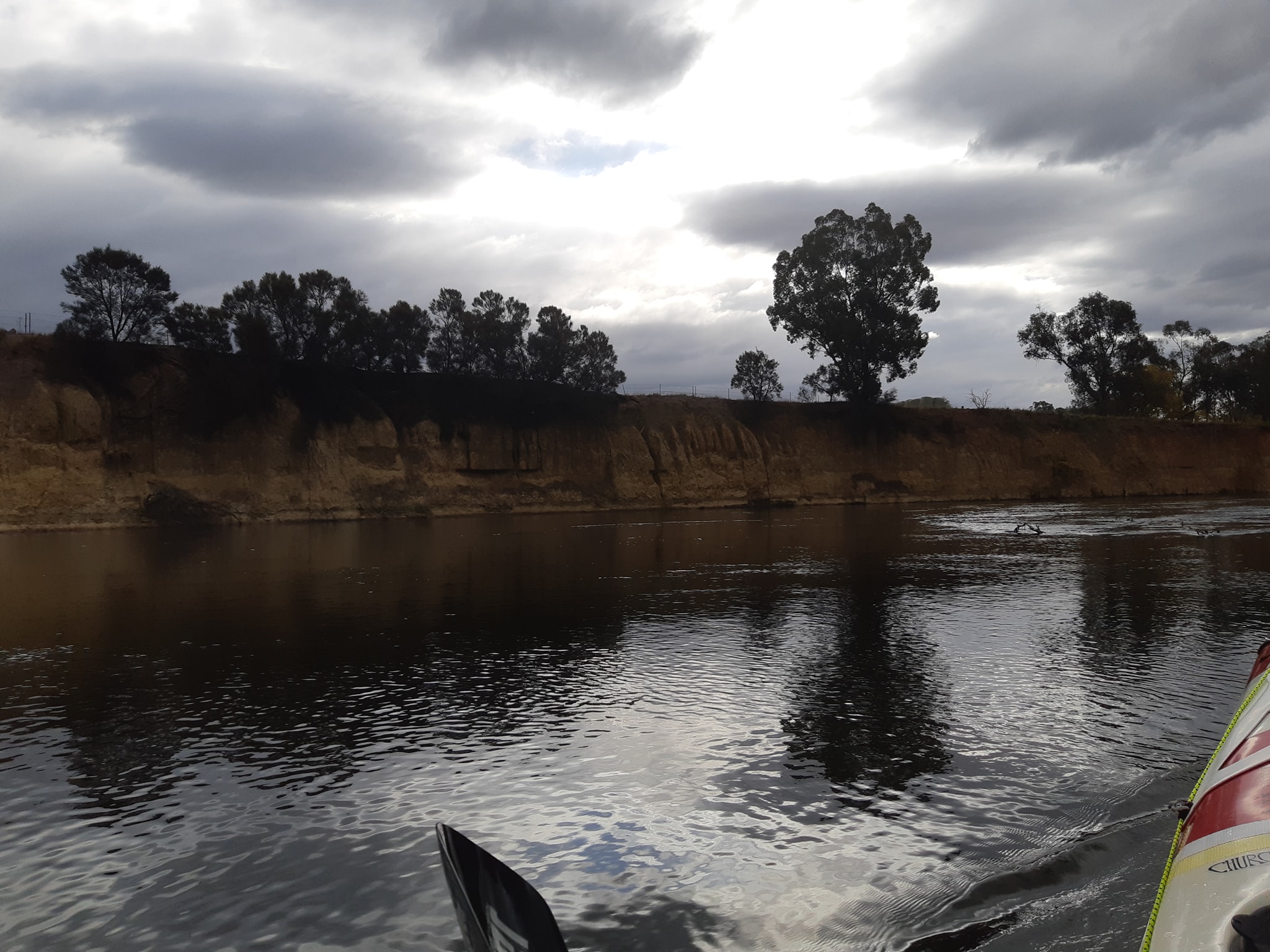
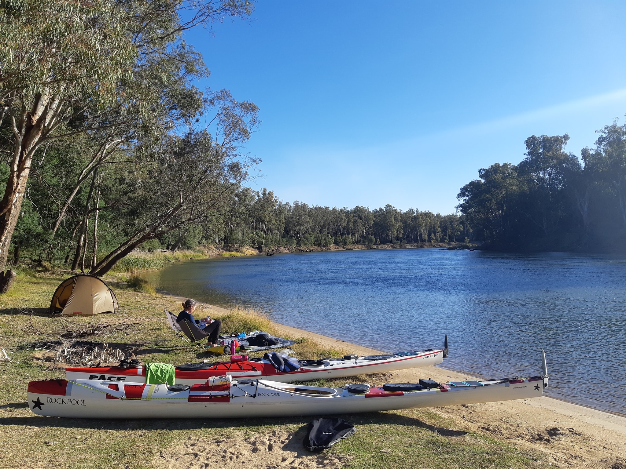
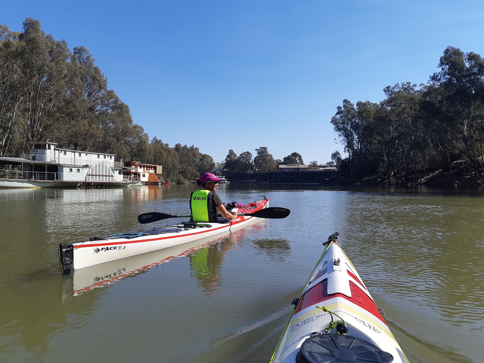
Day one. Late start at Bringenbrong because we needed to square away the truck and camper for 7 weeks of storage. Not particularly thrilled to find a skim of ice on the boats when we woke up. Finally hit the water at 10:45. Water moving quite nicely thank you so we were pelting along at 10-15kph for most of the day. Quite a relief since we haven't had a lot of boat time since leaving Sydney and the muscles need a bit of a gentle ramping up before we hit the slow water downstream behind the weirs and locks. Flew through Towong and Tintaldra, then started looking for a campsite after 4pm. Advice from somebody... The campsite we saw at 3:55 was the best of the day. Other options were fenced off with electric fences, or right in front of a farmer's homestead. Now set up for a night on a sandy beach here... 35°59'34.2"S 147°53'51.2"E
About 2km past Tintaldra.
Above: Icy!
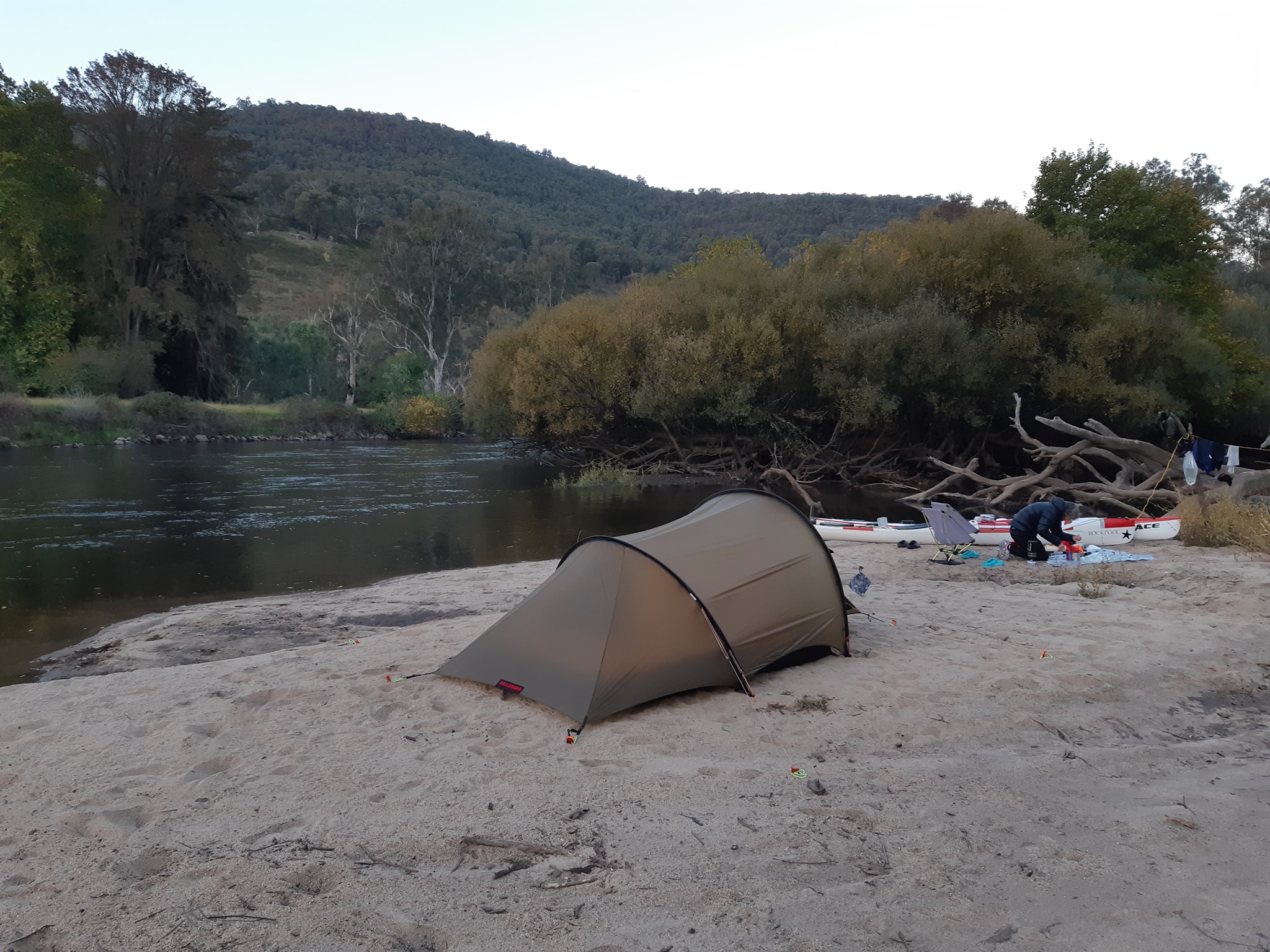
Above: Campsite
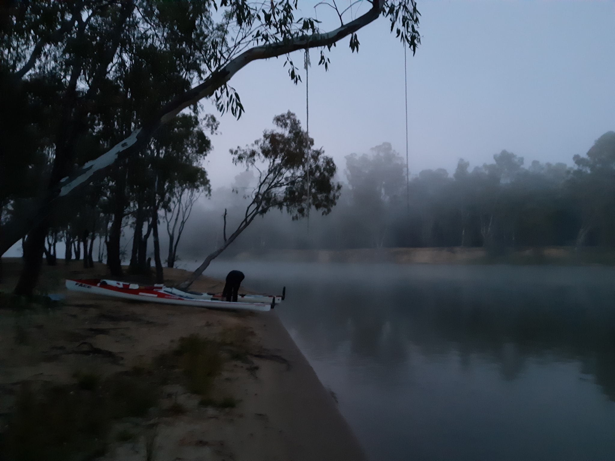
19 Apr 2021
Day 2 of 48. Happy Birthday Kate. No reception here, so I don't know when this one will go out.
Overnight the river mist condensed on every exposed surface. The tent fly was soaked inside and out, which took some drying out time in the morning. Our boat packing seems to be working ok with the regularly used items immediately inside the hatches and the low use stuff like food for downstream shoved deep into the ends of the boats.
The river has widened and picked up some speed today. It rose an inch overnight so maybe somebody has turned the taps on upstream. One large tree almost across the width of the river requiring a hard cross into shallows to avoid it.
60km down for the day, with lunch on the float. An easy 1.5km as we ate our lunch.
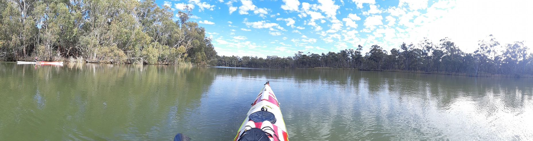
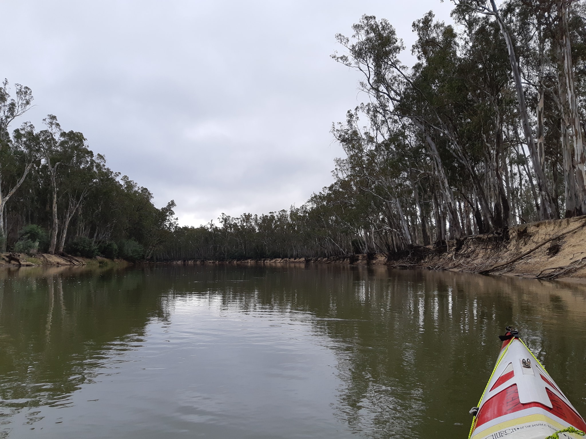
The river is beautiful, lined with gums, willows and some tree which has leaves turning golden in the Autumn. A huge flock of pelicans circled us for a while. Probably 35 or 40.
As we approached our campsite at Borrowye Bend we were a bit concerned to see that there were large hazard reduction burns being conducted, shrouding the river in smoke. Fortunately it cleared just as we rounded the bend to the campsite and the fields are now smoldering downwind of us.
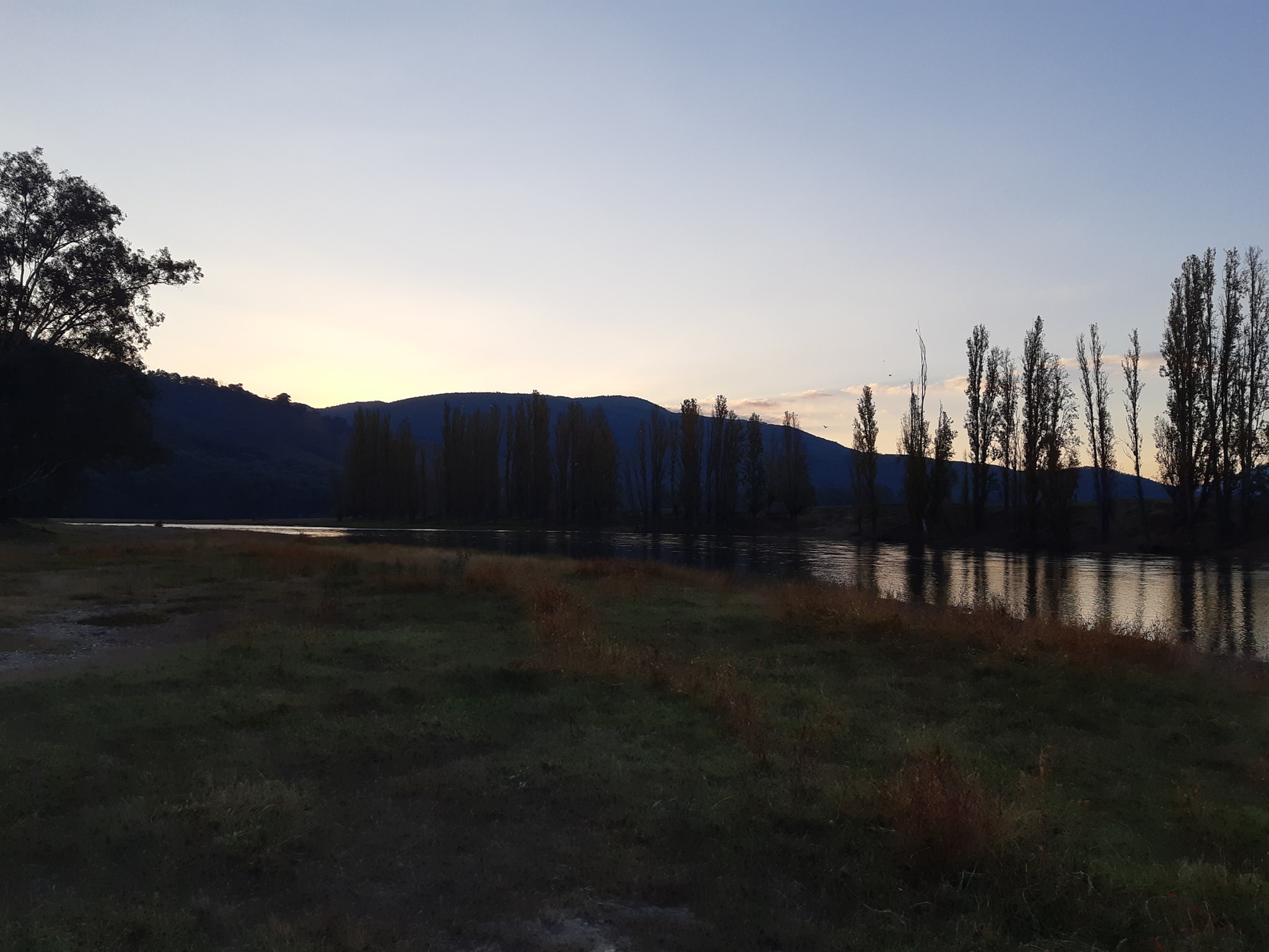
Above: Wide, poplar lined river
Above: Campsite
20 Apr 2021
Murray Paddle Day 3 of 48 (v2 after Facebook lost the first post) The plan for the day was to transition from the upper river section to the open waters of Lake Hume. We'd been using GPS maps to given us advance warning of the upcoming bends in the river and subsequently where the faster flows on the outside of the bends would lie.
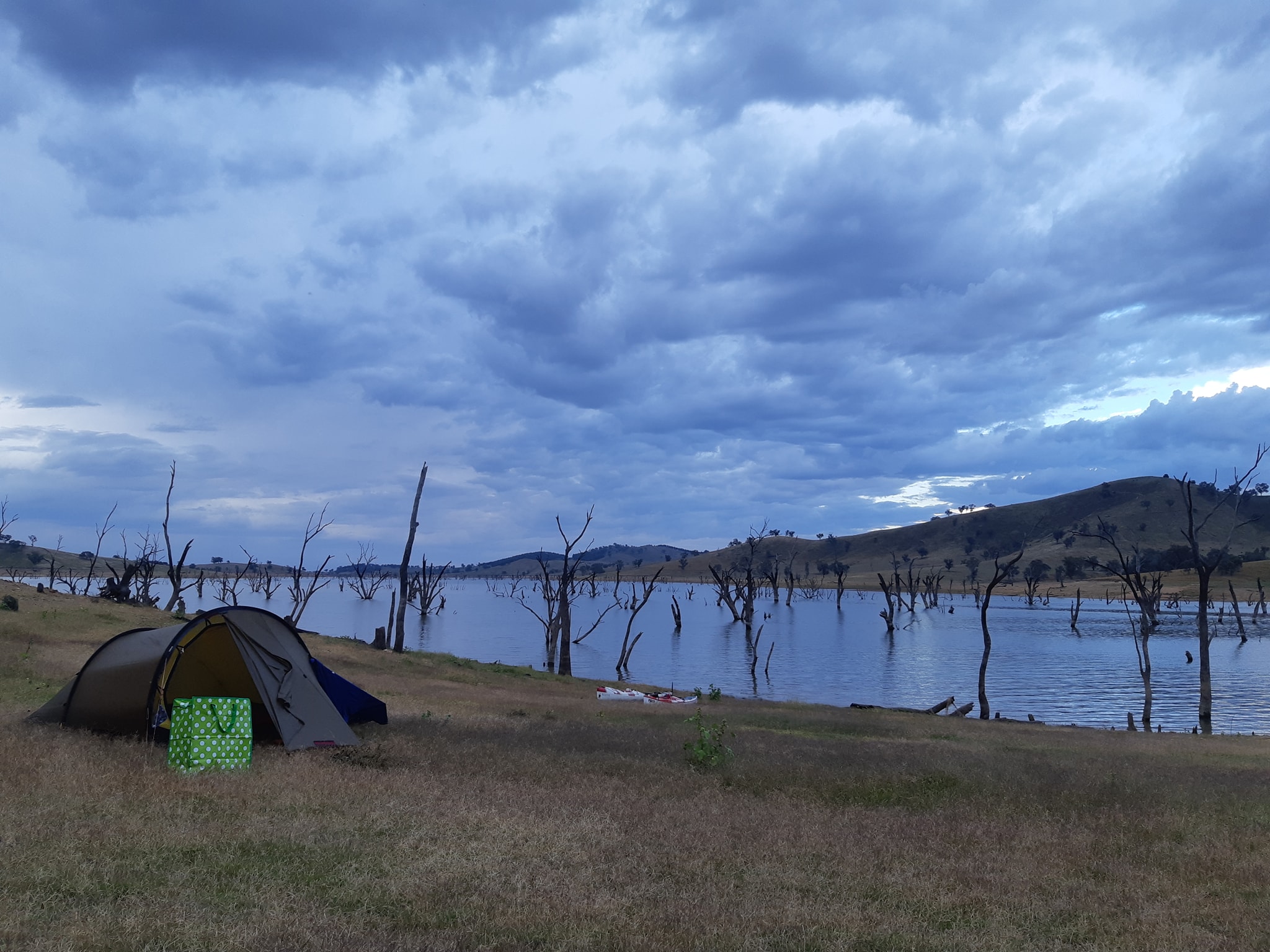
Transition to the lake would been taking longer bearings on distant points to navigate through the arms of the lake. We expected the river to end 18km downstream from our day 2 campsite, leaving us 56km from the Hume Dam. Unfortunately. The maps are a little disconnected from reality. The topographic maps show the lake margins as they would be if the lake was at capacity. It's currently at 44%, and apparently operates mostly between 60% in Spring as it fills with snow melt and 30% in Autumn after the irrigation water is released during Summer. For us that means that there are large areas mapped as "lake" where the reality is lake bottom which is exposed down to the old riverbed.
Above: Campsite
Initially the river just continued further downstream than expected, which was easy to follow. When we finally hit the lake, it was broad expanse of flat water, inviting us to take a direct line across it. The warning sign was a pair of fence posts poking up out of the water with a metal farm gate hung between them. The farm gate was swinging with the bottom of the gate a few inches above the water... if you haven't worked it out yet, that means that there was a very shallow lake extending off in all directions and we no longer knew where the deep passable river bed was because it was lost under water.
Kayaks don't like shallow water and anything shallower than a third of your boat length causes drag and makes paddling much harder than it needs to be. Our first strategy was to follow the line of the VIC-NSW state border as it is defined by the Victorian bank of the Murray River. That worked pretty well. Before long we also worked out that you can follow a corridor created by the dead River gums that must have lined the river before the dam drowned them. That got us through to the real lake where it up longer mattered where the water was deeper.
Out on the lake we got hammered by a head wind which whipped up small waves and slowed us even more than the lack of current across the dam. The lower water level also made finding a campsite more difficult as there is a rocky wasteland zone between the current waters edge and the historic edge 30 or so metres up the steep banks. With a storm front coming straight at us, the barren slopes didn't offer much in the way of flat tent sites or trees for shelter. We ended up camped in a vaguely flat area only metres from the lakeside road. 36°03'04.0"S 147°13'12.4"E
26km to the dam wall tomorrow.
Above: Borderline paddling
21 Apr 2021
Murray Paddle Day 4 of 48. A hard slow grind to the Hume Dam wall with no current and a head wind for the last 20km. The Taran is proving to be a great boat when loaded up. It's cruising speed is barely affected by the extra weight of gear and food, and the handling is possibly better as it shrugs off waves and wind with the extra load weight.
Other things that are working well...
- Synthetic sleeping bags. They may be larger and heavier than the down bags we've been using for hiking. But they aren't bothered by the damp conditions, and there are no cold spots where the down has flattened.
- Nemo Tensor sleeping mats. Thick enough to ignore and rocks and debris under the tent making for a good nights sleep. They're also a snap to inflate with a vortex bag that only takes three breaths.
- The Platypus gravity water filter is making easy work of the silt laden water of the Murray.
- Crocs. Ever fashionable. They're also functional as riverside camp footwear. Light, insulated from the cold ground and easy to clean the mud off.
Things not working do well...
- My Garmin Fenix 6s watch which has died of water ingestion after just 15 months of use. Not happy.
- We should have bought along a few extra drybags to store wet stuff in the boat. Counterintuitive, but every morning the tent fly has been coated inside and out with dew and there's been no time to get it dry. So we want to package it up in a waterproof bag and put it in a hatch while keeping the water out of the hatch.
- We also need to give a little more thought to the distances to the various locks and dams downstream and ensure we aren't arriving too late to pass through and then make the next campsite before 4:30.
After finishing the lake paddle. We were met by Joanne who's given us a bed for the night, fed and entertained us, and will drop us below the dam for a full day back on the river tomorrow.
Above: Not the Hawkesbury bridge
Above: Lake Hume
22 Apr 2021
Murray Paddle Day 5 of 48, and we are past the dam. Hume Dam that is, 2,224km from the sea, the first of two barriers which we are being helped past by generous friends. In this case Joanne Hamilton-Vale and husband Pete who picked us up above the dam, put us up for the night, then cooked us breakfast before sending us on our way from the boat ramp below the dam. If Pete's career in motorsport ever falls on hard times, he could easily make some good coin as a chef. His country style Eggs Benedict was even good enough to satisfy Kate who been well on her way to becoming a vegetarian. 🤫
An afternoon swapping stories with Jo of ultra marathon paddles and shenanigans across the world left us all longing fof the borders to reopen so we could go back and race again.
The water discharged from the dam comes out 10C colder than the river above, being drawn from the bottom of the dam. This has apparently lead to the localised extinction of the Murray Cod in the section of the river between Hume Dam and Yarrawonga which is the next impassable barrier we encounter, 1,986km from the sea, 238km or about 5 days ahead of us.
Counting down the distance to the sea now becomes easier with mile markers (Are they still mile markers when they're in kilometers?) posted on trees every few kilometers on the New South Wales side of the river.
26km and 6 bridges downstream from the dam, we were in the border twin city of Albury-Wodonga. We thought we were familiar with this section of the river, having raced it several times in The Frank Harrison race over the years, but the water level was higher than we were used to and the normally meandering course of gravel banks was wide and flooded with water.
With the water flowing again, we had morning snacks on the float - a mandarin - then lunch - peanut butter in a taco shell for me and hummus in a taco shell for Kate, followed by some mixed nuts and an apple each. While resupply along the river isn't difficult with towns every 2-4 days, we've opted to carry our food for 16 day blocks with us. It's all part of field testing some strategies we hope to use in 2022 when we're able to travel back to Canada for the Yukon 1000, a ten day self supported race through the Yukon, into Alaska. From Albury, the flow of the river was back and we drifted almost a kilometer during our 20 minute lunch break.
As the river has widened we've also changed our line from following the faster flowing water at the outside of the bends to running the shorter path through the inside of the bend and cutting corners between the alternating turns.
If you do the math, a river bend with an inside radius of 100m and an outside radius of 200m is 2 times longer around the outside, so the flow has to be much faster on.the outside to make it worth the longer path. As the river gets wider, the difference just gets bigger.
We even did some experiments to check our theory. We both started on either side of a straight leading into a bend. I positioned for the outside and Kate lined up for the inside. If the outside was faster, combined with my faster boat speed (I'm about 20% faster than Kate when we're both paddling hard), I should exit the bend before Kate on her shorter but slightly slower path. Kate beat me around the bends by a good margin each time.
If you're interested in this sort of stuff. Check out a Facebook page and website called The Science of Paddling, it's very cool and paddle nerdy. This random stream of consciousness will probably get worse as the days turn into weeks on this trip, and we literally go round the bend.
Anyway... having amused ourselves for a few kilometers we finally made our target campsite 60km downstream at Richardson's Bend for an early 3pm finish. Time to set up camp, make a cup of coffee and read a book for a few hours in front of a campfire. After 5 days, we are just s few kilometers ahead of schedule and everything is going well.
We are 10% through our journey and 10% of he way to our fund raising target (link to donate up the top).
23 Apr 2021
Murray Paddle Day 6 of 48 - Richardson's Bend to St Leonard's Bend about 8km short of Corowal.
We were still having our morning coffee when Paul Brooker, another source to sea paddler, paddled past our campsite. We weren't away until about 45 minutes later and ran into him again as he was stopped in Howlong for lunch where he'd met up with two other paddlers (sorry didn't get their names) paddling the river in a double. So with us, Paul. Amy who is a few days ahead, the double, another paddler Norm who passed Amy after Hume Dam, and one more starting in the next week, there are eight paddlers spread over the first 400 odd kilometers of the Murray, all on their way to the sea.
Andrew, the last paddler to start will be hiking and riding from the top of Kosciousco to Biggara where he plans to take a whitewater kayak through the higher reaches of the Murray, switching to a sea kayak at some point down river.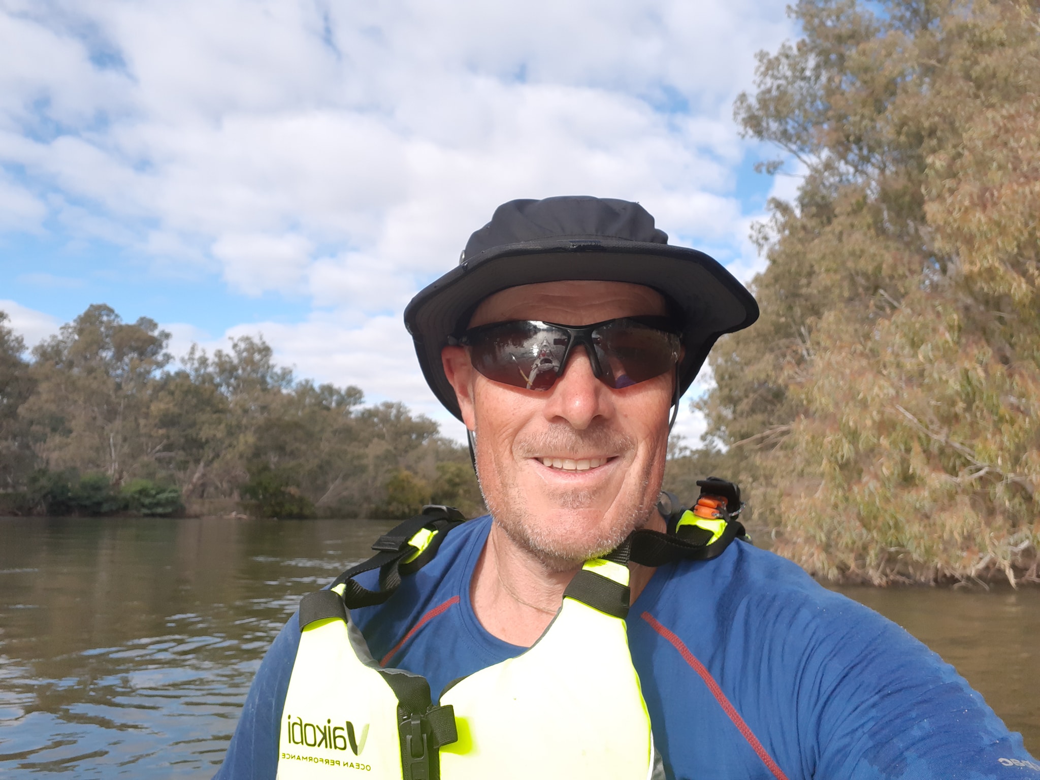 We began our adventure at Bringenbrong which seems to be the generally accepted point from which a competent paddler can safely take a kayak of canoe to the end without needing a second whitewater boat. (Although the day we were scouting we came across some fishermen in an oar rigged jonboat which makes me wonder how much further upstream we could have started with the current river level). Paul started a little down river from us at Towong avoiding the gravel chutes, twists nd snags you get from Bringenbrong to Towong.
I think the section gets a bad wrap from some of the paddlers who have blogged about their experiences. We caught it at a good flow (for us) when it was fast twisty fun, even in fully laden boats. On the other hand it isn't a section I'd recommend to an inexperienced paddler travelling alone. Scouting rapids from the shore would be terribly slow. Many of the snags are blocking more than 75% of the river requiring good boat control and decisive strokes.
The couple in the double began at Hume Dam. Amy started at Walwa about halfway between Bringenbrong and Hume Dam. Everybody has a different idea of what constitutes a Murray River Expedition. The starting points vary according to experience and inclination.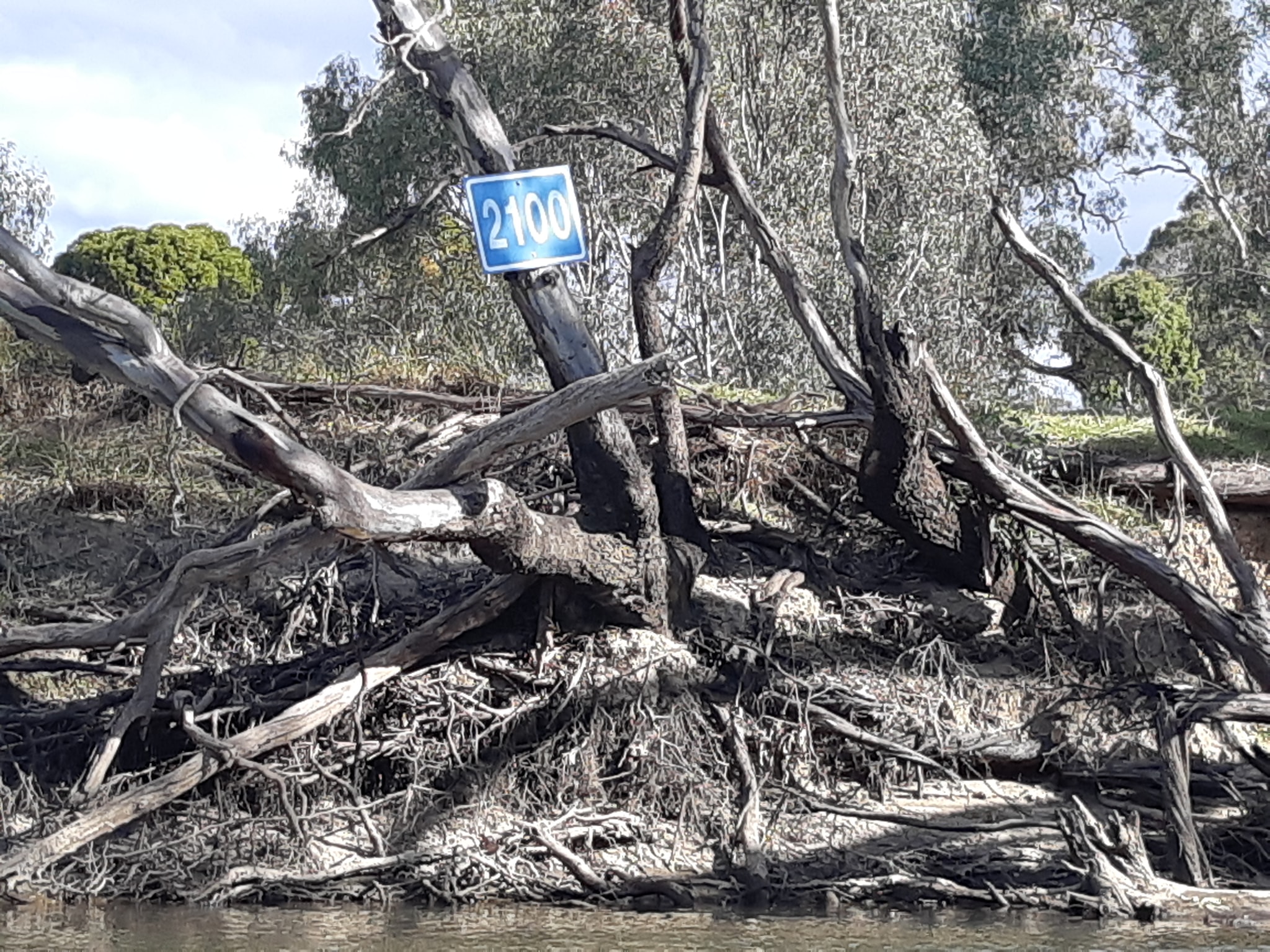 I cant argue with Andrew's True Source to Sea approach except to note that what flows to the sea from the Murray River could have started it's journey from any one of a thousand source creeks across most of South Eastern Australia. Is it true to say that there is a single trickle on the side of Kosciousco that is more essentially Murray than the others? To the purist, must the ultimate source be the highest point in the land?
As we continue downriver, there are forks and splits in the river where we have the option of continuing one way along the cartographers "Murray River' or taking another branch that deviates for long enough to get it's own name, before becoming the Murray River again somewhere downstream.
I cant argue with Andrew's True Source to Sea approach except to note that what flows to the sea from the Murray River could have started it's journey from any one of a thousand source creeks across most of South Eastern Australia. Is it true to say that there is a single trickle on the side of Kosciousco that is more essentially Murray than the others? To the purist, must the ultimate source be the highest point in the land?
As we continue downriver, there are forks and splits in the river where we have the option of continuing one way along the cartographers "Murray River' or taking another branch that deviates for long enough to get it's own name, before becoming the Murray River again somewhere downstream.
All of this is essentially a way of asking ourselves - are we cheating? Are we cheating if we take the old channel across the oxbow which is only open because the river is over it's banks? Are we cheating if we don't record the whole 2400km on our GPS? Which I expect would be measured down the middle of the river.
Will we arrive at the end and find that we aren't allowed to congratulate ourselves on paddling the length of the Murray?
I saw earlier tonight that Paul paddled 80km for the day, starting about a kilometre upstream from us and finishing in Corowal, 8km downstream of our campsite. The first thing that struck me when i saw the post was that we only paddled 61km today... (that's 10km unaccounted for on the same stretch of river). About a 10% difference. If we keep this up, we may only paddle 2200km. Won't that be good? 🙂
Our intention was to paddle from the highest practical access point at Bringenbrong to the sea. With a start point, and an end point, we'll paddle the bit in between except where we can't because of dams, cutting corners, and navigating whichever flow takes us closer to our destination. We're happy with that. We've been having a great time running the inside corners and diving through the gaps in the fallen trees that litter the river. Along the way, we're testing out some techniques that we hope to use on the Yukon 1000 in 2022, if the borders open up by then. I expect that even when we all get to the finish, we may have equally different ideas about where exactly the journey ends.
Anyway, that's today's random musing from 7 hours and 60 kilometres of progress down the river.
We are just past marker 2090, lying in our tent listening to something quite large snorting and splashing in the river down by our kayaks. If I was in Canada I'd be reaching for the bear spray. But since we know it doesn't work on drop bears, we'll just have to be vewy vewy quiet.
24 Apr 2021
Murray Paddle Day 7 of 48 - St Leonard's Bend to Collendina State Forest 5km short of Bundelong.
Today's random musing was going to be about river flow. We were padfling along and I was calculating that if the river flows at an average of 3kph for 24 hours then it covers 72km a day. While we paddle for 7 hours a day between breakkng and making camp, covering 50-60km a day.
This leads me to two conclusions...
1) if we sat in our boats and drifted, we'd get to the sea faster than if we paddle; and
2) it's quite likely that I've drunk some of the water from the Murray more than once. Thankfully increasingly diluted
But then the day became more interesting so I gave a story to tell instead
We started our day just past marker 2090 and ended up just short of marker 2028. Having paddled 42km in between the two. We misplaced another 18km.
As we entered the town of Corowa we crossed under our 13th bridge of the journey and entered the realm of the Murray River houseboat. Being the weekend it was also our first encounter with powered water craft. Fishermen were out in numbers as well as a few petrol-heads who were just racing up and down the river, turning petrol into exhaust fumes and noise.
We came across one fishermen who's motor had died leaving him drifting in the current. I offered to tow him in exchange for a cold beer or two but he said his campsite was downstream so he'd just drift along and drink the beer himself.
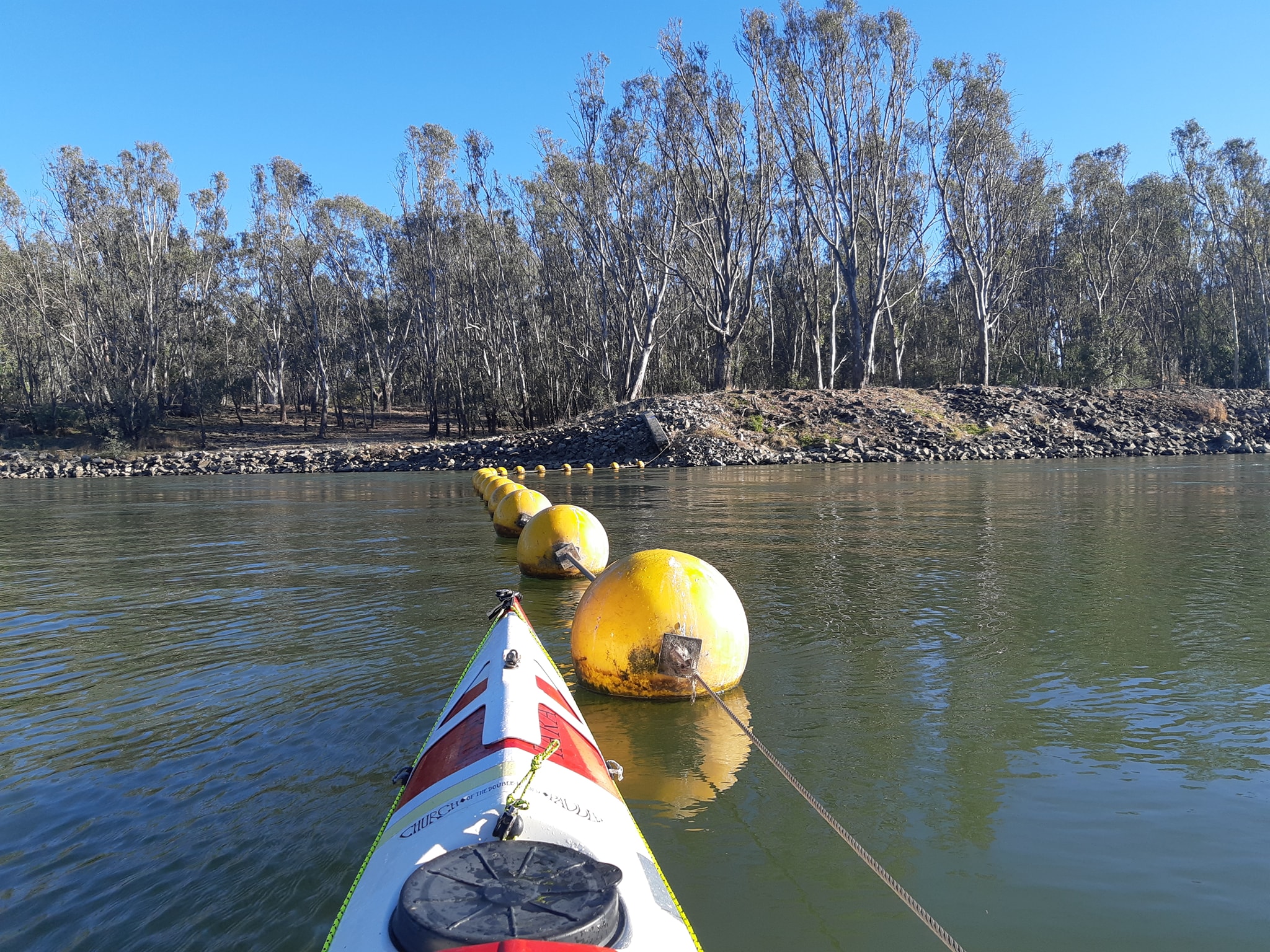
As others have warned us, we've entered the wetland area above Yarrawonga and there are many many different channels to choose from (see pic). From the water it's possible to just follow the flow, but we are searching for the short routes so we end up referring to maps and GPS on the fly.
Our main map set is the Murray River Access Guide Books which are fortunately available via a phone app. They show the river and details relevant to our travels and we refer to them every 5-10 kilometers. Once we have an idea of what's coming up, we use our Garmjn eTrex GPSs with topographic maps to choose the necessary forks and turns on the run. What we have noticed today is that Kate's GPS with a map from 2006 shows different channels to mine with a map from 2016. Surprisingly, mine has been wrong as many times as hers today. We paddled a fast moving channel that was 60-80m wide and 5km long. My map showed a creek-like hairline. Kate's showed a wide channel.
We made good gains on two of the alternates and then ran into a barrier of broken concrete and rubble which had been bulldozed across another to form a farm bridge. This was after a nearby fisherman had told us the channel was clear and he took his boat through all the time. I was just about to tell Kate to slap me next time I asked navigation advice from a beer drinking fishing potato when things got interesting.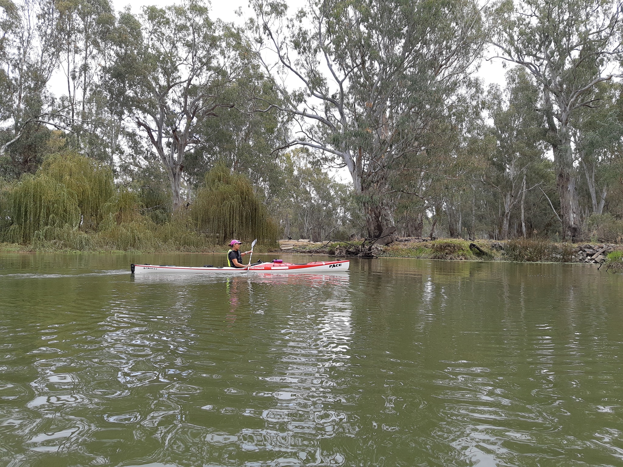 We were back tracking out of the blocked channel when a jet ski came roaring towards Kate and lunged to a halt. I was all set to give the new arrival a verbal spray, when I spotted the blue jumpsuit, and the NSW maritime patches on his shoulders and the jetski. "Are you the Dawsons?"
So obviously this wasn't about us trying to navigate a blocked backwater through somebodies farm, and we were wearing our PFDs (hi-vis yellow so there's no excuse for the skiboats not seeing us).
We were back tracking out of the blocked channel when a jet ski came roaring towards Kate and lunged to a halt. I was all set to give the new arrival a verbal spray, when I spotted the blue jumpsuit, and the NSW maritime patches on his shoulders and the jetski. "Are you the Dawsons?"
So obviously this wasn't about us trying to navigate a blocked backwater through somebodies farm, and we were wearing our PFDs (hi-vis yellow so there's no excuse for the skiboats not seeing us). 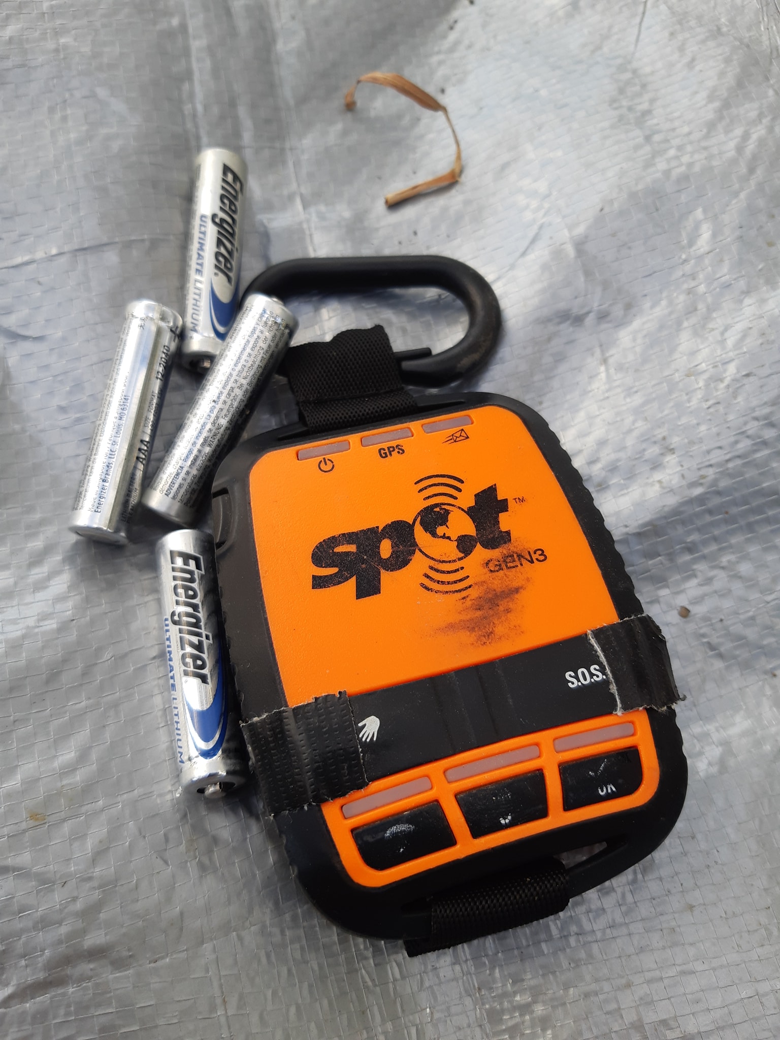 This guy knew who we were... I got that sinking feeling that we've been here before... In 2019 we raced the Yukon River Quest and were visited by a search party from the RCMP (The Mounties, who disappointingly dress like normal police when it's not Canada Day) Our SPOT tracker has malfunctioned and sent an SOS. It did that five more times during the 700km race before we swapped it for a replacement.
Sure enough it has happened again with a new device. At 11:30sm our SPOT started transmitting an SOS in addition to its 5 minute tracking updates. The police coming downstream found us at 13:30, and the SES volunteers coming upstream found us about 10 minutes later. They were pleased to find that we were safe and well, and remained quite good humoured about being called out on a Saturday morning. Their first assumption that we'd accidentally activated the device was disproved when I showed them that the safety covers over the help and SOS buttons were covered over with duct tape. We'd been with a hiking party in Tasmania who had got an evening visit from a rescue helicopter crew after accidentally depressing the SOS button an InReach shoved inside a backpack. I'd put the tape on my spot the next day.
What was surprising was that the police had been forced to search the river for us because the SPOT control centre hadn't passed on info about the position updates we were sending every five minutes. During a conversation between the police and SPOT about it being a fault in the unit, the SPOT operator asked if it was possible that we might have got it wet? If you're thinking about buying a SPOT, don't.
We assured the search team that we were fine and that we carry a real PLB each which we will use if we really get in trouble over the next 2000km. We've pulled the batteries out of the SPOT to keep it from causing more trouble. We then spent the next hour contacting our kids who are our listed emergency contacts. They'd initially been concerned, except for "B" who'd been our contact in Canada and was convinced it was a false alarm again. "L" was pretty sure we would be evacuating ourselves and wouldn't need help. "G" was sure we were in good hands so went shopping for lounge furniture. "R" hasn't checked his messages yet.
Tomorrow we make a push for Yarrawonga weir and the second obstacle on our journey that requires some external assistance. From the bottom of the weir, we will be back on the familiar waters where the Massive Murray Paddle aka The Murray Marathon is held. We've raced 404 of the 550 odd kilometres from there to Swan Hill so it will be familiar yet different to do it in ten days instead of five
25 Apr 21
Murray Paddle Day 8 of 48 - Collendina State Forest to Yarrawonga - 1986km to go Blisters 1
So here we are in Yarrawonga staring across the river at the 1986 mile marker. According to the upper river markers on the Victorian side, we are now 439km from our starting point at Bringenbrong Bridge. With eight days behind us, it feels like it's time to talk about our charity - Coast Shelter and the work they do before continuing with the ramblings. We are paddling this river for lots of reasons. We've always wanted to test ourselves against the challenge of the 2400km journey; we wanted to get back to paddle fitness after nearly a year travelling around the country; and I'll admit I was trying to distract Kate from the idea of hiking the 1000km Bibbulmun Track in Western Australia.
But it was also an.opportunity to use our adventure as a way to do something for a worthy charity. I chose Coast Shelter after talking to a friend who found herself in an abusive and dangerous relationship. She turned to Coast Shelter and they provided the shelter, and support, that allowed her to escape the relationship and start building a new life in safety.
We were workmates and friends. Not close friends, but close enough that I'd like to say we would have helped out if we had known or been asked. So now we are trying to help by sharing our adventure with you all in exchange for a little bit of your time, and your support, and your willingness to help them help more people like my friend.
Judy's Story
Judy was a 55 year old lady who had been admitted to Gosford Hospital with bruising and a possible rib fracture as a result of severe domestic violence. Police had arrived at Judy’s house after her neighbours reported screaming and immediately took out an AVO against her abusive partner. As it was unsafe for Judy to return home, she came to Kara Women and Children's Refuge with just the clothes on her back.
Staff were able to provide Judy with clothing and toiletries until a time could be arranged with local Police to accompany her home, so that she could collect her belongings. Through the Housing NSW Start Safely Program, Judy was able to secure a one-bedroom private rental in a new area where she could feel safe.
Judy keeps in touch with Kara staff and has made new friends through a Domestic Violence Support Group that she attends weekly. Judy is looking forward to a bright new future and will no longer live in fear.
Laurens Story
Lauren came to Maya Young Women's Refuge after she was unable to live at home due to the ongoing violence and abuse she was suffering. Lauren arrived in a very chaotic state and at first, struggled to adjust to the routine at Maya. Unfortunately, this caused her to rebel and she failed to return home to the Refuge on a number of occasions. Eventually, with extra support from staff, Lauren settled in and started to enjoy and rely on the structure and positive household at Maya. She reengaged with schooling, regularly attended TAFE and even obtained a part-time job which was fantastic for her confidence.
As it was unsafe for Lauren to return home, she actively looked for accommodation while saving for a bond. Lauren ended up moving to her aunty’s house in Sydney and is now working full time as a trainee chef, which she is enjoying immensely. It was a fantastic result for a young lady who was committed to turn her life around and create a positive future for herself. To make a donation to Coast Shelter and help women like Judy and Lauren, click the link to our charity fund raising campaign. If you are in Australia, Coast Shelter is s registered charity and the donations are tax deductible. (Thanks to our wonderful friend Bernie Cairns for pointing that out)
We can now return you to our scheduled programming...
The 439km from Bringenbrong is around the same distance as the Texas Water Safari with a very similar progression from stream to creek to river to a grinding slog across a wide expanse of water with no current.
Kate in particular isn't enjoying the still lakewater, the inevitable head winds and the weight of the loaded boat. Our decision to paddle single kayaks might seem strange to some people, especially those who know we have a double sea kayak and a tandem canoe in storage at the back of the rack at Expedition Kayaks (deserving of a plug as our favorite equipment supplier and enthusiastic supporter)
The tandem canoe, a Wenonah Minnesota II, would have been great for the load capaciity. The idea of carrying full sized camp chairs, fresh food, an esky (ice chest, chillibin, cooler) and other luxuries was very tempting but in the end we havent been able to get the seating right for Kate over more than 3-4 hours. With a trip that would probably mean a duration of closer to 60 days or 400 hours in the seat. Our North Shore Atlantic II double sea kayak was a definite contender for the trip. It's deceptively quick for its 6.0m length and 60cm beam. It's even won a race - the 111km Hawkesbury Classic. But it has two downsides. Firstly there's less storage in a double than there is in two singles. and way less than a tandem canoe. Secondly, and this was the deal killer, it's a wet ride for whoever sits in the front seat because with our high angle marathon racing stroke, the paddler in the back (usually me, because I'm not allowed to steer when Kate's in the boat since "the incident") throws paddle drips at the person in the front, leaving them permanently soaked and cold.
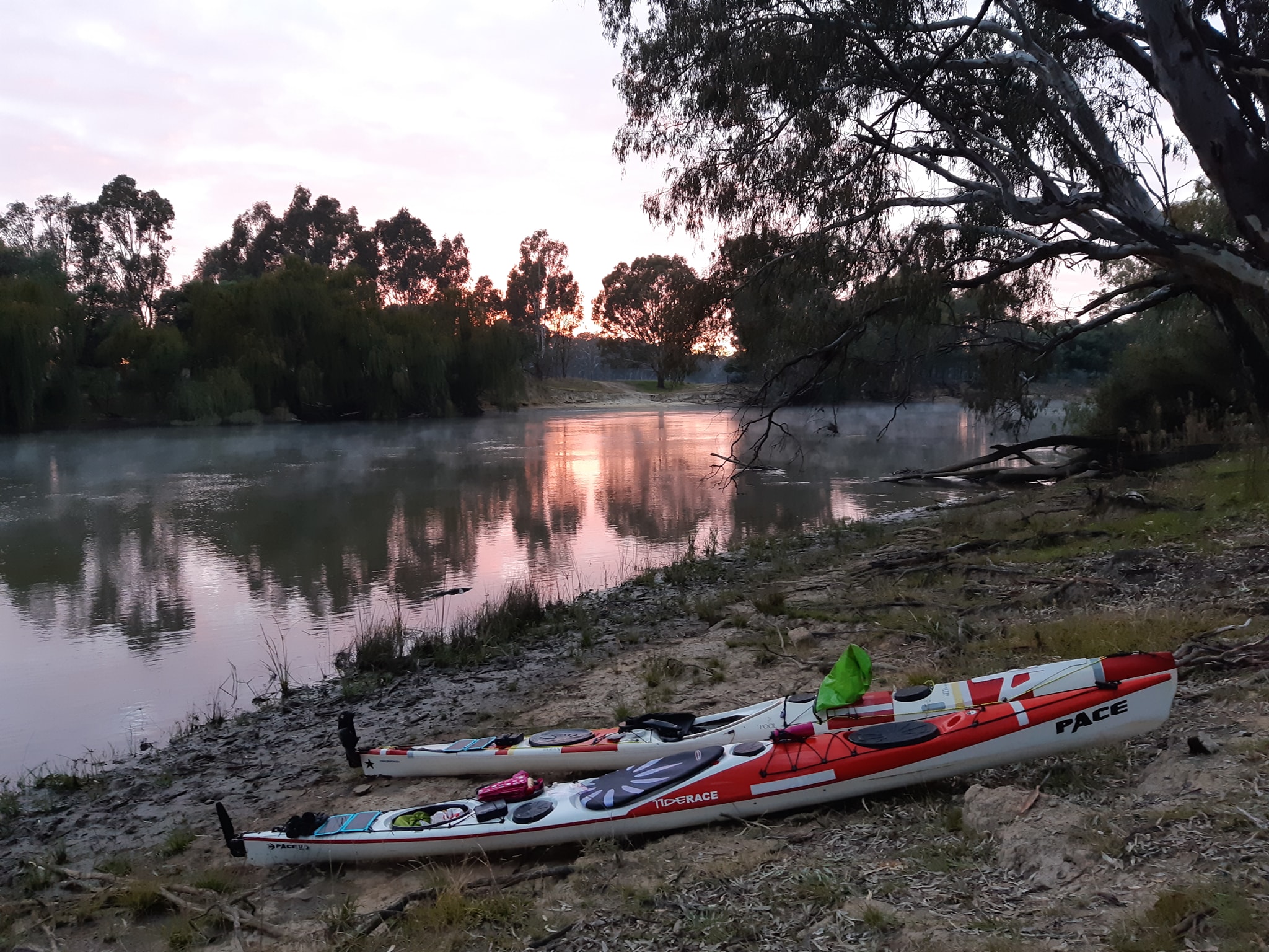
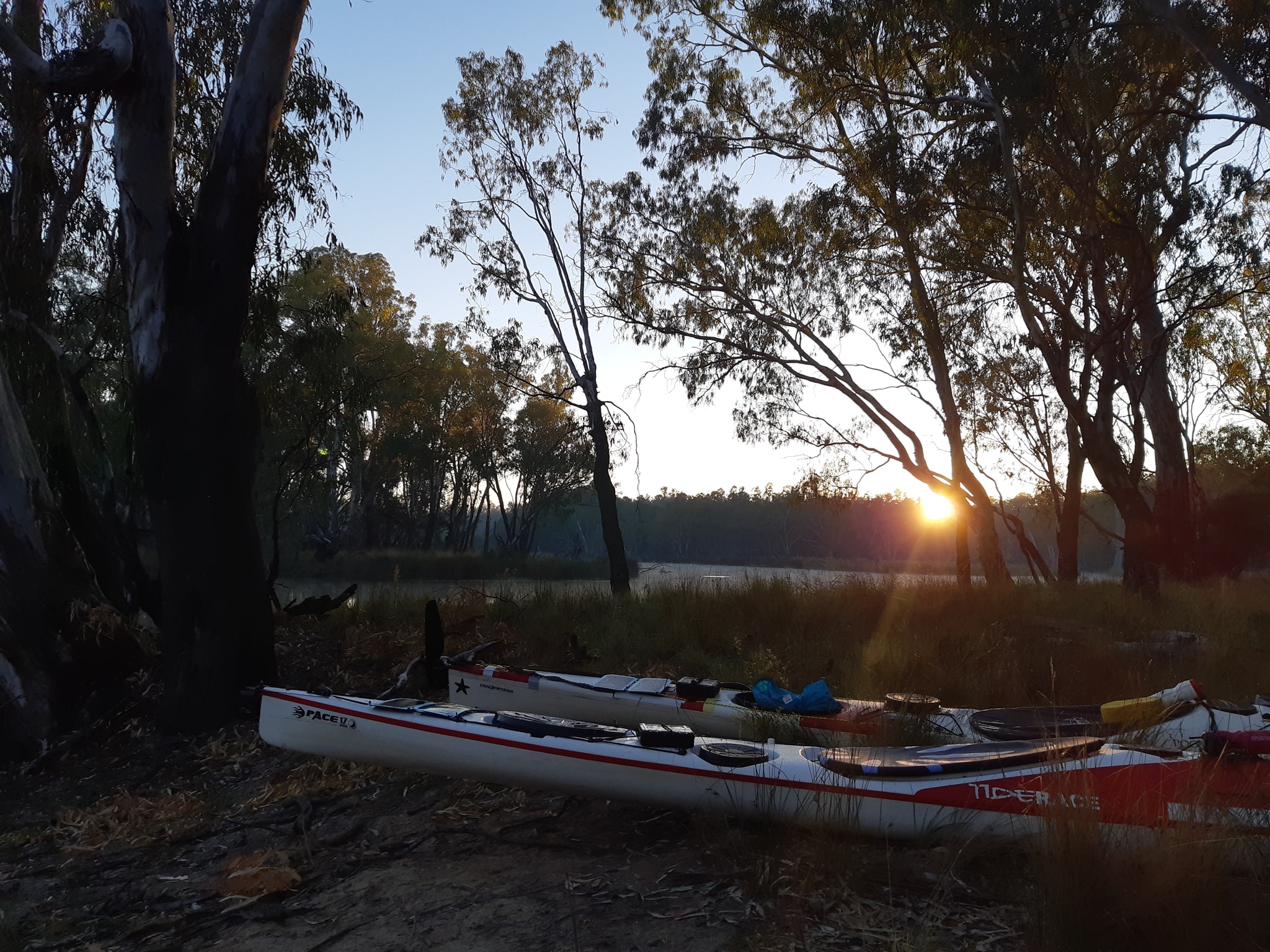
So we chose our single sea kayaks. Mine is a Rockpool Taran, and Kate's a Tiderace Pace. They are both fast sea touring kayaks.each with a plumb bow like a surfski, a rudder. and watertight compartments separated by bulkheads There's a stack of storage to the point that we haven't had to think very hard about what gear we couldn't fit in the boats or how we squeeze everything back in each morning. The main drawback of the singles is that we havr a speed differential between us of 15-20%. I'm not good at paddling slow because it just isn't my natural rhythm and if I do slow down my cadence, it slips back up a gear whenever my attention starts to wander. But we've managed 439km so far with Kate paddling away relentlessly and me stopping every so often to check maps or consult my GPS.
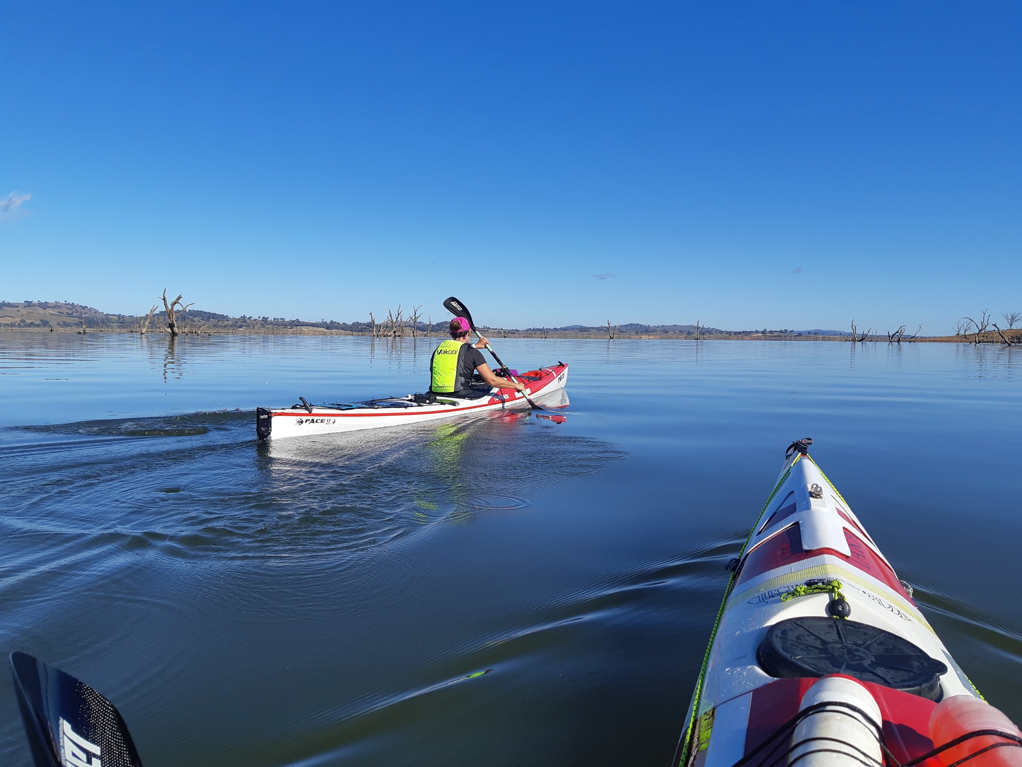
Incidentally for the ultra marathon racers out there. We both got over 50 hours of tracking time from a fresh pair of Lithium AA batteries in our Garmin eTrex 20 series devices with the backlights off. Today however the GPS maps and the River Access Guidebooks were all a bit useless as we liberated ourselves from the multi channelled wet land and emerged into the upper reaches of Lake Mulwala, the final transition before arriving in Yarrawonga. We'd camped the previous night at the entrance to a short 500m shortcut hannel which led to another shortcut, bypassing a 4km looking section of the main river. Or at least that's what the map showed. Actually my map showed the area as dry land Kate's showed a channel and the guidebook showed an even bigger channel. This was the same route I posted a pic of yesterday. We made it 550m before we ran into a wall of reeds and weeds, choking the channel. Forcing us to back track a kilometer to our campsite and then take the long way round. Overall, 5km travel when we expected 0.5km. Back in a major channel our hit rate remained at about 50% with half the shortcuts we entered ending in passable vegetation or fallen trees
Eventuallt we emerged into the lake near the town of Bundelong from which it's a fairly direct transit to Yarrawonga. Like many dammed lakes Mulwala is littered with the ghosts of trees drowned by the forming of the lake behind the dam. We ignored the meandering path of the submerged Murray river bed and took a direct line across the lake as soon as we had open water in front of us. The crossing was incessantly interrupted by water weed getting caught on our rudders. We would get 30-50 paddle stroke in before having to pull on the rudder uphaul to dump the weed off the rudder blade. The maps had one last chance to let us down on the approach to Yarrawonga a boat ramp was indicated just a few hundred metres upstresm from.the dam wall, bit it doesn't exist and by the look of the resort in its place. It hasn't existed for a few years.
We diverted to the other side of the dam approach and pulled ourselves out of the lake and into an empty lot awsiting the start of some construction. Local paddler Tim Roadley had kindly offered to shuttle our boats and gear from above the dam to a boat ramp in the caravan park below With much of the day gone the chance for a hot shower and the convenience of a toilet that doesn't involve a shovel, we decided to check in for a night at the caravan park Tomorrow we leave Yarrawonga and follow the course of the Murray Marathon (now the Massive Murray Paddle) for the next 250km to the river port of Echuca. We're not sure what our progress will be like down the river as the flow from here is controlled by whatever is being released from the dam we can see upstream.
26 Apr 21
Murray Paddle Day 9 of 48 - Yarrawonga to Cobram Beach
Distance remaining 1926 km
Blisters 0
Bridges: 13
Location: here
As we climbed into our boats this morning at Yarrawonga it was hard not to think of the other times we've paddled this section of the river. From Yarrawonga to Tocumwal 97km downstream is the course for day one of the 5 day. 404km, Massive Murray Paddle. Once known as the Red Cross Murray Marathon. Kate and I have raced the marathon four times since 2016 so this is a familiar stretch of water. What's different this time is doing it at 3/4 of the pace.
In racing trim, our lightweight carbon fibre kayaks, weighing 11-12kg are bare of any weight except water and electrolytes - no more than 4 litres for the section, and enough energy gel sachets for one every hour with a spare. In our racing double we've covered the 97km in 7 hours and 6 seconds. Today in our sea kayaks, we paddled for 7 hours and only made it 60km.
Loaded with gear for an extended trip, our sea kayaks are so heavy that it takes both of us to lift them and we struggle to carry them any distance when they're loaded. The base weights are around 25kg and they're loaded with at least that much again. We haven't weighed them. We don't want to know. It was a beautiful day with a clear blue sky. The river is running but perhaps a touch slower than the we had experienced upriver.
While we paddled away the kilometres we had another go at validating our corner cutting race strategy. After an hour of Kate cutting corners and me hanging wide in the faster flow, I'd paddled 1.3km further than her to wind up 300metres behind her.
I can see why people like the fast water at the outside of the bends... my gps speed was around 10-11 kph conpared to Kate at 9-9.5 kph on the inside. You'd think if your boat is moving faster than the other persons you're going to be ahead, but the extra distance kills the advantage. The only reason Kate ended up 300m in front of me was that there were some long straights where I could make back some distance. Otherwise she would have been further ahead.
By now you're thinking that this isn't supposed to be a race. And you're right. But this does have a practical application. As I said yesterday there's a big speed differential between us in our singles and I've been spending a little chunk of each day so far stopped or floating and waiting for Kate to catch up. Now that the river has widened, i can paddle a wider line and end up beside Kate by paddling more kilometres at a slightly faster pace
It does make for confusing progress tracking. We paddled from mile marker 1986 to marker 1926 (they count down to the sea), 60km by river markers. Kate had only logged 52km on her GPS and mine was showing 55km.
27 Apr 21
Murray Paddle Day 10 of 48 - Seppels Beach to Doctors Beach, 16km past Tocumwal
Distance remaining 1870 km
Blisters 0
Bridges: 18
Location: 35°48'50.4" S, 145°28'04.1" E
So the counr of consecutive paddling days has finally made it to double digits and we"re both very happy, if not a little amazed that while we've broken some equipment, the anatomical damage has been confined to a handful of blisters and some aching shoulders.
Unconventionally our preparation for this adventure didn't include months of paddle fitness to toughen up out hands and bums. It didn't actually include months of anything as we've been hiking in TAS all summer with every intention of a pending the colder months in Northern Queensland.
What does seem to help is that we both have good paddle technique from enfurance racing pre-Covid. Since leaving Bringebrong we've gone from zero paddling to day after day of 50-60km.
Based on a quick calculation. I'm.expecting to grind through 1.5M paddle strokes on our way to Goolws.. f you're considering this kind of adventure, a good forward stroke is probably the most important thing you can bring on the trip. Even s single stroke clinic with a good coach will make a huge difference to your endurance. And lower your wear and tear.
Progresing downstream banks are becoming more crowded as we gp. Every few kilometers there are caravans parked and tents pitched on the beaches and river banks. Finding a campsite isn't difficult here, if you don't mind neighbours.
With the increase in campers comes the increasing frequency of the small room with the big view setup. This common camp set up is where an ensuite tent is positioned on the beach facing out across the river so the occupant can contemplate the wonders of the australian bush whlle on the portaloo. Usual the occupant is not expecting a close proximity visit from a pair of kayakers cutting close to the corner. Another variation, the shower tent with a view is also popular in summer.
Also competing for campsite space are seven groups of year 8 students from Ballarat, paddling tandem canoes. Its always fun to watch students in tandem weaving and careening around on the water like drunken honey bees.
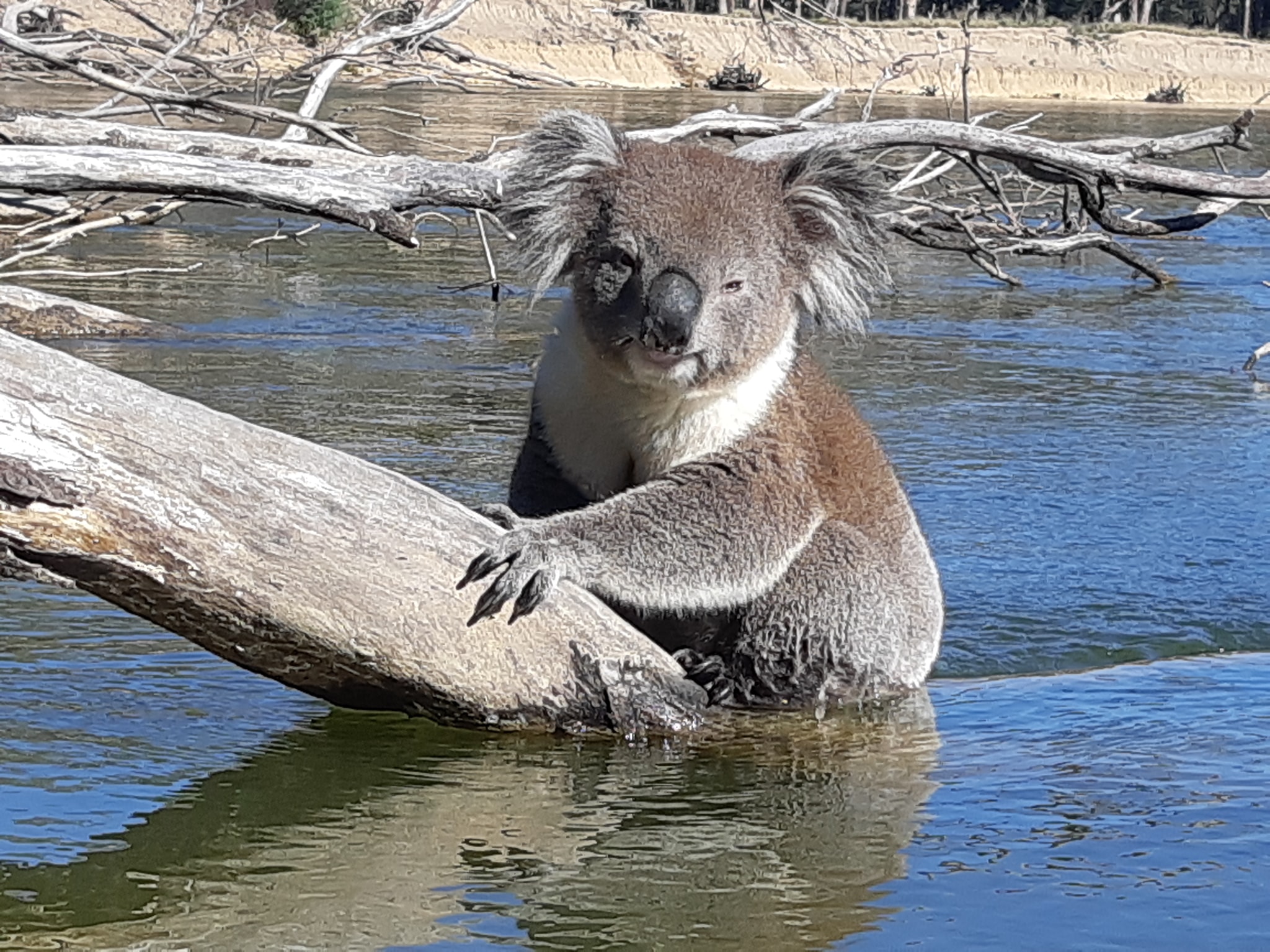
After 14 years living in Australia I finally had a close up encounter with a koala in the wild. Not the grey fuzzy maybe-it-is-maybe-it-isn't blob high in eucalyptus. This one had climbed down onto a fallen branch to get to the river fof a drink. I called Kate over and we spent 10 minutes watching him ignore us completely. Kate spotted another koala high in a tree half an hour later. But once you've seen one. You've seen em all.
Along with campers comes fishermen and I managed to paddle into a fishing line today. Luckily the hook failed to catch on anything as it whizzed past and the fisherman didn't seem too upset at having their line relocated.
More scenery today which is familiar from the Murray Marathon and yet unfamiliar at a slower pace. We cruised into the end of Day 10 at Tocumwal just after lunch, tied our kayaks up to a tree by the boat ramp and ducked across the road to visit the bakery for a milkshake and a slice. Every other time we've been to Tocumwal, the race officials and support crews for other teams have picked the bakery clean of everything except a food-free pastie and a spinach quiche. Adding insult to injury, they then proceed to tell us how good the carrot cake is and that we should get some if we come back when its there. Returning to our boats we discovered the tree we moored them to is home to the entire local population of Corellas all of which ard apparently incontinent.
Tomorrow we continue downstream to somewhere near picnic point
28 Apr 21
Murray Paddle Day 11 of 48 - Doctors Beach to Sixty Mile Bend in Barmah National Park
Distance remaining 1811 km
Blisters 0
Bridges: 18
Location: 35°49'24.9" S, 145°07'08.2" E
The fast flowing descent from Bringenbrong to Hume and the wet lands from Hume to Yarrawonga are behind us and we are now settling into a rhythm for the long haul ahead.
The day begins around first light when we take the shovel for a walk into the bushes. We boil some water in the Jetboil for a hot drink. Tea for Kate and a decaf coffee for me. And then we boil some more for porridge while we drink our first cup.
In between coffee and porridge we pack away the sleeping bags, mattresses, inflatable pillows and sleeping bag liners. Then we detach the inner from the tent, leaving the fly and ground sheet to dry. We're finding that the tent fly is always wet on both inside and outside from the river mist. It's almost never dry before we are ready to leave, so we burriito wrap it in the waterproof ground sheet and pack it wet. A final hot drink while we wait for the sun to rise high enough to give us some warmth.
Packing the boats is a quick process now with everything having a well established position. I'm my boat, the camping gear is all in the front hatch except for my sleeping bag which only fits in the rear hatch. The rear hatch has a loose bag on clothes which are the last thing into the boat in the morning, as I switch into my paddling gear, and one of the first things out of the boat at the end of the day.
Typically, we are on the water at 8:45 give or take 10 minutes. We paddle until 10:30 when we have a morning snack on the float. Usually that's a museli bar or a piece of fruit like a mandarin. Our next break is at 12:30 for lunch, by which time we've usually paddled 30km. Lunch consists of taco pockets filled with peanut butter for me and hummus for Kate, a handful of mixed nuts and an apple. Again we're eating on the float, drifting along while keeping an eye out for snags in the river.
By 1pm, lunch is over and its back to paddling for another few hours.
By 3pm, we've usually logged 50km on our GPS which is our target distance for the day. There's an ongoing discrepancy between the distances we record on GPS and the marked river kilometers. Kate's 52.6km by cutting corners is the same as my 56.2km hanging wide on the bends and the same as the 57km on the posted distance.
Initially we were paddling until 4pm and then looking for a campsite but we've moved it up an hour to improve our campsite options. It also means we a getting more time in the sun and our paddling gear gets to dry out before we turn in for the night.
Over the past few days we've skipped a lot of good campsites because there were school parties already camped there or they were crowded with caravans.Today's options have been reduced by the high muddy banks that are vommon in Barmah National Park.
For those who don't know, you can only camp on the left bank, which is Victoria. There's no camping on the rivers edge on the NSW side. Murphy's law says all the really good looking campsites are on the NSW side, but the autumn sun is on the VIC side, so it evens out.
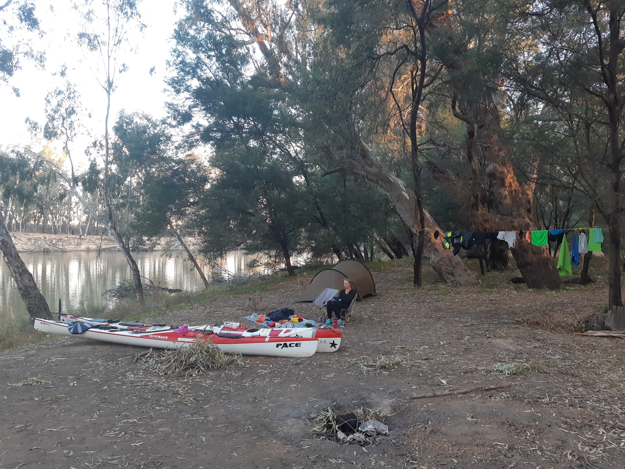
The first task after we find s site is to start filtering water through our 6L gravity filter. The first litre goes into the jet boil for coffee and the next 4 goes to an MSR dromedary bag with a couple of water purification tablets for drinkkng the next day. The filter get refilled so we have water for cooking and hot drinks.
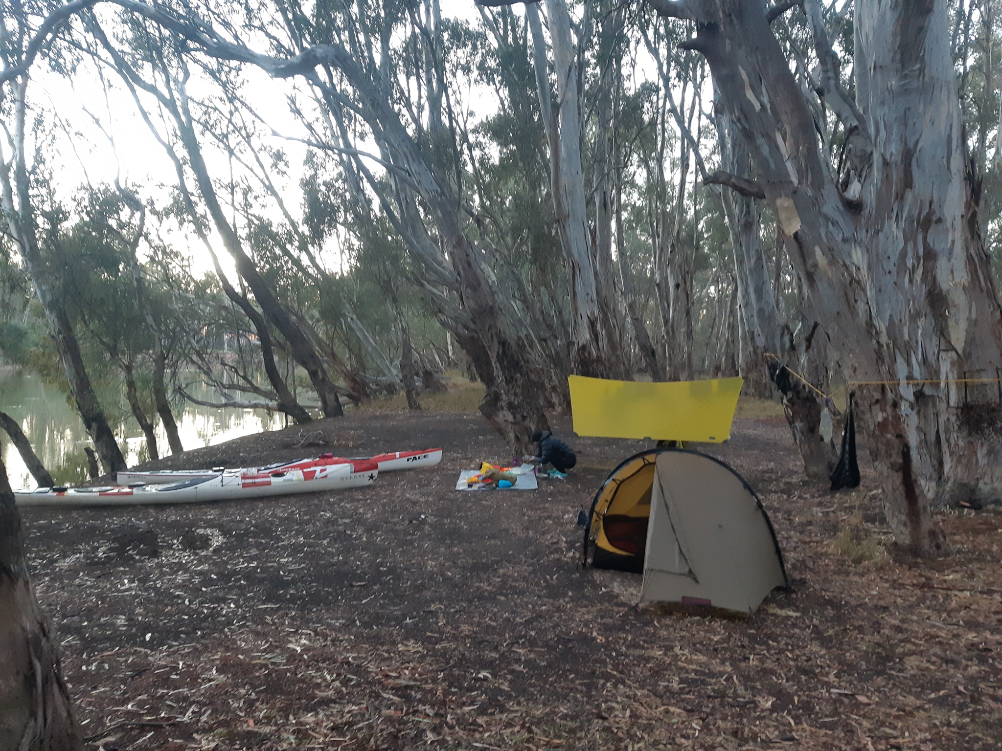
After setting up the tent, sleeping gear and helinox chairs, we have some time for a little reading in the sun. We each bought a drybag full of paperbacks and a Kindle for when the paperbacks run out. One more tea/coffee before it's dinner time.
Kate has prepared dehydrated meals for the whole trip. It's s system we've been using on hiking trips for a few years now. All of the dehydrated ingredients are added to a large Ziploc bag before the trip and cooking is as simple as adding boing water, putting the bag into an insulated sleeve and waiting a few minutes.
Flavours include. Butter chicken, mango curry, green curry, yellow curry, laksa, spaghetti Bolognese, chilli con carne, miso, and gumbo. After dinner, there's a hot chocolate and it's time for bed because it's dark by 7:30. That's likely to be the routine for the next month, broken only by riverside towns and the occasional lock which we have to pass through.
Today there was some variation as we ran across Barry Bell and a school party in one of the better campsites. While it was great to see Barry. It was even better to hear that they had only stopped for lunch and were loving off down river leaving us with the campsite all to Our selves
For the Murray marathon paddlers out there, we had a quick scout through the shortcut at day2 checkpoint bravo. It is passable, if you can pull two 120° turns, two boat lengths apart at speed as you're being swept sideways into a fallen tree.
Tonight, we arar21ekm frkm Picnic Point so we will be on one of pur favourite parts of the river tomorrow - The Narrows
29 Apr 21
Murray Paddle Day 12 of 48 - Sixty Mile Bend to Morning Glory River Retreat about 12km past Barmah
Distance remaining 1750 km
Blisters 0
Bridges: 19
Location: 36°4.810' S, 144°56.773' E
Our day started with a visit from some horses grazing in the forest. They didnt seem bothered by us except that we were probably between them and the low bank providing access to the water.
Another fine day to be on the water and we set off expecting to run into Barry Bell and his school party who were camped 8km downstream from us. Barry had expected them to be on the water by 8 so we were surprised to catch them not far after the 1800 river marker near Pelican Point.
The 1800km sign marks the completion of the first 600km of our 2400km journey. With 1/4 of the river behind us on the morning of Day 12, we were slightly under a day up on our schedule of 50km a day. Despite Barry's optimistic estimate, the kids had only managed to get on the water at 9:30. It's great to see the skills growing in the kids after just a day of paddling. When we first saw them they were weaving arcane patterns on the water. Second time past they almost looked like they were travelling in an orderly fashion. You have to have paddled a tandem canoe with a stranger to understand how hard it is to just go straight.
There was another school party from Lilydale waiting at Picnic Point. Apparently part of the same organised group because they were waiting for Barry's group, who were presumably handing over their canoes, and they knew who we were. We got to do a quick Q&A with the kids who were interested in his far we were going, where we'd come from, why our kayaks were different, and how well our solar panels could keep our phones charged.
In the Murray Marathon, Picnic Point is the end of day 2 and the start of day 3. The first section of Day 3, known as The Narrows is by far our favourite (except maybe the last 100m to the finish line). The Narrows is tight and twisty with lots of dead trees in the water making it even twistier as you duck and dive to avoid them. On race day you have the added challenge of up to 50 boats charging from a mass start into a confined path more suited to single file.
Our tandem racing strategy for The Narrows has always been to get out in front and stay there until it opens up. Just having another boat beside you, restricts your options and the fallen trees in the water can be very unforgiving on rudders, paddles, and hulls in general.
In single kayaks, we take it up a notch and race through the fallen trees, exploiting gaps in the branches and logs which are submerged "just enough" to skim over the top and straighten a corner for some advantage. It takes a good eye and a lot of practice to pick the right holes.
Today, travelling at about 3/4 of our race speed, we were both able to play with our racing line without the risk of seriously damaging a boat. Our sea kayaks are about ten times stronger than our race boats and our rudders flick up and back if they hit an obstacle. Kate's line was sharp as always and she got some laughs out of watching me fail to fit a large kayak through a couple of small gaps. Nothing ventured, nothing gained. Not far into the narrows, we came across Norm and his wife. Norm has been paddling ahead of us for a whIle on his way to paddling the only section of the Murray that he hasn't paddled. We chatted for a few minutes about where we were each going while Kate and Norms wife paddled off down river without us.
By the time we got moving, they were both out of sight and it was clear that Kate wasn't stopping for lunch until I caught up with her. She wasn't slowing down either... It took me a good 15 minutes hard paddling to finally catch her so we could have lunch.
We'd hemmed and hawed over whether to stop for the night at Barmah, 50 river kms for the day, or continue another 12km to the next caravan park. By paddling the extra 12km, we'd be improving our approach to the lock at Torrumbarry two days ahead. We need to reach the lock during operating hours so we can get to the caravan park immediately downstream and collect our first resupply cache. We haven't done a lot of planning ahead on this trip, but the upcoming locks will probably require some forward thinking if we don't want to be delayed for hours as we wait for a lock to be raised.
The extra 12km also means we're now a whole day banked ahead of our plan which we can withdraw if we want a rest day without worrying about how many days food we're carrying. The decision to proceed had absolutely nothing to do with the two school parties who said they'd be camping at the Barmah caravan park tonight. Nothing at all
As much as we love The Narrows, we have equally bad memories of the section from Barmah to Echuca. The first time we raced the Murray that section was blasted by a wind so cold we had to stop so Kate could put on one of my thermal tops as an extra layer. She was still shivering uncontrollably when we arrived in Echuca. We'd beaten our support crew who had all of our warm dry clothes and Kate was saved from hypothermia by Tony Bond and Rod Clark who loaned us the jackets they were wearing. Like I said. Bad memories.
Today those memories came flooding back as the head wind came calling and the high tree lined clay banks did their best to block the sun from the river. We pulled up at our stop just after 4pm and were a little nonplussed to be charged $44 for a square of patchy grass at the far end of the park away from most of the amenities and to find that tent sites don't warrant a picnic table or even a bench seat. The listing had said there was a large sandy beach in front of the park, but it appears to have rum away somewhere leaving a clay bank in it's place. We have taken full advantage of the hot showers and porcelain based amenities, but the price is a bit steep for an area where there's so many great campsites available for free on the VIC side of the river. Straight across the river even.
I absolutely did not say to Kate that we could have got out tent site as well as one of the best pub meals in Australia for the same $44 back in Barmah. The Barmy Parmy is the stuff of legends. Tomorrow, we should be passing through the river port of Echuca, which may involve dodging some paddle driven riverboats on the river. If we're really lucky, they might be going our way and we can get a bit of a surf ride downstream. At this point I'm running out of things to write about our trip as the river turns to a progression of sameness punctuated by small towns. To prevent me from resorting to phrases like corruscating sunlight and dappled leaves, it would be great to get some questions about the trip or the equipment we're carrying.
We are now past the 1/4 mark for our journey and the find raising is just behind. If you're getting a little entertainment from these daily updates then give a thought to making a small donation to our charity. If the refuge we've chosen to support isn't in your locale, then consider making a donation to a women's refuge near you.
Murray Paddle Day 13 of 48 - Morning Glory River Retreat to Girriwa Bend
Distance remaining 1694 km
Blisters 1
Bridges: 21
Location: 36°04'18.6"S 144°41'30.6"E
https://goo.gl/maps/d5a5qwW1fNdVezpP7
Two parts tonight. First a recap of the day and then answers to a few reader questions.
The weather continues to favour us as we progress downstream. We started the day at marker 1750 bound for Echuca at 1712 - 38 kilometers. We were a bit late getting on the water but made up some time on top of a good current and ended up having our lunch about 8km short of Echuca.
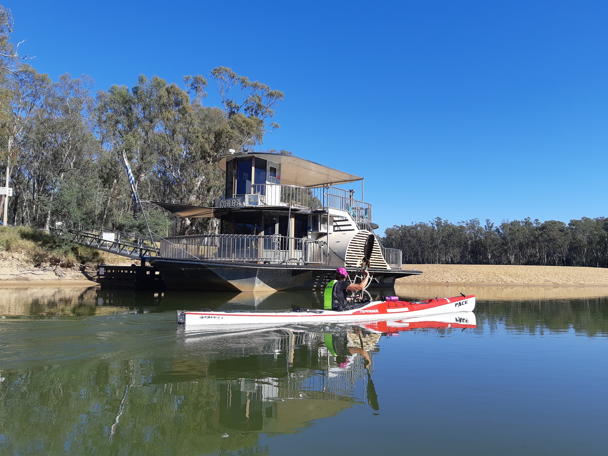
The first sign you're getting close to Echuca is the sudden increase in the number of house boats tied up on the river banks. Then there's the bridge and finally the high dock with paddle wheel boats moored alongside. We've got a bit of a soft spot for the river port town. A lot of our friends call it home and we've got some good memories of the place.
The local canoe club had left us a sign showing their support. From Echuca we have 96km to cover before we reach our food cache at Torrumbarry Weir. We've decided we need to push 10-15km past Echuca before setting up camp, leaving 80km to Torrumbarry, a 50km day tomorrow and a short 30km day on Sunday which will allow us to pass through the lock (open 8:30-4:30) and arrive at the caravan park below in time to do laundry and restock our food. We're making the final day a short one in case the current is slower up to the back of the weir.
At this stage we are surplus two days food, one from being ahead of schedule and a second from a night spent with friends in Albury. We may have to have seconds if there's no room. A more pressing storage problem is the gas canisters we've cached. We packed 5 on day 1 expecting to.use one every four days which we consistently do when hiking. So far we've only used two with a third looking like it will see us to Torrumbarry. At this rate we'll finish the trip with four or five of them bouncing around the boat.
We will probably be offline for 48 hours after this as we pass through some unpopulated areas. Now to the Q&A - if you have a question you'd like to ask. Just post it in the comments
What books are you reading?( Casle Portner )
I packed 4 paperbacks into a drybag along with my Kindle. The four were the last of Lee Childs Jack Reacher series. I've just started the last one. After that I'll be switching to my Kindle and reading Dark Emu by Bruce Pascoe which is an account of pre colonial aboriginal life making the case that they weren't hunter gatherers but had developed, according to evidence from the first explorers, settlements, agriculture, and some complex societal rules. After that it's Eureka by Peter Fitzsimons which describes a part of Australian colonial history I've never understood (except that the Eureka flag appears today in the same contexts as the Confederate flag does in the US). I'm not sure what Kate's reading, she churns through one a day so it's hard to keep up.
What about blisters? - Michael Vitnell
There's plenty of potential for wear and tear on the trip... 48 days. 6 hours paddling per day. 70 strokes a minute...comes put around 1.2 million strokes from start to finish. We haven't managed to completely avoid them but they're not getting out of hand. When we started we hadn't been seriously paddling for about 8 months so our hands are a bit soft.
Our secret weapon is Bandaid Tough Strips. The fabric ones, not the waterproof ones. They stick well and usually last two days wet on a rub spot. As soon as we get the start of a blister we wrap a tough strip around it and give it a chance to dry out and harden up. Adding the strips does tend to move the rub point so we've been chasing them from one spot to the next since the start of the paddle. If a blister appears while I'm on the water, my hands are too wet to stick a bandaid, so I use a strip of duct tape until we get to camp and dry out. A light grip on the paddle definitely helps reduce blistering as well as not paddling aa if we're racing. In answer to the second part of your question. Yes We have other abrasions. Mostly skinned knuckles from pushing things in and out of tight hatches.
I do have one seating related injury, which is a small abrasion about the size of a 50cent coin.where a seam on my shorts bunched up for a day and left me with something looking like very localised carpet burn. Mostly due to leg drive in the boat.
What's you solar setup?
We are carrying USB chargeable Samsung phones, Black Diamond headlamps, Kindles, and Garmin watches (although mine died in the first few days)
The phones last around a day. More if they're in airplane mode, less if the cell signal is weak or marginal
During the day we each have s 10W waterproof solar panel feeding into a USB battery in a waterproof case. At night we take out the battery and charge whatever devices need charged. So far nothing has run completely flat.
We also have a pair of Luci Lamps which charge up enough during the day to provide working light for several hours each night. Having two means we are covered for overcast days.
As a back up. We have a small mains power 6 port USB charger which we use to top off every thing on nights when we are in paid campsites. It seems to be keeping up with our power use so far.
1 May 21
Murray Paddle Day 14 of 48 - Girriwa Bend to Norris Bend
Distance remaining 1640 km
Blisters 0
Bridges: 21
Locks: 0
Location: 35°57.630' S, 144°29.998' E
We're camped tonight 10km above Torrumbarry weir.
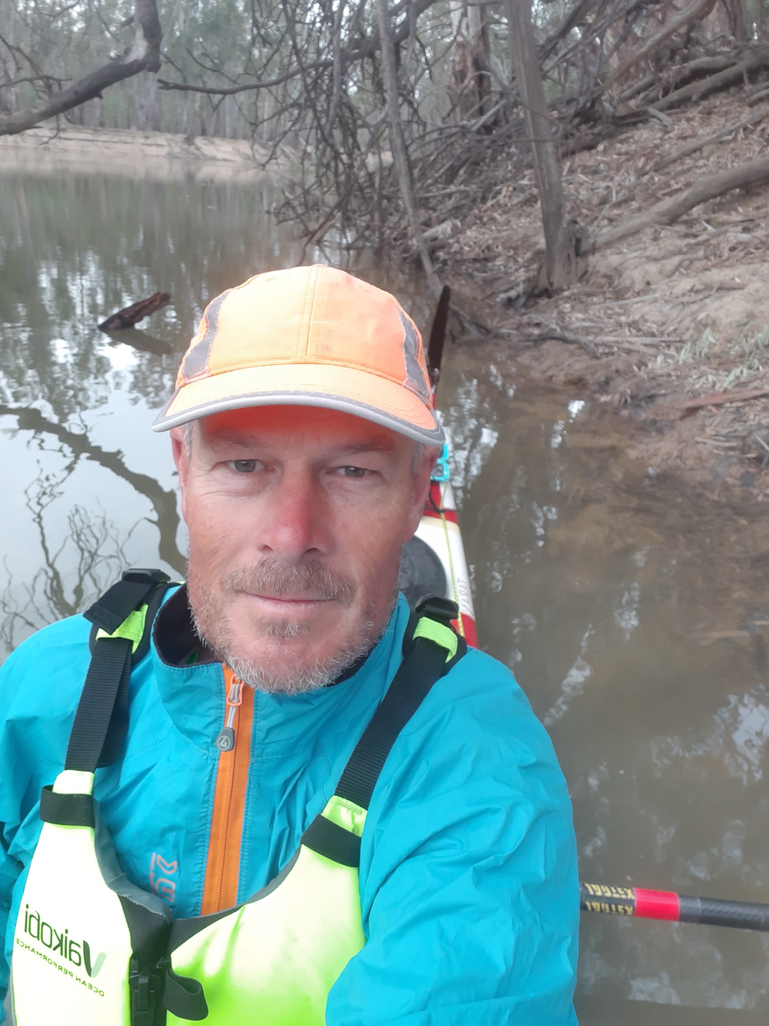
It's been a slow paddle today as we've run into the impounded waters above the weir. Because its the weekend, we've also been dodging jetskis and skiboats for most of the day. That's another reason why we like our day-glo yellow Vaikobi life jackets.
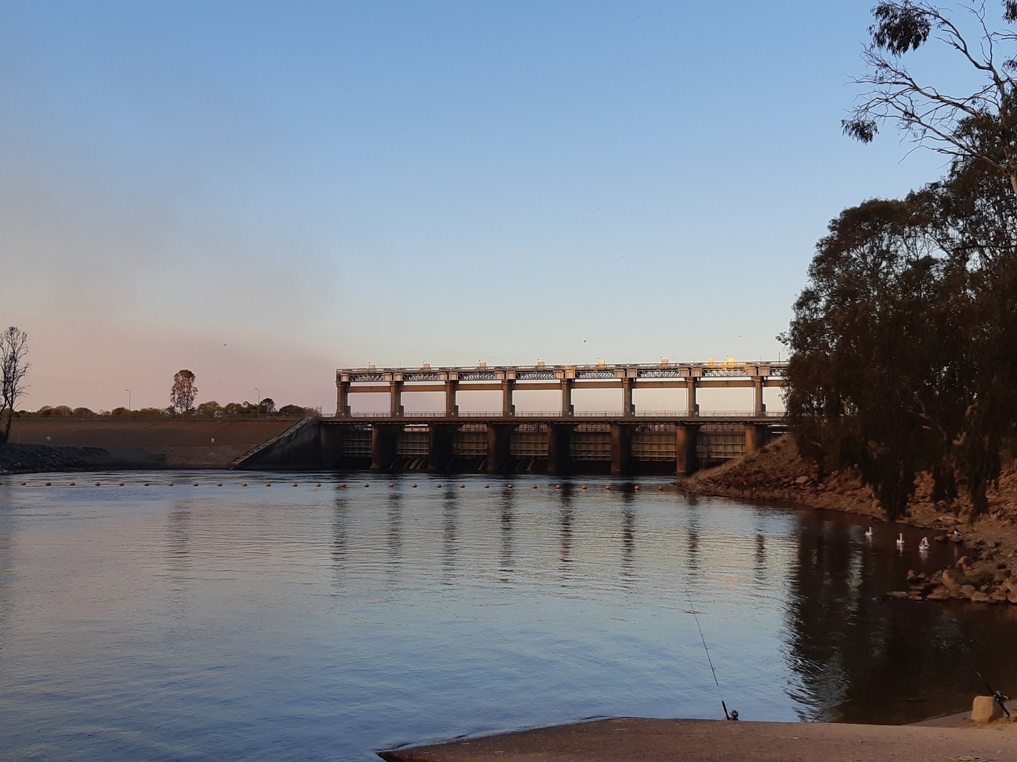
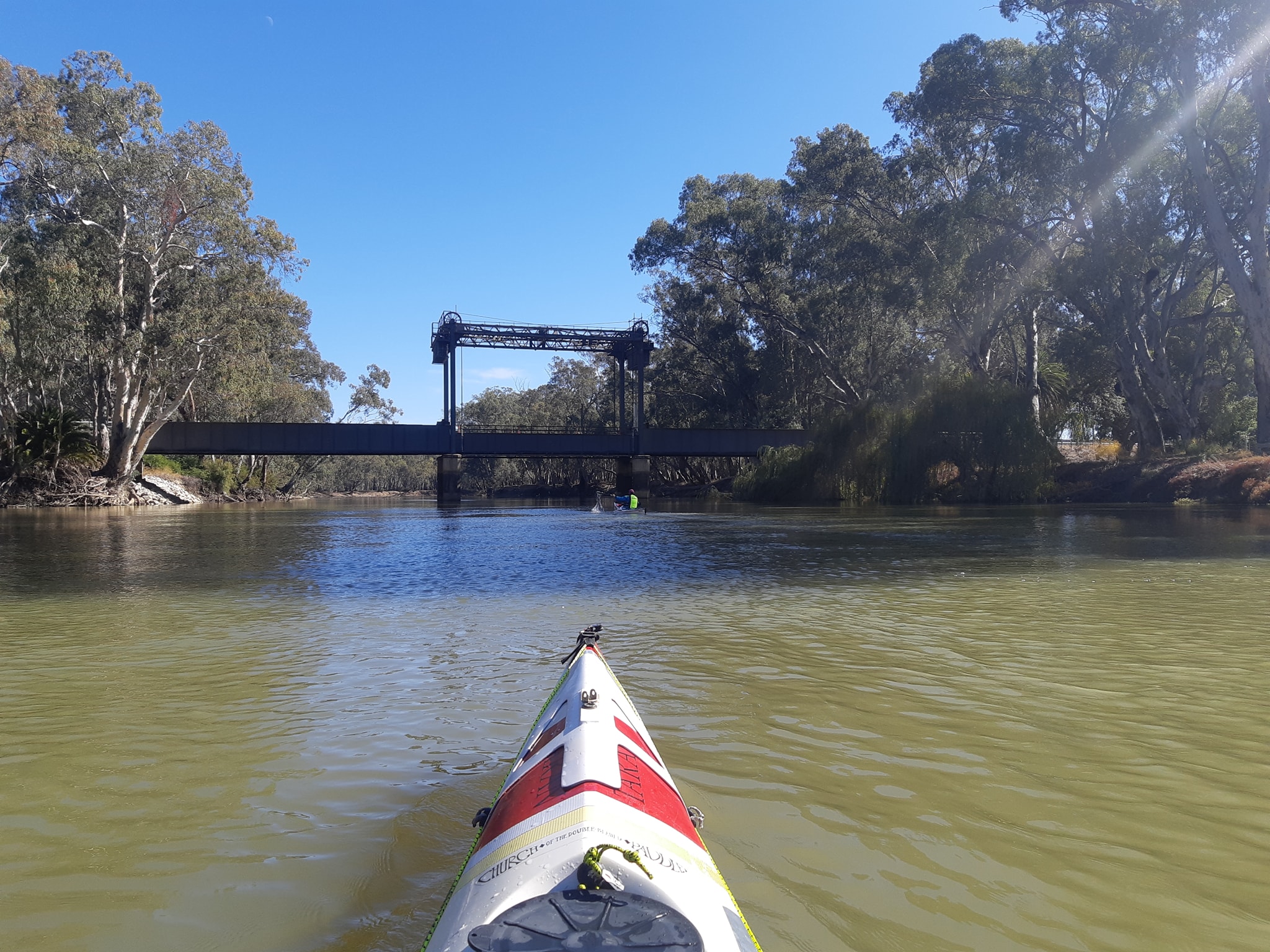
Tomorrow, we'll have a short 10km run down to the lock, the first of 26 locks on the river, then check into the caravan park for a resupply, shower, and laundry.
We started this morning on the familiar waters of the Murray Marathon day 4 which ends near Welton about 8km back upriver from our current position. I say it's familiar but as we paddled past Perricoota Station and the cluster of buildings there, we both thought we'd overshot the stage finishline. Apparently we've been focused on the final 3km to notice them. One thing wnowe'venoriced is that we're noticing features we havent noticed before when weve been raceing through.
Finding a campsite tonight has been a bit of a trial. The area is obviously popular with water skiers and it shows in the river banks. Almost everywhere is bordered by a 1-1.5 metre clay bank that's been eroded away by boat wakes.
The next section of river from Torrumbarry to Murrabit isn't part of the marathon. There's not enough road access for race officials, relay crews, or supporters, so the race jumps about 100km downstream for the final section. We haven't seen it before.
Today's random musing was about how many paddle strokes it was going to take to get from Bringenbrong to Goolwa. I started figuring that at 70 strokes per minute in the sea kayak, and 6 paddling hours a day for 48 days I was looking at 1.2 million strokes. If we cut some corners and finish a few days early maybe just an even million strokes. Alternatively, I know my stroke moved my race boat about 3 metres so 2,400,000 metres comes in at 800,000 strokes. It's likely to be less with the heavier boat, so maybe edging towards 950,000 or a million again. It's a big number.
Late addition. As darkness falls, we find that we've got a Boo Book Owl across the river from us. He's quite loud and will probably go on all night. He sounds like this Now the idiots camped across the river have started trying to imitate the owls call and it's set off the dogs at the next campsite so we can't hear the Doof-Doof music from the skiboat camped somewhere on the other side of us. Weekends...
30 Apr 21
2 May 21
Murray Paddle Day 15 of 48 - Norris Bend to Torrumbarry Weir
Distance remaining 1630 km
Blisters 0
Bridges: 21
Locks: 1
Location: 35°56.662' S, 144°27.802' E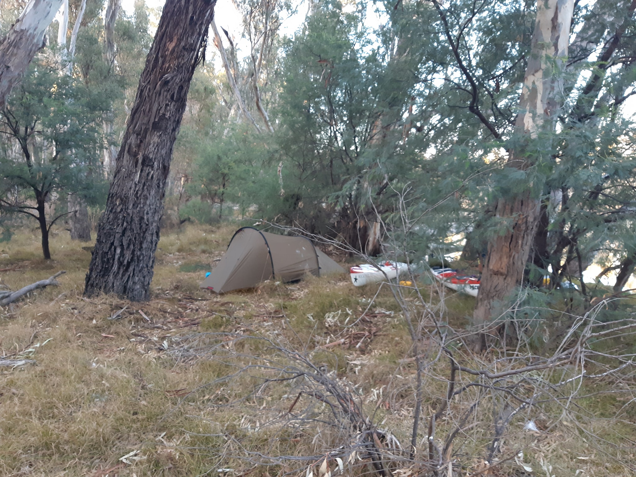 After struggling to find a riverside campsite last night that wasn't crowded with caravans or ski boats, we cut our losses and picked a gap in the trees leading to a patch of flattish long grass and called it a campsite.
This morning we paddled around the corner to find a half dozen really good, vacant campsites over the next kilometer. Such is life, as Ned Kelly once said*.
After struggling to find a riverside campsite last night that wasn't crowded with caravans or ski boats, we cut our losses and picked a gap in the trees leading to a patch of flattish long grass and called it a campsite.
This morning we paddled around the corner to find a half dozen really good, vacant campsites over the next kilometer. Such is life, as Ned Kelly once said*.
With only 10km from our camp to Lock 26 at Torrumbarry, we are putting today down as a rest day and putting our feet up at the Torrumbarry Weir Caravan park for the afternoon. We arrived at the weir by 10:30 having been told by one of the lock masters downstream than the locks went down on the hour and up on the half hour. We were all set for an 11am down. Then we tried to find the phone number for the lockmaster and I was reminded that Google search is actually crap when you want an exact piece of information. It gave me the numbers for the holiday park, the Murray Darling Basin Authority, the Murray water board and a list of phone numbers for lock masters in South Australia!
Eventually I walked up and read the phone number off the office door. I'm still wondering why the phone number isn't on the sign as you approach the lock. Too sensible?
The number is... 03 5487 2900
It took us 30 minutes to find it.
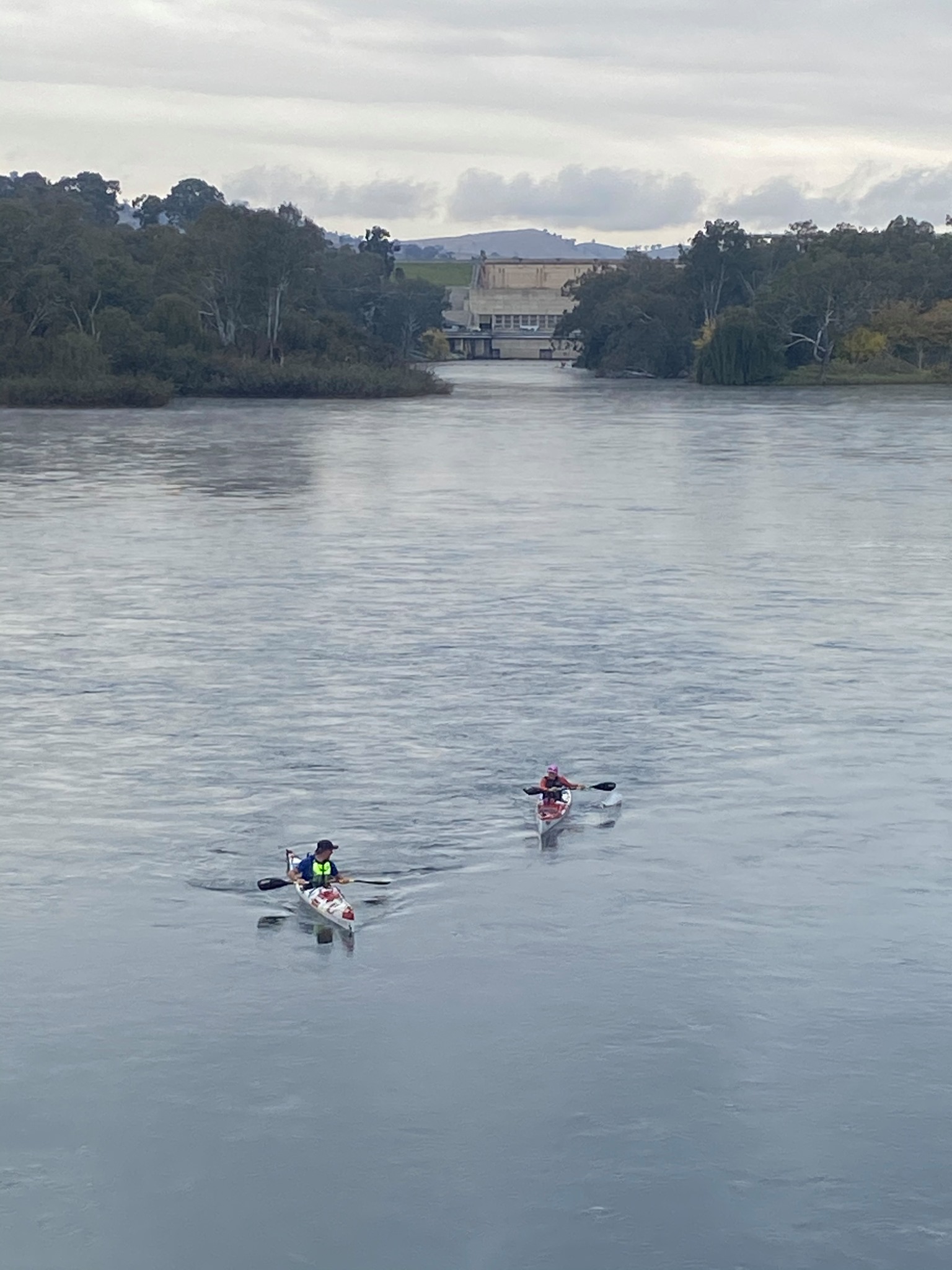
From there it was a simple matter of the lockmaster opening the gates and cycling the lock to pass us through. Apparently there are no set times up this far as there are only about 4 boats through each weekend. Our 15 minute journey through the lock created an opportunity for some travellers to actually see the lock being cycled, and gave us an opportunity to talk about our trip and our charity as we slowly sank out of view.
Torrumbarry marks the end of the first 1/3 of our trip and confirms that our plan, as loose as it may be, is pretty much good enough to get us to the end. We are 800kms in with 1600km to go. That's 1000miles left in ancient Sumerian.
I'm looking for some gimicky equivalent of the 2425km like if you laid the population of Melbourne end to end along the river you'd drown a lot of people and create a world surplus of espresso coffee, or perhaps if you lined up all the kangaroos in Australia they'd stretch from one end to another, but apparently they'd stretch to New York, so it's a work in progress
The lock master told us that we are effectively riding the peak of a water release from upstream, which if we stick to our plan should follow us all the way to the end of the river at Goolwa. Wouldn't that be nice?
Q&A
Mark asked the question of how are we managing the wear and tear and are we using and supplements to help us along the way. The answer is largely that we are keeping the work rate to a manageable level and consuming a balanced diet of carbs proteins and fats, interspersed with the occasional ice cream or milkshake when the opportunity presents itself.
If I was racing, my stroke rate would be around 82spm. For this trip, with a heavier boat, and maintaining visual contact with Kate, it's running at 70spm so I'd guess I'm burning about 400 calories an hour for a six hour stint. We've also shortened our paddles by 2cm from normal which is a bit like dropping to the small chaining on a road bike. It makes a surprising difference.
The only concession to the exertion is we are drinking 750ml of electrolytes each per day to avoid cramps and maintain hydration. Its not especially hot on the water so our water consumption is another 750ml for the day. The temp during the day has been warm enough to paddle in shorts and a quickdry shirt, but not warm enough to be comfortable sitting around in the same.
We both had leg cramps in the first few days but the electrolytes seem to have sorted that. Tomorrow we will be back in the water refreshed, washed, laundered, and restocked for the next 800km to Mildura via Swan Hill, Koondrook, Nyah and other strange and exotic sounding places.
- he was dead minutes later.
3 May 21
Murray Paddle Day 16 of 48 - Torrumbarry Weir to Nursery Bend
Distance remaining 1575 km
Blisters 0
Bridges: 22
Locks: 1
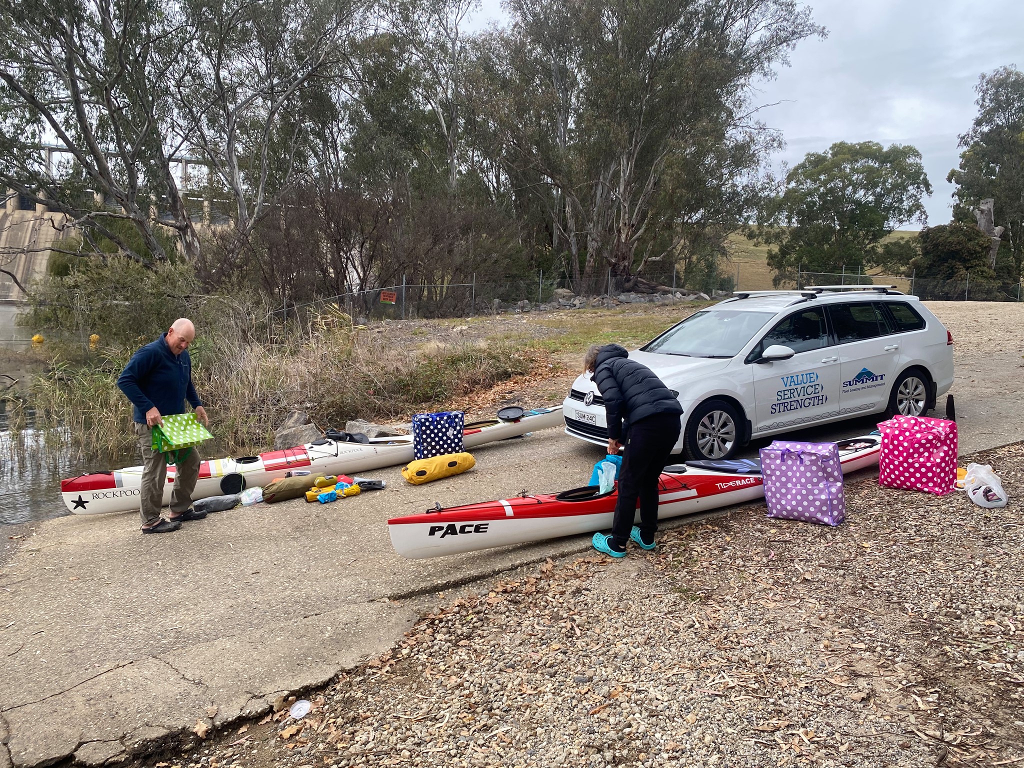
Location: 35°46.528' S, 144°21.185' E As we've chewed our way through the 16 days of food, fuel, and toilet paper we packed into the boats on day one the job of repacking the boats each morning has gotten easier and easier. Reaching our resupply drop in Torrumbarry, I was a little concerned that we would have trouble fitting in the next 16 day installment. The box we left at the weir 20 days earlier was 55 litres (the size of a medium backpack), and again the boats just swallowed it as if it were nothing. It did delay our departure slightly as we sorted the food so that the stuff for after Mildura - still another 16 days ahead - could be stowed right up the end of the bow where it isn't going to move until we have our final resupply in Mildura.
The river speed picked up a little again as we left Torrumbarry. This was some consolation after I plotted a GPS waypoint to the section of river 50km downstream where we would start looking for camp sites. According to the GPS, the waypoint 50km downstream was 18.9km away as the crow flies. It wasn't wrong. The river bends and bows endlessly as it passes through Gunbower National Park. At one stage later in the day we were 2km from our target with 8km still to paddle, The river was pleasant enough. Wide and free from the ski boats that dogged us upstream.
There were a few fishermen who claimed not to have caught any fish. This is a bit of a theme on the Murray⁰ where the fishing is good but the catching is bad. We've pitched camp in some bush at the top of a riverbank which at least has a reasonably gentle slope leading up from the water. For the past few days the river banks have been predominantly tall and eroded, making them difficult for a fully loaded kayak.
There have been a few kangaroos on the riverbank today. Its quite impressive to see a roo drinking at the waters edge and then keep to the top of a six foot bank with a single bound. Lying in our tent. There's a couple more roos bouncing around in the bush nearby and we're just hoping that they don't trample the tent in their excitement. Tomorrow we continue on to Koondrook. Another 50k downstream.
4 May 21
Murray Paddle Day 17 of 48 - Nursery Bend to Koondrook
Distance remaining 1517 km
Blisters 0
Bridges: 23
Locks: 1
Location: 35°35.918' S, 144°6.473' E
Away from camp early this morning, encouraged by the arrival of light rain and a persistent south westerly wind. One of the challenges of moving 50km every day is that there isn't much time to dry gear once it's wet. As much as possible, we've avoided getting our camping gear wet, with the exception of our tent fly and our tarp. Overall we've been lucky so far having only had two days of light rain (scans heavens for thunder clouds). I suppose that's one upside to paddling in one of the most arid countries in the world.
When we started the trip back in Bringenbrong, we wore sprayskirts to keep the splashes out of the boats on the rapids and to trap some warmth in the boat while it was a little cool in the foothills of the Snowy Mountains (At the oxygen scarce altitude of 250 meters above sea level.) As soon as we reached the flat waters of Lake Hume, we stowed the skirts, opting to paddle in light shirts and paddle shorts, these being easy to dry and not so warm that we sweat, because let's face it, we are carrying a limited amount of clothing and it's more than a few days between laundry facilities. We aren't stopping at campsites with other people so it's not a hygiene question as much as it is about really not wanting to be climbing into wet cold paddling gear that is too dense to dry overnight. There will be plenty of that down the line I'm sure.
For the last ten days, we've been running comfortably cool as long as we keep moving, bordering on cold if we stop for more than about 20 minutes. Its an incentive to keep moving. To some extent, we're trying to acclimatize to the cooler weather in light gear so we have some latitude to go warmer when we hit the inevitable cooler weather down the track in South Australia, on the final third of our adventure, which will also be closer to Winter. At this point I can imagine about 80% of the kayaking world reading this and heading for the comments to type "Dress for immersion!", or "something something drysuit" probably in ALL CAPS and with a generous portion of exclamation marks thrown in for good measure and emphasis. Please don't, we know our capabilities, the inherent risks, and the probabilities. Its Australia. Its flatwater. This is about dressing for exertion.
Today though, we made a concession to the conditions and broke out the spraydecks and paddle jackets. The air temp was OK, but the persistent SW wind was threatening a degree of wind chill beyond just grin and bear it.
Maintaining a good working temp is also complicated by our speed difference. If Kate's working hard enough to stay warm, I'm still running cool to cold unless we take very different paths down the river. So Kate cuts the corners and I paddle the widest line I can find on the outside of the bends, so we are both work-warm and still maintain visual contact on the river. The different paths approach has absolutely confirmed in my mind that tight through the corners is the fastest line down the river. We've been doing it for 10 days or more now and I'm logging 10-15% more kilometers than Kate and working that much harder to stay with her on the water. It also accentuates the difference between the marked river kilometers and the much shorter distance Kate is paddling (watch out everybody who thought she was sharp on the Murray Marathon corners before. She's learned some new tricks... 🙂 ). Upstream my path around the outside of the bends was almost exactly river kilometers (I'm guessing river kms are either the centre of the river or the centre of the navigable channel.) Now as the river has widened, my worst case path is actually more than river kilometers which is have to say is starting to bother me.
Anyway... After my GPS watch died on one of the earlier days, I'd ordered a replacement, having it delivered to a post office parcel collect point in Koondrook. We'd actually tried two previous times to get an online retailer to deliver to a post office ahead of us but they both cancelled the purchase claiming it was some sort of internet credit card scam - maybe there's a dark den of hackers known to be operating out of Koondrook Victoria? So a big tick for Wild Earth in Brisbane who actually so what they're asked to do, efficiently and without fuss. So internet security wonks aside, if you break something, or forgot something the parcel collect service is very good.
We had camped 52km from Koondrook and thanks to our rain inspired early start, we arrived at a small muddy beach under the wharf just on 2pm. None of the locals seemed particularly surprised by the two bedraggled paddlers, walking up Main St in our paddle jackets and crocs. I've got my new watch and now I can stop annoying Kate by asking her what time it is.
Leaving Koondrook, we continued down river for another 7km until we were clear of the houses on the NSW side of the river. There were some very tempting sites just out of Koondrook, but the houses across the river would have been staring straight into our bathroom, so we plugged on a bit further. We're currently 107km from Swan Hill and the towns are continuing to be about 100km apart, which isn't ideal when we want to bush camp on the riverside as much as possible and avoid any late night visitors over the weekends.
Over the next two days we're looking to shift our phasing by about 25km so we can camp away from towns, but also be able to drop into a town around lunchtime for a treat or groceries. Fresh fruit is the main grocery item which we're craving at the moment. Looking to pick some up in Swan Hill on Thursday. Then we have another package to collect in Nyah on Friday, 150km down river, a new poo hole shovel. I broke the old one.
5 May 21
Murray Paddle Day 18 of 48 - Koondrook to Pental Island Junction
Distance remaining 1462 km
Blisters 0
Bridges: 24
Locks: 1
Location: 35°26.372' S, 143°49.145' E
Rain overnight and a cold SE wind blowing across the river made for cold paddling despite the clear blue skies. The early morning sun was blocked by tall trees on the northern side of the river and paddling into shade around the bends dropped the temp by a couple of degrees. Almost immediately after setting off we came to a fork in the river we didn't expect. To our left, the Murray River. To our right, Little Murray River. Never heard of it... probably an indication that our hasty decision to paddle the river has left us with some gaps in our knowledge. In this case the river splits around Campbells Island and rejoins just before Murrabit 27km down river.
We decided that sticking to the Murray River was most likely to be the right answer, even though the flow seemed to favour the Little Murray Rivee at the junction. Continuing downstream we came across some large snags that caused us to wonder if the LMR was the route preferred by the riverboats. The snags seemed to block enough river to make navigation difficult for a large riverboat. A few kms in I spotted a section of deck railing hooked on tree branch overhanging the river, about 15 feet up. Ruling out flood, it looked like somebody in a two level houseboat had misjudged the channel and the tree had collected about 10ft of their upper deck railing.
Just before lunch time we reached the spot where the two flows merged back together, 5km upstream from Murrabit. A glance upstream into the LMR settled the question of which branch the riverboats took. There's an old wooden bridge across the river just before the junction and there's no way a riverboat would get under. Murrabit is the start of the fifth and final day of the Murray Marathon, where depending on how your previous four days have gone, it can be a sprint to the podium or perhaps a grit-your-teeth and cross the line suffer-fest. For many of the team's that enter for the challenge of finishing, it's the elation of completing a 404km paddle over 5 days. One of the regular teams is Blues and Brothers, made up of police officers and young aboriginal kids. Each of their boats pairs a kid and an officer for one of the four relay stages each day. Watching their teams paddle the river and cheer each other on at the relay checkpoints is to me one of the events highlights. Seeing them finish in Swan Hill on day five is simply magic.
Kate and I have chased the podium on this section three times and then paddled it to finish on a fourth. My memory of the terrain from Murrabit to Swan Hill is of grassy farmland either side of the river. Its not like that at all. There's tall trees and plenty of camping spots along the way. Clearly we've missed a lot of scenery in the past as we've been tunnel visioned on the next bend and where the other boats were around us. There are definitely less other boats on the water since we passed through Torrumbarry. Each day we see just a few fishermen in boats and a few on the bank.
I've been asking them all if they're catching anything and from their responses, there's either no fish in the river, or the fish are smarter than the fishermen, or they think I'm some sort of under cover fisheries officer. Kate's getting sick of hearing me say "that's why the call it fishing, not catching". I'm considering changing my question to "Have you ever thought about our saviour Jesus Christ?" just to see what response I get. Kate will probably stop paddling near me if I do.
By mid afternoon we were coming up to our target 50km and had been seeing some great camp sites on the Victorian side where free camping on the riverbank is allowed. Needless to say the banks of the NSW side are overrun with sandy beaches leading gently from the waters edge to grassy tree lined clearing where the PRIVATE PROPERTY TRESPASSERS PROSECUTED signs are posted.
We passed at least a dozen good Victorian camping beaches* before getting to 50km. Then they completely dried up for almost the next 10km. This is also typical. If anybody is looking for the best camp sites for a future source to sea, simply check our camp sites and go 500m further each time. We generally find them around the corner the next morning.
We've pretty quickly established that the most promising camp sites on our left (Vic side) are located on left hand bends which turn more than 120°. 180° is better, creating a little promontory. A deep public reserve filling the bend means there isn't likely to be a farm house just behind the trees. And no road access means there won't be caravans already parked there. *a Victorian side campsite is a clay bank with knee deep water at the base, a muddy bottom, and a flat patch of dirt almost large enough for a tent. Its inexplicable why they aren't mirrors of the NSW side on opposite bends. Something to do with the earth's rotation making all the sand go to one side, I suppose.
6 May 21
Murray Paddle Day 19 of 48 - Pental Island Junction to Swan Hill
Distance remaining 1410 km
Blisters 0
Bridges: 24
Locks: 1
Location: 35°20.587' S, 143°33.928' E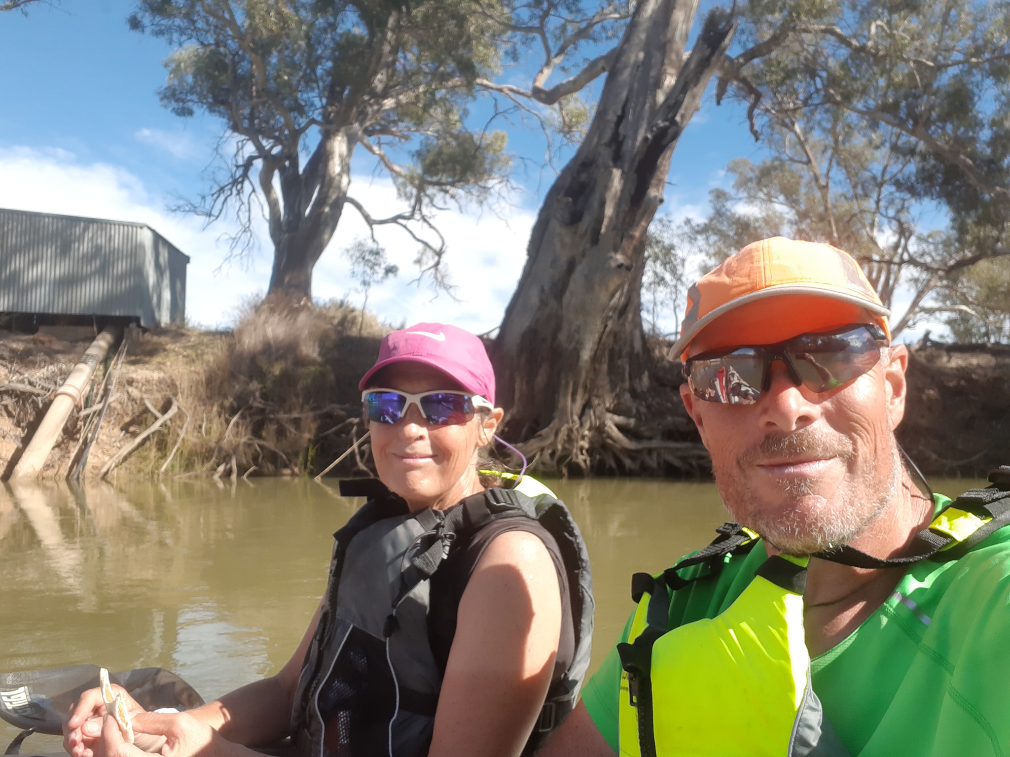 A short update today because we've arrived in Swan Hill to find friends waiting for us on the riverbank. A night of catching up is long overdue. Today we passed the 1000km mark of our journey which is starting to make the impossible seem less improbable.
Thanks to everybody who is following our trip and especially those who have donated to our charity. If you don't want to donate to our nominated shelter, consider finding a shelter near you. Make a donation. Get involved. Help those in need.
7 May 2021 - Day 20
Murray Paddle Day 20 of 48 - Swan Hill to Devil's Elbow Bend Just past Nyah
Distance remaining 1353 km
Blisters 0
Bridges: 26
Locks: 1
Location: 35°9.565' S, 143°23.208' E
Departing Swan Hill today, we were back on unfamiliar waters. Swan Hill's waterside park, 500m beyond the caravan park is the finish line for the Murray Marathons 5 day 404km course. We've never been past there.
The river seems to be running a little more discolored today with light debris floating along that suggests a rising level has dislodged sticks and leaves from the beaches. Hopefully giving us s little push. The character of the river has changed noticeably with more farming and a thinner screen of riverside trees between us and the surrounding paddocks. The banks are more uniform through the farmland. Looking more like stop banks in their regularity.
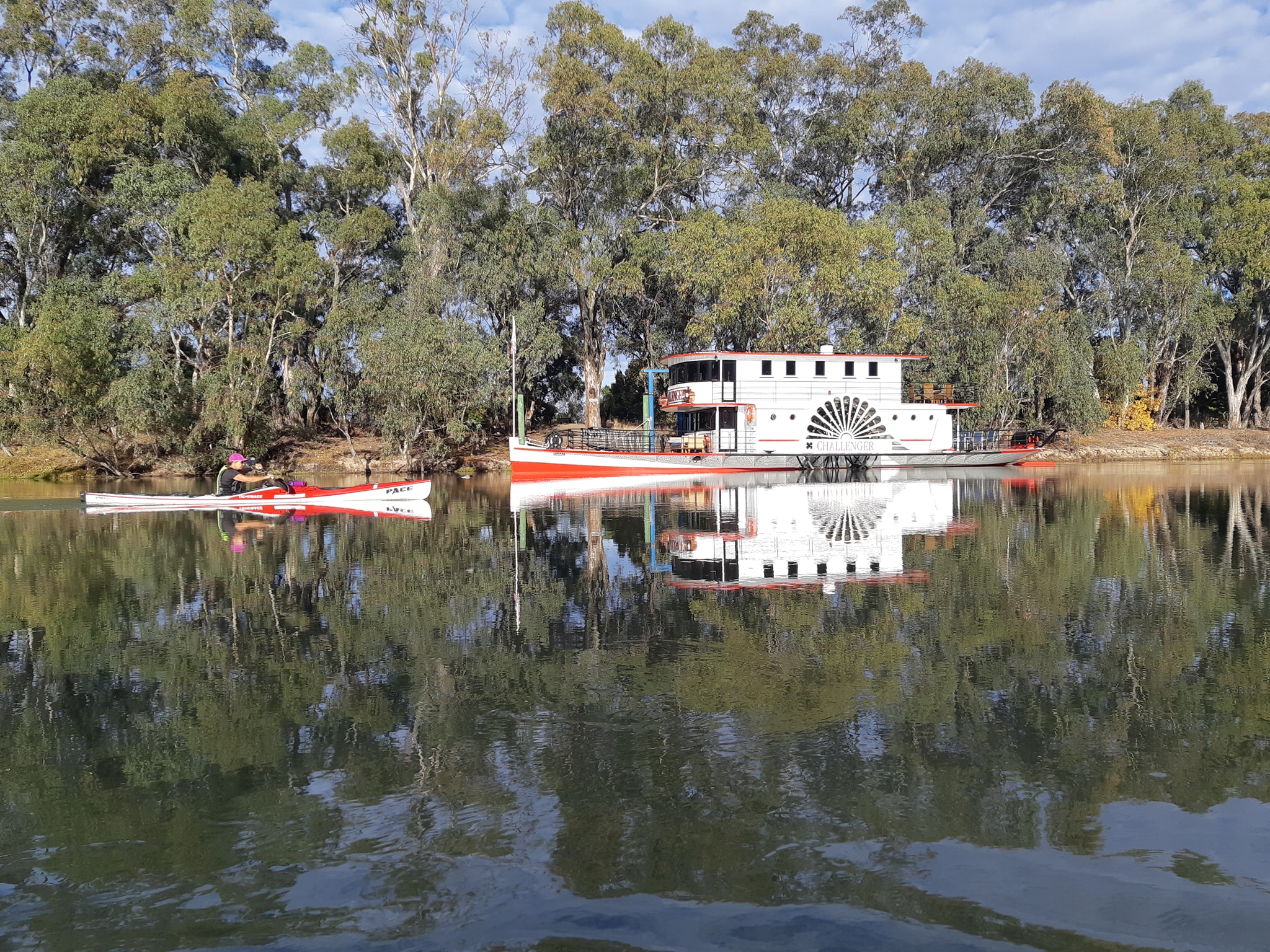
Another fork in the river at Tyntynder and another opportunity to fast track towards our destination. The Murray River turning right to run around Beveridge Island and an anabranch running left on a more direct path. We took the anabranch. Tonight we are camped back on the riverbank at Devil's Elbow with the sound of possums defending their territory in the trees across the river, and a nice warm campfire. Note to self. In future take note of where you dispose of spent GPS batteries as dropping them into a paper rubbish bag which is then used to get the fire started is a bad idea. I can confirm that batteries do explode in a fire, at least a little.
Along the way we stopped in at Nyah to pick up a package from the post office. It's pronounced Nigh-ahhh apparently. Not my first guess to be honest.
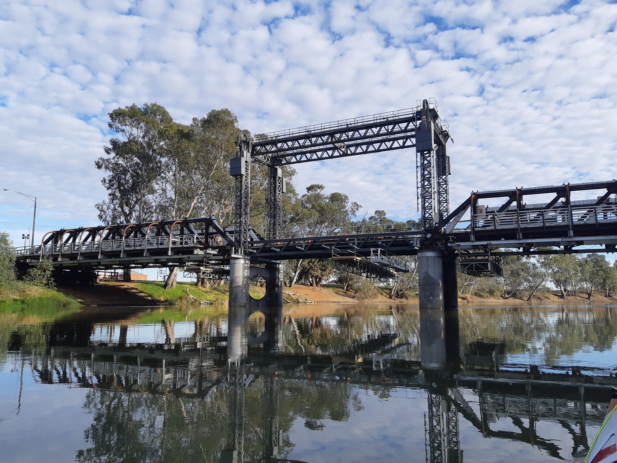
Q&A
Ashley - best, worst, and most wanted bits of kit?
Best and most used is a cheap 6ft x 4ft poly tarp which we use to keep everything off the dirt and ensure we don't lose anything while we're packing and unpacking the boats. Worst and wished we'd left it behind is the SPOT tracker. After an unwanted visit from a search and rescue team because it activated itself after getting wet... In breaking news, SPOT have contacted me for a followup on my response to their customer satisfaction survey, which I filled in a few days before our incident. They were keen to get my story of the activation so they could publish it on their website. I'm keen on getting a rare T-bone steak and a 40 year old single malt scotch. Neither of us are getting what we want this week.
Unnecessary weight... nothing so far unless you count underwear and a pair of shorts for warm days off the water. Wished we bought it... a couple of climbing pulleys so i could rig a z-drag for pulling the boats up aome of the steeper banks.
Almost right but not quite. We've got a 10m length of floating rope. I've discovered that trees are statistically likely to be 11m apart. Next time, I'll bring a 20m rope.
Magical medical. I've already plugged bandaid tough strips for blisters so this time, Gurney Goo for all those things that rub.
Luxury item. Helinox Zero chairs. So good to not have to sit on the ground.
Things that haven't survived the distance...
1) SPOT Tracker waterproofing fallure
2) both our MSR 4L dromedary bladders have been punctured by something sharp and are leaking
3) my Garmin Fenix watch another waterproofing failure but being replaced under warranty.
4) two of our sand pegs bent in ground too soft for normal pegs but too rocky for sand pegs.
Ian - what about hygiene on the trip...?
I know some people who have done this trip made a point of swimming in the river each day. We are not those people. The river is carrying silt to the point where wading in to wash off the mud means coming out with new mud washed onto you. So we are stopping at caravan parks every 4-6 days for a shower in water that is at hot and transparent.
8 May 2021 - Day 21
Murray Paddle Day 21 of 48 - Devil's Elbow Bend to just short of Gundagai Bend
Distance remaining 1293 km
Blisters 0
Bridges: 27
Locks: 1
Location: 34°53.055' S, 143°19.603' E
We set off this morning expecting to be 30km downstream in Tooleybuc in time for lunch.10km (1334km marker) before Tooleybuc we came to another shortcut to the south of Murphy's Island. To the right, the river follows a sedate loop for 4km, but the path to the left is a short cut, just 400m long, moving fast and littered with snags. As soon as we made the turn, the river leapt into high gear with some small pressure waves forming over the initial drop. According to the river authority... "The grade or fall of the Murray varies from 14 cm per kilometre near Albury, to about 2.5 cm on the last 160 kilometres to the sea". So... the long route - 4km - drops about 10cm per kilometer for a total of 40cm. The short route, which is 0.4km drops to the same level at the end of the short cut. Ergo, the gradient of the short route is 10x the gradient of the long route. The result was a few brief moments of yeehaa like we had back at the start of the trip near Bringenbrong. It was a short lived but enjoyable interlude to our day.
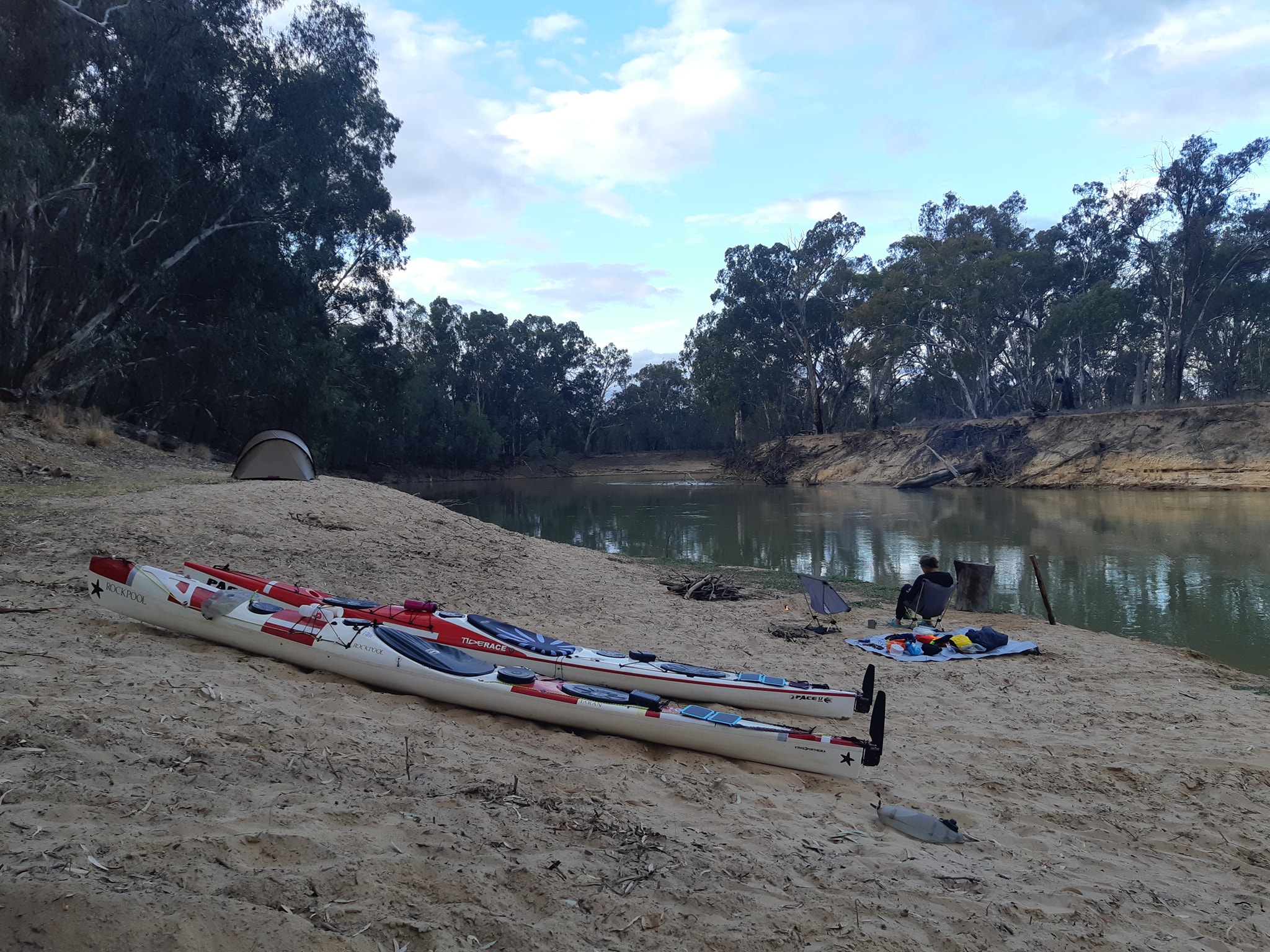
We considered stopping in Tooleybuc for lunch or whatever might be available, but the waterfront park offered no easy landing spot, just a pontoon which was positioned at the edge of the current. We opted to have lunch on the float. Our drift speed during lunch was nearly 3.6kph compared to our usual drift of 1.5-2.5kph. It was a nice bonus to cover 1.5km while munching on lunch, but did mean we needed to watch over our shoulders for what we might be drifting into. For some reason, both boats assume a stern first position when drifting in the current regardless of where the wind might be coming from.
The river appears to be running a little faster in the current section, particularly once we were past Tooleybuc where the alternating oxbows have given way to wider bends where you can almost see through the bend and into the next one ahead. With Tooleybuc behind us, we put in a few more kilometers towards a large area of bush near a place called Goodnight NSW.
There were a few concerning moments as we paddled downstream to the sound of gunfire over the riverbank on the NSW side. It sounded like somebody was shooting clay birds and we could only assume that they were shooting away from the river and not towards it... we don't make noise on the water like a power boat to advetise our presence so we were glad to put the sound of gunfire behind us.
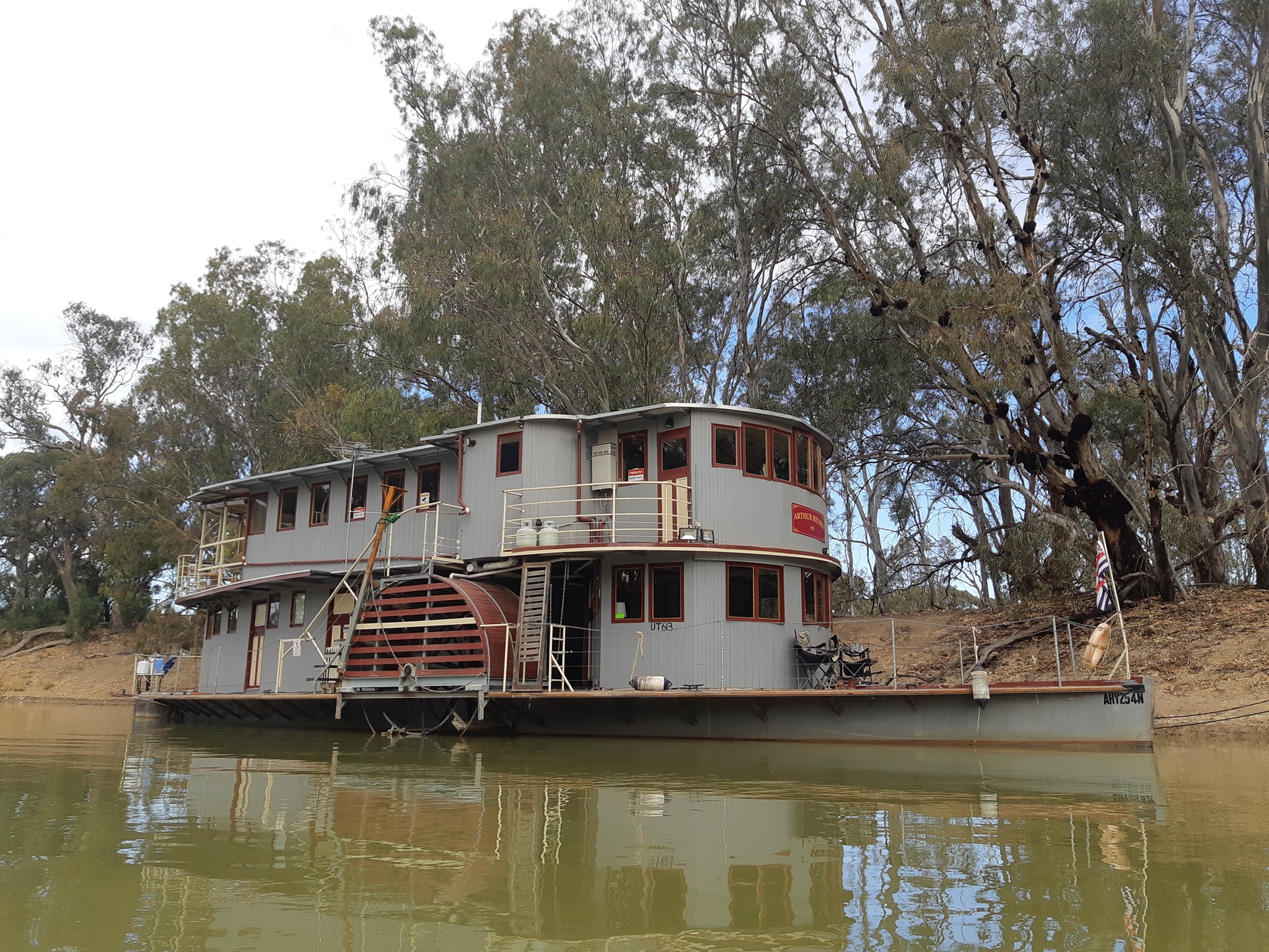
Reaching the start of the bush reserve, which runs for around 20km, we decided we were early enough to be fussy and find a good campsite for the night. A good campsite has a shallow bank, ideally with sand at its base; it has to be on the Victorian side of the river; trees to provide shelter, but not too many to make it shady and cold; a flat spot for our tent, clear from branches and debris; and no caravans or campers close so we can walk the dog in the morning*; no irrigation pumps, because the motors run all night; and finally we want an eastern exposure so we get the morning sun as soon as possible in the morning.
The process of finding a camp is a strange game. You paddle around a bend and see a potential camp site. You assess it's merits using the criteria above and then decide whether to continue on, looking for a better site, or pull up onto the beach and forgo what might be a better site just around the corner.
It reminds me of a joke about a man who goes to Hell. He is welcomed by the Devil who tells him that he gets to choose from a number of rooms where he will suffer eternity. He'll be shown each room one at a time . If he decides to go to the next room, there's no going back and the room he picks is for eternity. Entering the first room, the damned souls are being burned over a fire, screaming and wailing. He hesitates for a moment and asks to be shown the next room. In the second room, the damned are having strips torn from their flesh, and he rushes to the next room. And so it continues for a number of rooms until he walks into a room where everybody is standing around waist deep in excrement drinking tea from fine china cups. He turns to the devil and says, "this is the one for me." And instantly a cup of tea appears in his hand. The devil watches for a moment then smiles and says "ok sinners, breaks over. Back to standing on your heads for a thousand years." But I digress.
We did find a campsite and it seems to be quite nice. The rain has also found it, so we are presently sheltering under the tarp, waiting to make a run for the tent and go to bed. It's almost 9pm after all.
On that note, I bid you goodnight from Goodnight
- We don't have a dog, it's a euphemism for going out into the bush with a shovel and some toilet paper.
9 May 2021 - Day 22
Murray Paddle Day 22 of 48 - Gundagai Bend to Major Mitchell's Passage *snigger*
Distance remaining 1238 km
Blisters 0
Bridges: 27
Locks: 1
Location: 34°43.008' S, 143°11.998' E
As with other mornings after a rainy night, we were slow to get packed up as we grappled with a wet tent fly and a wet tarp which had both been pitched over a sandy beach. Sand is great until you have wet sand from rain sticking to wet gear that you're trying to pack away.
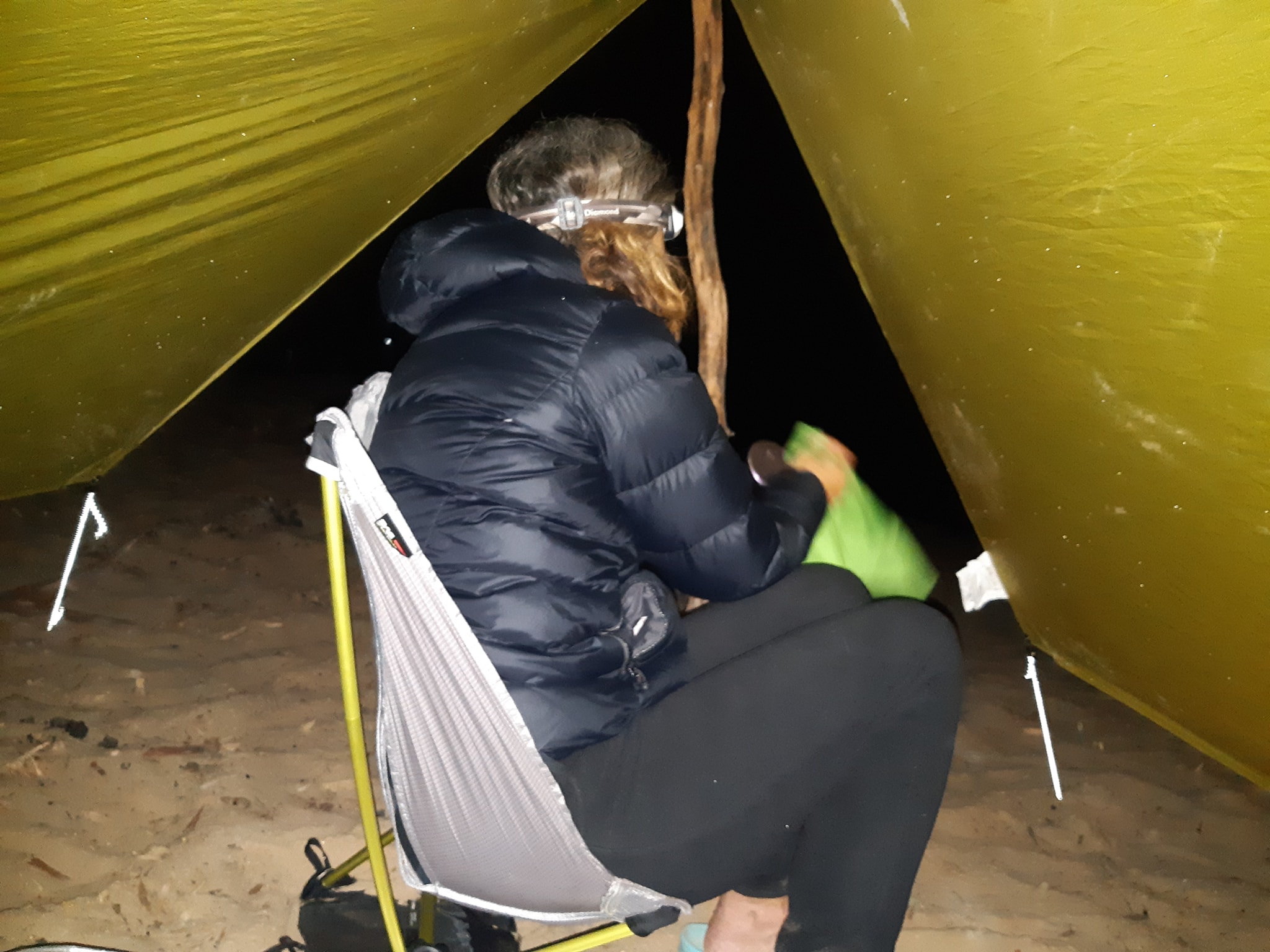
Adding to the list of things I'd bring next time... a couple of light dry bags for packing wet gear into my dry hatches. Water is insidious stuff. If you pack something wet into something dry, the dry thing is no longer dry. As much as you think your gear bags are waterproof, you can only go so long before water transfers from wet items to dry items. I'd also pack another brace of sand/snow pegs for the tarp. We've brought a set of 8 for our tent, but didn't think to pack some for the tarp. This led to a pantomime performance last night as I rushed to pitch our tarp over a sandy beach using a couple of branches for uprights and random bits of wood, frantically buried as snow pigs in the sand, all as night fell, a rain storm arrived overhead, my headlamp decided it needed new batteries, and Kate yelled encouraging phrases like "I'm getting wet" and "Your dinner is ready". Last night's choice of camp site proved to be the best option for the next 10km which is always nice to find. Too often we set off, only to find a better camp site around the next bend.
Despite being Mothers Day, Kate declined my offers of calling it a short day and stopping early at any of the nice camp sites we passed to spend a day in the sun. With only a moment of hesitation she chose to continue to our daily target of 50km.
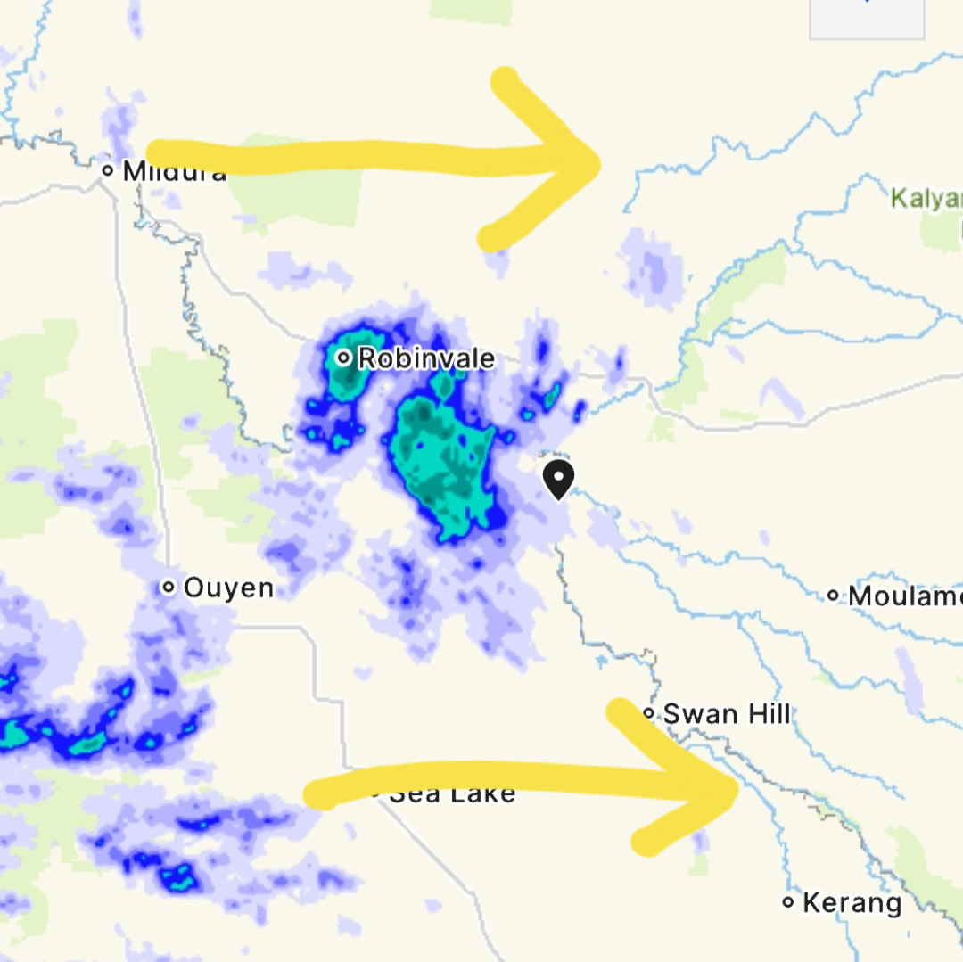
Later in the day when we were slogging along in a listless non-flow, she may have regretted that decision, but by then we were beyond the attractive camps and were following the river along a course that offered no afternoon sun and little chance of morning sun tomorrow.
While the Murray largely travels west along the NSW-VIC border to South Australia and then SSW to the coast, there is not a point on the compass that doesn't get used several times a day as it meanders and bends, gets lost, almost crosses over itself, then paddling directly away from your intended end point for the day. The character of the river has continued to change with two more tributaries merging in from the north. First was the Wakool River which seemed to add a fair amount of flow, but then the river widened and slowed as if it had become shallower from silt injected by the newcomer. That was followed late in the afternoon by the Murrumbidgee which merged just before we made camp. We've paddled parts of the Murrumbidgee up above Wagga Wagga (which I remember fondly as the road rage capital.of Australia). The vague flow entering the Murray here bore little resemblance to the quick flowing Murrumbidgee we remember racing from Oura Beach to the middle of Wagga Wagga.
Our campsite for the night is another beach camp, this time with some trees that have yet to fall to the ministrations of campers searching for nearly eligible firewood, so we have our wet gear hung out to dry and a nice fire crackling away on the beach. The skies are clear and the stars are out.
We're a little under 70km from Robinvale and a caravan park with showers and laundry, so its 50km tomorrow and then a shorter paddle into Robinvale on Tuesday morning. Some time tomorrow, we will pass the 1200km marker and we will be half way through our adventure. On Wednesday morning we'll ride the lock to the next level down and then its seven or eight days to Mildura and our second and final resupply drop for the trip. Another gear note. We've been concerned that we might have punctured our inflatable mattresses. They've been noticeably deflated in the morning when we wake up. Finding a potential leak would mean immersing them in the river to look for bubbles, then trying to get them dry enough to patch and sleep on before nightfall. Its an exercise which is better performed at home with no time pressure. As a stop gap, we topped up the mattresses just before we went to bed last night and in the morning we found they were much better. We're now convinced, and more than a little relieved, that it's the cooling air contracting overnight that's deflating them. Its around 23°C when we set up camp and inflate the mats. By the morning it's dipped to between 5°C and 8°C. Crisis averted.
On the solar panel front, mine is working great with my battery usually maxed out at the end of each day. Kate's however isn't charging the battery, so either we have a battery problem - it's a Goal Zero unit we've had for a number of years - or it's that Kate's hugging the corners so much that she's in the shade too much. The charger and the cable appear to be ok since the battety detects a charge current as soon as it's plugged in in the morning. Investigations will continue.
Q&A
From Ian: I see on the news that the Darling River is full - getting a bit of a flush from recent flooding rains. Presumably some of that reaches the Murray after Mildura? Do you do any monitoring of river levels/flows downstream for planning - or more a day at a time?
This is probably a reflection on our minimal approach to planning and research. We haven't got a clue what the normal levels on the river are, or what effect they might have on flow when they change.We just paddle the river as we find it, untroubled by the idea that this section might be running slower that usual or that there's another section ahead which might be faster in a few days.
Realistically we can only accelerate our progress by maybe 20km a day before we risk pushing too far to be sustainable in a paddle where we have no scheduled rest days. At the end of the day, there's little we can do to change the conditions on the river once we committed to a start date, so we just accept what we find in front of us each morning.
10 May 2021 - Day 23
Murray Paddle Day 23 of 48 - Major Mitchell's Passage to a bend with no name between Cods Head Reef and Meilman Station
Distance remaining 1180 km
Blisters 0
Bridges: 27
Locks: 1
Location: 34°39.920' S, 142°57.537' E
Today was tough.
We'd had a clear sky all night with a great view of the stars overhead, but by the time we woke up it had clouded over and was threatening to rain. We managed to get everything packed away dry and got about 5kms behind us before the weather made good on its threats. First the wind and then the rain.
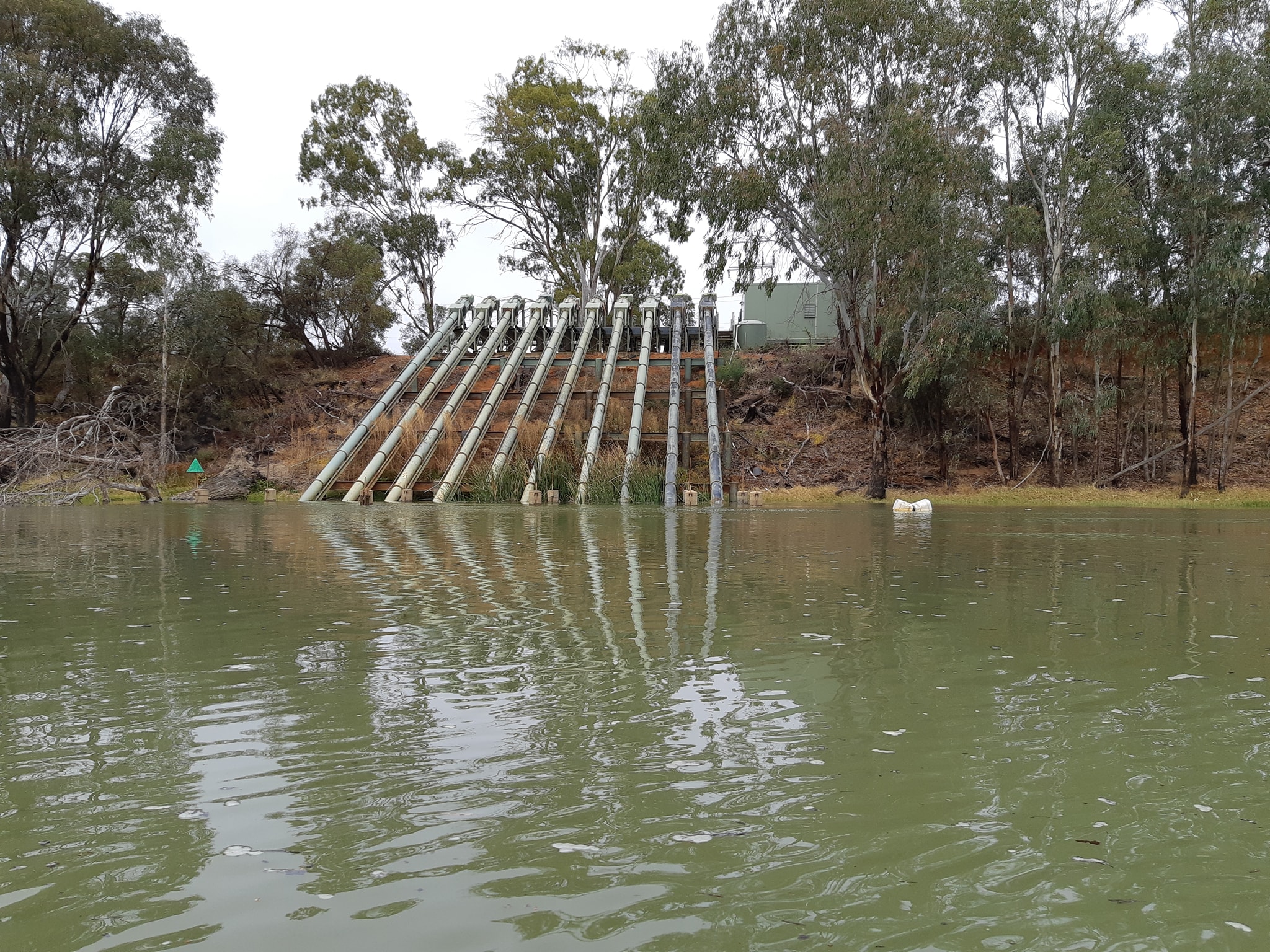
The river is following a path which is predominantly WNW and there was a strong wind gusting in from the north for about 1/4 of our course. We'd get battered every time we turned a bend. We were seriously considering pulling in to a sheltered beach and sitting it out for a day. Progress was slow. Really the only thing keeping us moving was the the complete lack of any good places to pull over and sit it out.
We'd just spied a beach on the sheltered side of a bend which looked promising when the rain started. And it started with enthusiasm. This cloud wasn't just lurking to sprinkle a bit of water over us. It was out to soak us to the bone. At that point we decided that we were already as wet as we could possibly be and there wasn't any upside to putting the tent up in the downpour, so we may as well just keep paddling. The forecast had said rain from 10am to 4pm and we could see some patches of blue sky in the distance.
Eventually the rain did stop and well before the forecast 4pm. We found a camp site which is tucked into a depression below a sheltering hilltop and now we're wrapped up warm in our sleeping bags with our Kindles listening to the wind howling over the hill. The wind is forecast to continue until 6pm tomorrow.
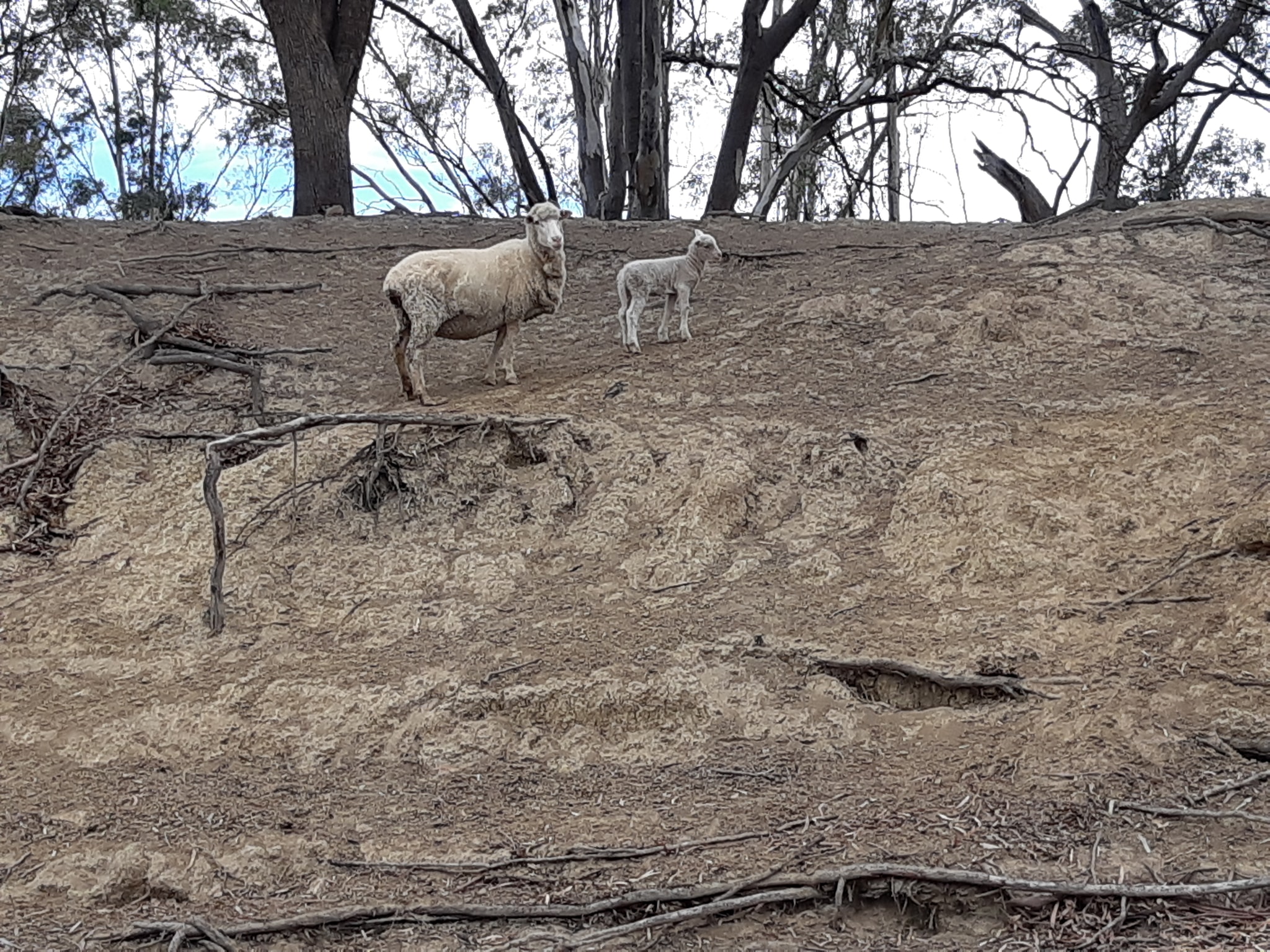
We are 42kms from Robinvale and a hot shower (not that I'm starting to obsess about hot showers). Kate has checked the map and thinks we can cut 10km off the marked distance with a few judiciously chosen shortcuts. I fully endorse that decision.
One thing we have noticed today is that there is a lot of aquatic weed in the water. Presumably some flow increase has torn it loose from upstream. We can't tell whether it's a release of water down the Murray or a flood of water that came down the Murrumbidgee. Its been fouling our rudders all day.
11 May 2021 - Day 24
Murray Paddle Day 24 of 48 - The bend with no name to Robinvale
Distance remaining 1124 km
Blisters 0
Bridges: 27
Locks: 1
Location: https://maps.app.goo.gl/n11RDWcookgkBKNh8
The rain stopped overnight leaving the howling Sou'wester to dry out the gear we'd left hanging on the line thinking it was too soaked to bother bringing in. For the first time on the trip we layered up with thermals, paddle jackets and spray deck against the chill wind. We figured everything was going into the laundry at Robinvale so there was no downside to wetting more gear.
Setting out for Robinvale (...and did I mention the hot showers?), we had 56km according to the river markers but Kate was convinced that there was only 36km of paddling after she deducted the cuts for the day. The weed we'd been fouling our rudders with yesterday continued to be a problem. It soon became obvious that it isn't flotsam torn lose by a flush of water down one of the tributaries. It's mostly growing up from the riverbed. There's weed in all the usual shallow spots on the inside of bends, but its also growing up from the riverbed out in the channel where the water was definitely deeper than I could reach with my full paddle length. It's everywhere.
It hasn't formed solid mats in the channel, but its been almost impossible to paddle a full kilometre without picking up some of it and having to unfoul the rudder - again. We just haven't been able to drop into that hypnotic rhythm that turns minutes into hours without you really noticing the passing of time.
Fortunately Kate and I both have smarttrack rudders which are spring loaded and have an uphaul line beside our cockpits, so as soon as you feel the extra drag on the boat, you pull up the rudder with a quick yank and it dumps the clump of crud behind you. I was having a bit of trouble with my rudder because the spring tension was set too soft, so every time it caught weed the rudder blade would deflect back at an angle making my steering very heavy. Not usually a problem but the wind was kicking up small waves and pushing the boats around as we battered into the southerly portions of the bends. It made the boat sluggish to respond, with the rudder feeling like it had gained 20kg.
Predicting that we wouldn't be able to float downriver while we had our morning mandarin break we pulled into a small beach on the NSW side, risking prosecution for trespassing with every minute we lingered. I thought it would be an opportune time to wind up the tension on my rudder. It's an adjustment I've made a dozen times on various boats. It's quick and simple. You pull a small stainless locking pin out, pull the tension dial out, turn it a little tighter, push it back in, and replace the locking pin.
Simple.
Or not.
I've never done it with hands so cold from wind chill that I couldn't feel my fingers or apply decent grip. I got the locking pin out using the knife out my PFD to pry it out. Then used the knife again to pry the tension dial out of its locked position so i could turn it. As I struggled to dial in the new tighter tension with hands that were still feeling like they belonged to somebody else, Kate suggested she should head off as she was getting cold and I could catch up.
My recollection is that I said "sure, fine". Her version is somewhat different, with a strong suggestion that she should just be somewhere other than where I was struggling with the rudder adjustment. She left.
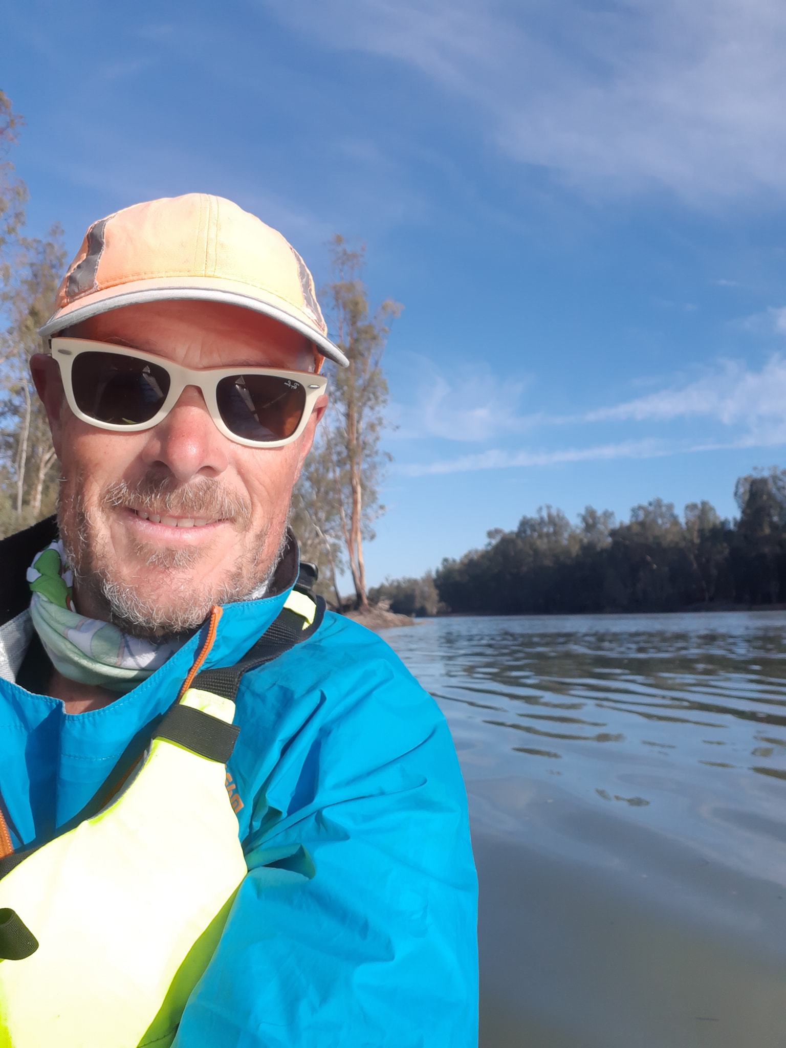
At that point I managed to snap the tension knob back into a locked position only to find it was back where it had been before. Again, I couldn't pull it out with my bare hands so I pulled my knife out of my PFD and watched drips of blood fall into the water and all over my rudder. In my haste to adjust the rudder, I'd reversed my knife in its pocket so that it was blade up instead of blade down. When I grasped the sheath to pull it out, I'd put my thumb where the spine of the blade should have been. It wasn't.
My fingers were so cold, I still couldn't feel what I was seeing. In my head it was like viewing a test question in first aid training. Blood squirting so circulation is good. Blood is bright red so oxygenation is ok suggesting good respiration... and now bleeding is starting to slow so probably good white cells and clotting going on. "%&@%$#%!", I said.
Patient conscious and responsive. A little blood really does go a long when you're in a wet environment. Good thing there's no sharks in this part of the Murray. Some of my friends will recognise this as a Gayle Edith moment. And yes Stewart Nicol I was using the wrong tool for the job, despite the multi-tool which was three feet away in my day hatch. I believe an I told you so is due.
Back to the rudder, now without using my knife. I managed to extract, tension, and relock the tension dial, then dropped the stainless steel locking pin in the water because it was slippery with blood. In answer to Ian's question later, the water is turbid enough that it's bloody hard to see a dropped stainless steel pin in elbow deep water. Assuming it had dropped straight down, I was feeling gently on the bottom until I realised that weed was drifting through my drop zone on the current and my pin might be getting carried away on a lump of weed. Another reason to hate on the weed. I quickly took a large step backwards to where the weed would have drifted and began a thorough search of the gravel and weed back to the spot beneath my rudder. No joy. I'd almost given up when I caught the slightest glimmer of metal about a foot up-current from where the pin dropped. It wasn't my pin, but as I swept my hand across the gravel, my fingertips brushed a familiar shape. Found it.
By the time I got the pin back in and set off on pursuit of Kate, I'd been stopped for over 30 minutes. She was well ahead and out of sight. I had momentarily considered what would have happened if my slip had been more serious and I was unable to paddle after her. I guess the rescue boat from Robinvale would pass her on the way to my location.
Fifteen minutes later, paddling hard, still no sight of Kate, the bleeding had slowed to an occasional drip and I came to a fork in the river. Kate had mentioned this one. 4km of slow water to the left, 400m of fast water to the right with some trees to dodge and some waves caused by the velocity jump. I took another moment to consider that if Kate had gone the long way I could be chasing her down when she was actually behind me. Then I decided that for the last 1200km she'd cut more corners than a Western Sydney property developer so there was almost zero chance that she'd gone left. It was half an hour before I caught sight of her and a full hour before I finally caught up. Just time to stop for another mandarin.
Tip of the day. Don't peel a mandarin or any other citrus fruit with the end of a cut thumb. Not good. My hatred of the weed was completely wiped from my mind for a good five minutes.
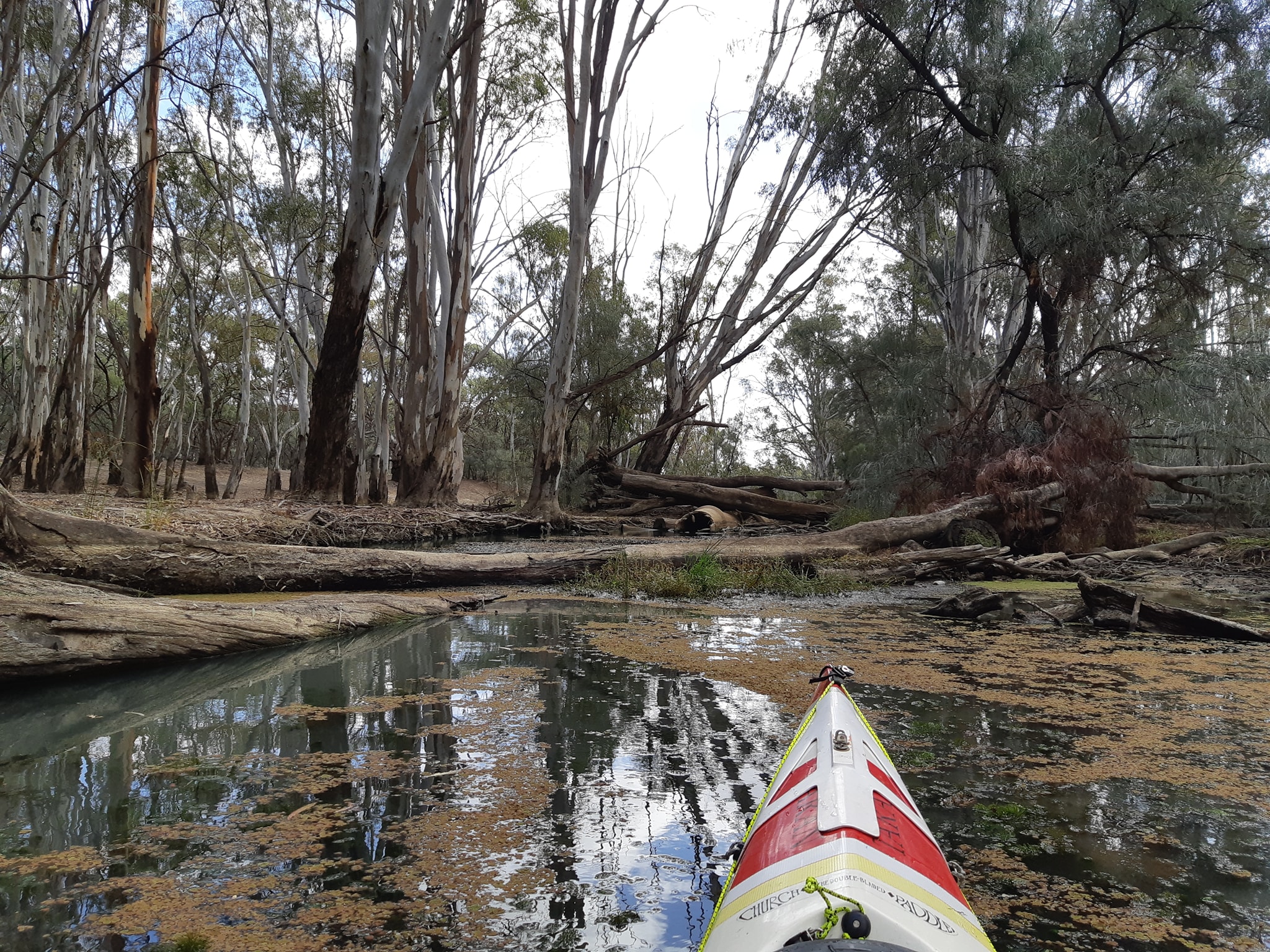
The wind continued to blow and we continued to paddle. We slipped through another cut which was almost blocked with fallen trees, shaving 2km off in exchange for a slow passage of branch dodging and pushing through weeds. I think I could have taken the long way and beaten Kate to the merge. The next cut promised a 4km upside but 200m in, we found it was completely blocked with multiple trees spanning the river and a lift of 4ft to go over. Slmebody had helpfully dropped in some concrete pipes to block it even more thoroughly. We backed out through the weeds and surrendered ourselves to the long route.
The final cut is a wide channel and teleports you from river marker 1138 to 1124 at the cost of only a few hundred metres. A 14km saving. Very welcome even though the wind died to nothing just as we got to it. We've had a nice afternoon in Robinvale where you can get a good coffee and an excellent snot block (vanilla slice to the uninitiated). The local economy has been somewhat improved by our injection of cash in exchange for hearty edibles of the meaty and pastried variety. We've called the Robinvale lockmaster about passing through tomorrow morning. There's no set time for the lock to operate and he'll just run us through whenever we get there.
Its only 6km from the caravan park where we are staying in a powered caravan site overlooking the river for just $35 a night. Good value i reckon. Tomorrow is a new day and hopefully we'll have blue skies and light winds as we start our next push on to Mildura.
Q&A
From Ian: Do you have a view on whether river water quality is improving or disproving (?) as you paddle downstream? As measured by the amount of car-ap caught in your filtering system? I was intrigued to learn how much the murray darling system is 'managed' (seems like your paddling day is dictated by water releases)
A: It seems to vary up and down as we progress. It started clear up at Bringenbrong and went downhill as fast as we did until we reached the Hume Dam by which time there was a lot of clay suspended in the water. Out of Hume Dam there was a chocolate brown colour to the water as there was some sort of release pushing through. That colour seemed to settle out and the water cleared up a bit going into Lake Mulwala above Yarrawonga. We were pretty good from there until Swan Hill.
There was a sudden drop in water clarity after the Murrumbidgee merged in. I've also seen a lot more floating debris like twigs and leaves as we've been collecting water for the filter. Right now the water clarity coming into Robinvale means I can see my paddle blade in the water but not all the way to the end so it's about 8 inches of visibility. You also can't see anything but the tips of the weed. I'm hoping there's a change for the better in terms of weed, particulates, and debris below the next weir. A nagging question for the weeks ahead is how the salinity of the river water will change as we enter South Australia.
Did you know that the weir at Berri has a secondary role to providing irrigation? It also acts as a salt water barrier, as do all of the weirs from there down. There's some stuff about it on an info board at the weir. As far as our paddling day, we were discussing it tonight and we think that 50km remains a reasonable days objective. Some days may just take longer than others. We've been starting at 9am and we've been past 50km by 2:30-3:00 most days. Then it's just a matter of how much further we go to find a camp site. That part of paddling day is usually markedly slower as we scan for possible tent sites. I expect it would be very different if we'd planned all of our stops in advance using Wikicamps and Google satellite view. But we'd probably also be 100-150km back upstream.
At some point yesterday we passed our halfway point, where the 1200km marker would be if it wasn't not actually there. Our fund raising target is $5000 and we are just below half way on that so if you're finding these ramblings either informative, or entertaining then please give generously to Coast Shelter.
12 May 2021 - Day 25
Murray Paddle Day 25 of 48 - Robinvale to Tammit Station View camp
Distance remaining 1078 km
Blisters 0
Bridges: 28
Locks: 2
Location: -34.722705°, 142.663097°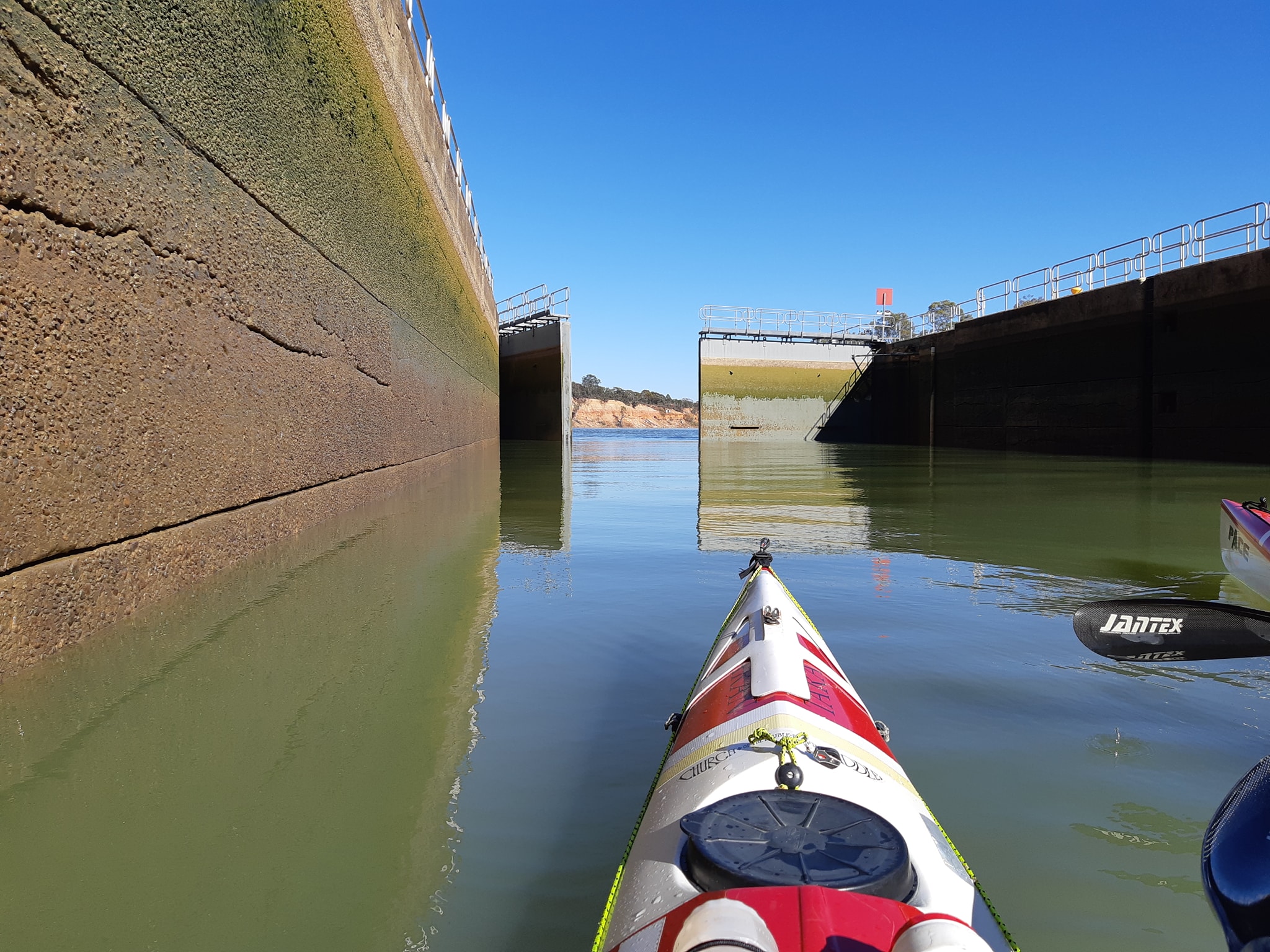 After two windy days, we'd considered having a rest day in Robinvale, but then we'd already gone and contacted the lock master about coming through this morning so it was sort of easier to keep going. We'd have kicked ourselves if we'd missed out on paddling today. The river out of Robinvale is predominantly southerly and would have been pretty horrible if the Southerly we'd been bashing into was still blowing. But it went away. Leaving a beautiful day with clear blue sky and calm mirrored water.
We'd been given a spot in the caravan park which was shaded from the morning sun by some large trees so we didn't realise the sun was up until the other campers around us started to move. We didn't get onto the water until 9:30 which is possibly a new latest start for the trip. We were only a few minutes off our previous days 10am estimate for arriving at the lock and Greg the lock master was there five minutes after we phoned him. We had a good chat with Greg while he ran us through the lock and he gave us some good tips about free water and free showers at the locks in South Australia.
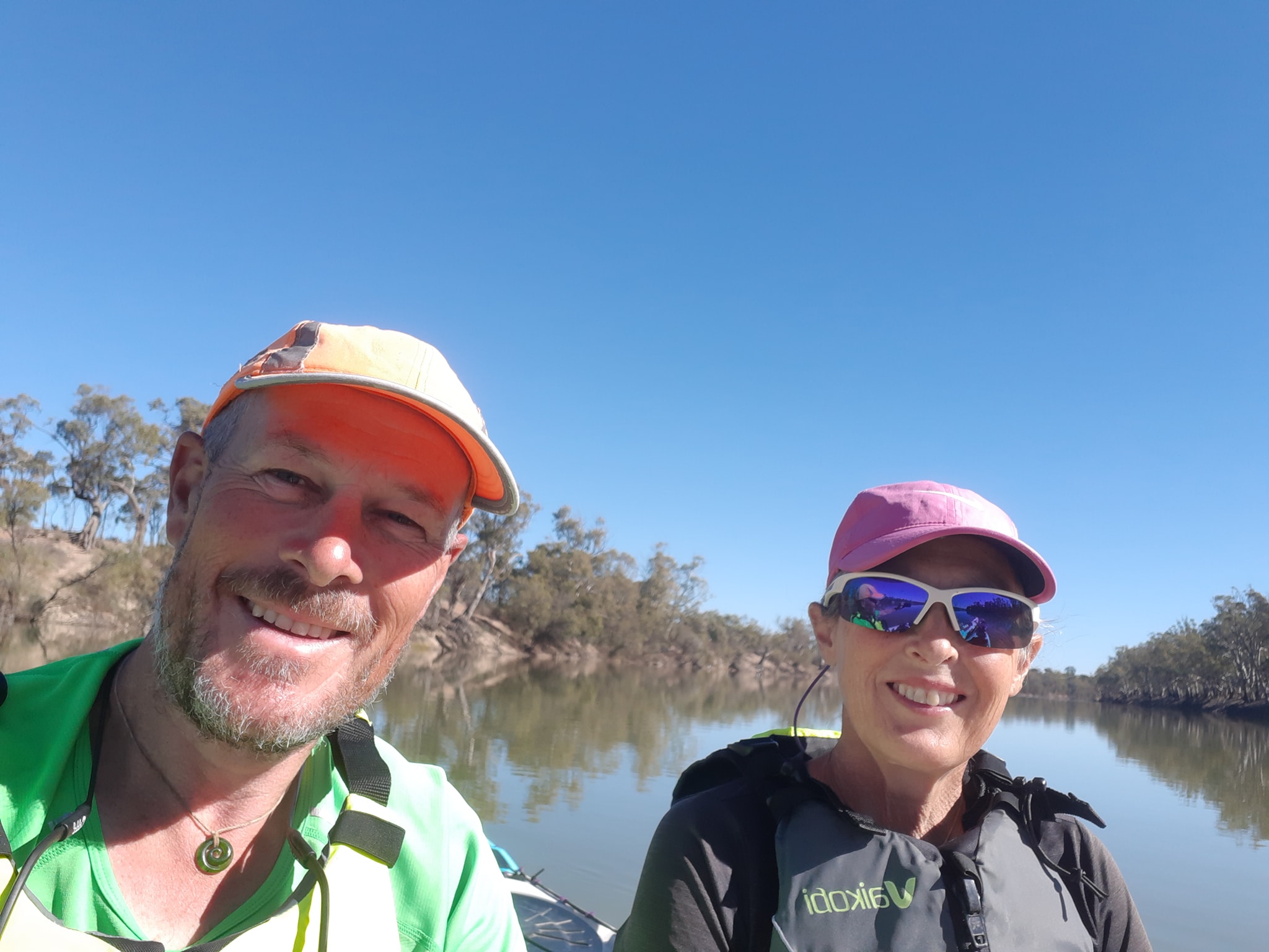
After passing through the lock, we had a long drift while we phoned in some orders for replacement gear we wanted sent ahead of us to Mildura. We've decided to replace the two hydration bladders which were punctured early in the trip. We've tried all sorts of patches and tapes, but their silicon surface seems to be seriously non-stick. We also need to replace my spray deck before we get to Lake Alexandrina. My current one is about 8 years old and the neoprene has started to delaminate. Hopefully the couriers get to Mildura before we do. It's just under 200km downstream so we should get there some time on Sunday.
We saw more wild budgies flitting through the trees and drinking at the riverside today. The little sparkles of emerald green are wonderfully bright but you have to be quick to see them.
Anyway, short update tonight. Not a lot of miles and I'm typing on my phone with one thumb because the touchscreen doesn't like Bandaids. Tomorrow morning we pass through Wemen and then we are on the long haul to Mildura.
13 May 2021 - Day 26
Murray Paddle Day 26 of 48 - Tammit Station View camp to Boisz Camp on the edge of Hattah Kulkyne National Park
Distance remaining 1021 km
Blisters 0
Bridges: 28
Locks: 2
Location: 34°38.280' S, 142°29.048' E
Another short update tonight as I've managed to break my reading glasses which makes my nightly battle with autocorrect even less appealing. Hopefully I can get through this without turning it into one of those internet memes where everybody is super smart because they can read words even though they are all jumbled up.
We've adopted an approach to campsite selection which means we look for sites on a northern point with an Nor'East facing exposure where we can get morning sun on our tent as early as possible. if we're lucky we get the last of the afternoon sun from the Nor'west. It's worked pretty well so far.
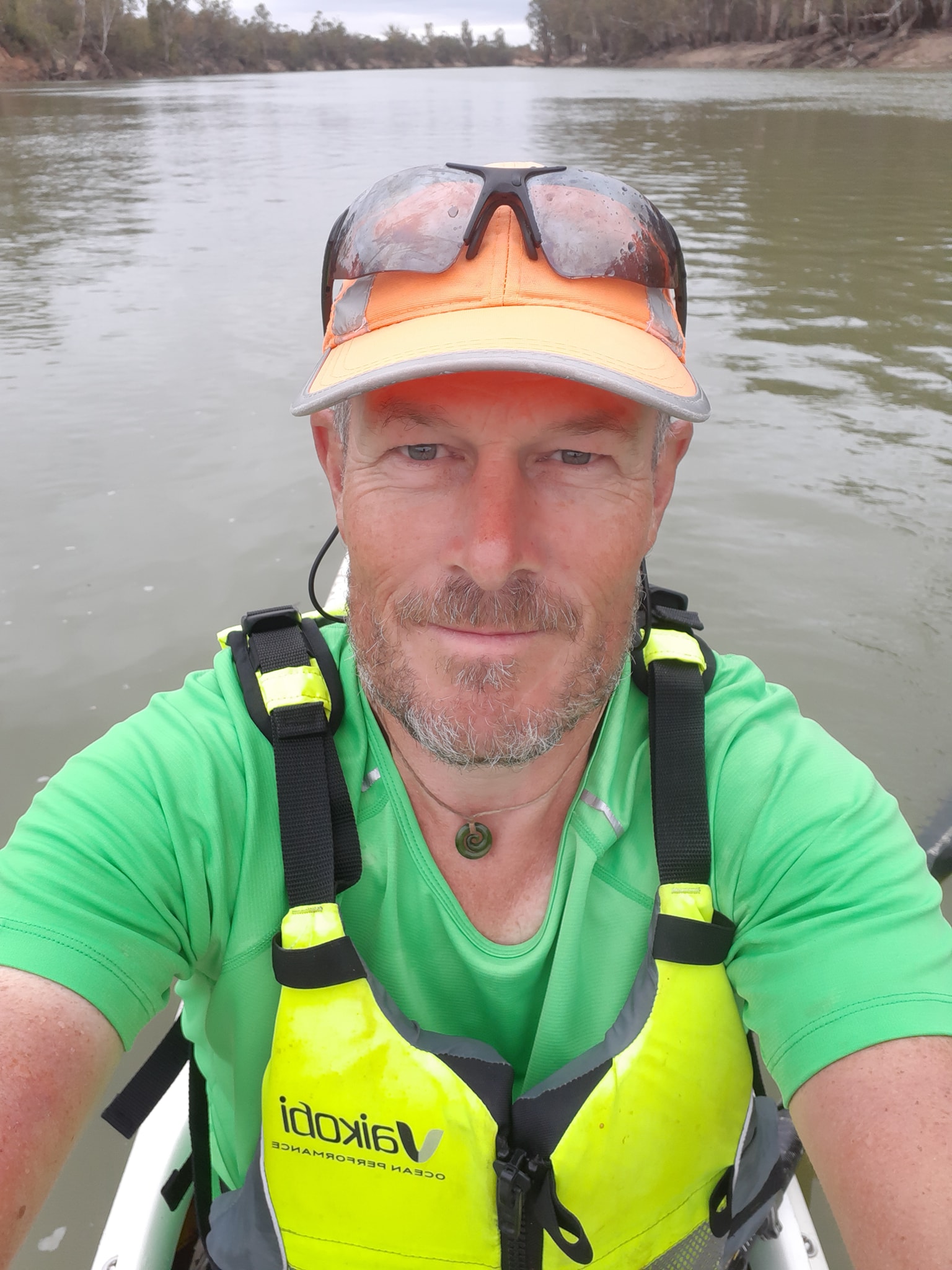
This morning we got a full shine of sunrise for about an hour as we were getting ready and then the sun ascended into a quilted blanket of cloud for most of the day, only coming out to tease us for a few moments. We did catch an odd optical effect that we will call a cloud-bow where the sun was refracted into the spectrum colours by a small cloud which must have been loaded with moisture, or had just started unloading it's moisture.
Before long the wind had started up again, this time from the NW which pretty much coincides with a head wind in our direction of travel as we traversed west and then turned north across the countryside. Fortunately it only seemed to hammer us when we were travelling exactly NW. As soon as we'd turned 90 degrees, it either died to a zephyr or turned into a slight tail wind. It was still cold though and we've spent much of the day with chilled hands.
By lunch time, I couldn't manage fine motor control tasks like ripping open a sachet or peanut butter to fill my taco shell. Kate reverted to her paddle jacket while I opted to shiver in shorts and t-shirt for the last of the day. The wind was strong enough in some reaches to kick up wind waves big enough to break over my deck ans into the cockpit. The water is generally warmer than the air temp, but I still prefer not to have a gallon of it dropped into my lap.
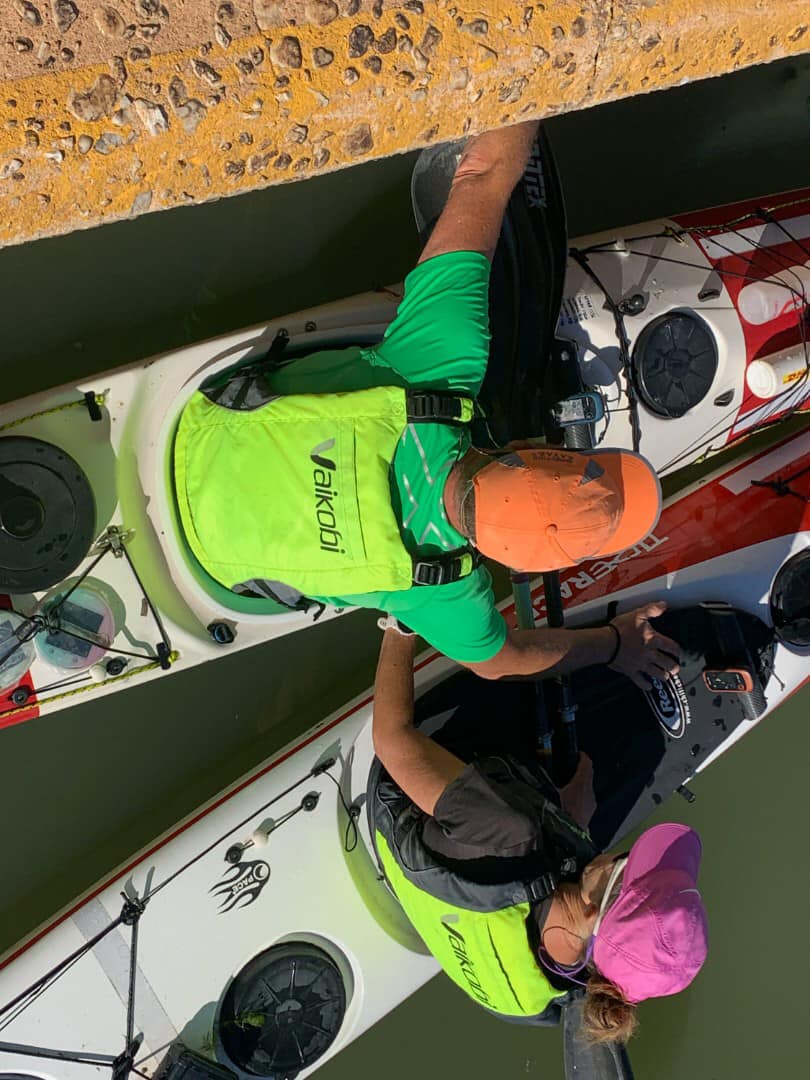
Todays section of river has offered more great beach camp sites on the Victorian side than I think we've seen on the trip so far. It was a shame that most of them appeared well before we were ready to stop. There's been a wide variety of bird life today. Pelicans are a constant on the river and I never tire of watching them glide hundreds of metres just inches above the water until they land like flying boats again. More green budgies and some ring neck parrots at one stage. And a few prey birds whixh i think are hawks, but could be falcons or else.
We reached our 50km target for the day and discovered a nice open sandy beach with a flat area at the top for our tent and tarp. There was even a half oil drum on the beach that had been cut into a fire pit. We got the tarp pitched just in time to huddle under it while the first half hour of rain passed over.
Since then we've alternated between sitting beside the fire and huddling under the tarp while it rains. It not raining heavily, just a drizzle that drifts horizontally on the wind. We are now around 140km from Mildura and should get there on Sunday afternoon. We're considering a rest day in Mildura.
Tomorrow we will cross the 1000km to go mark which is quite encouraging. And then probably a day later we will have paddled 1500km for the trip. We've had plenty of time to calculate the encouraging little milestones of our adventure.
14 May 2021 - Day 27
Murray Paddle Day 27 of 48 - Deep Bend (1021) to Hooleys Beach across from Spences Bend (959)
Distance remaining 959 km
Blisters 0
Bridges: 28
Locks: 2
Location: 34°26.732' S, 142°21.852' E
[Note: this post is a rewrite after Facebook dumped the first version when it couldn't get enough signal to upload. Grrrrr. The terrain is as flat as a pool table out here so we must have line of sight to some cell tower. Anyway version 2, the no frills update]
Another day of wind from the southeast as we move northwest which would seem positive except that the river winds and curls aimlessly through the flat terrain towards Mildura. We got solid head winds for about 20% of the day, then we'd round a bend onto dead calm with water like a mirror.
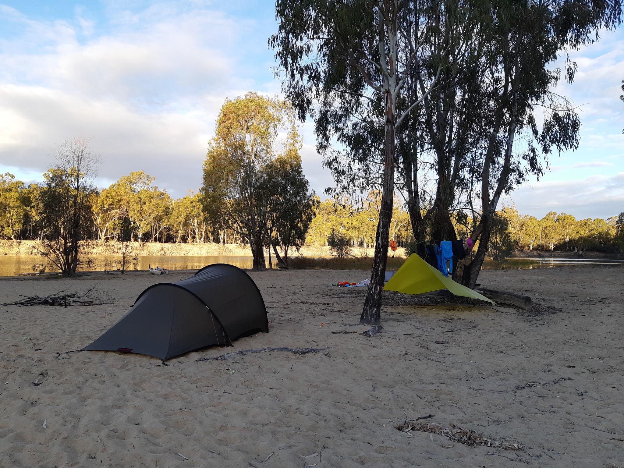
The wind has been cold but we finally managed to get our paddling clothes dialed in for the temp and the work rate. Kate has gone for a spray deck and jacket while I opted for a light thermal and jacket without the spray deck. It's made paddling into the head winds less onerous because at least we are not sweating or shivering while we do it.
A mixed day for map reading with one shortcut being good at Tarpaulin Cut and then another after Colignan and St Helena Island being completely nonexistent unless the water level was at least 2m higher. Even then its been dry so long that it's full of trees and there are 4WD tracks mapped across it at both ends. Total gains about 7km of the 12km we were hoping for.
Somewhere along the way we passed the 1000km to go marker which was typically not there so we were at 996 before we realised we were finally into 3 digit distances. It's a small psychological milestone that helps keep us going
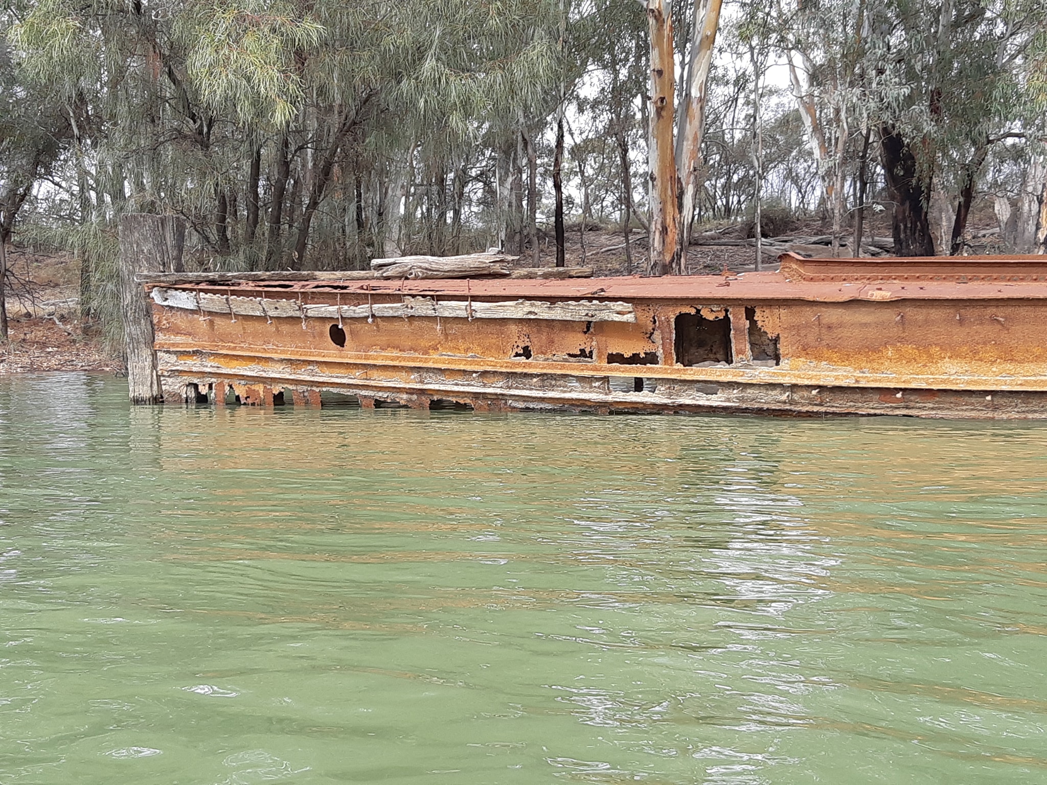
A 970 we came across a couple of dogs loose in the national park which were barking at a big male grey kangaroo. I yelled out them to get out of it and go home which they did until we had passed around the corner and we heard barking again. Well I tried. At least one of the dogs is going to get the snot kicked out of it. It was a big roo and despite having open exits in two directions he was standing up and standing his ground. Tonight's campsite is huge low lying beach with a view straight into the morning sun. We had it to ourselves and the birds until a couple of vehicles arrived towing a boat and camped down the far end. They've just lit their fire and about a thousand Corellas have taken wing which sounds like a scene from Hitchcock's Birds, if he'd had a much larger special effects budget.
15 May 2021 - Day 28
Murray Paddle Day 28 of 48 - Spences Bend (959) to Psyche Bend Pumphouse (904)
Distance remaining 904 km
Total Bridges: 28
Total Locks: 2
Location: 34°15.450' S, 142°14.128' E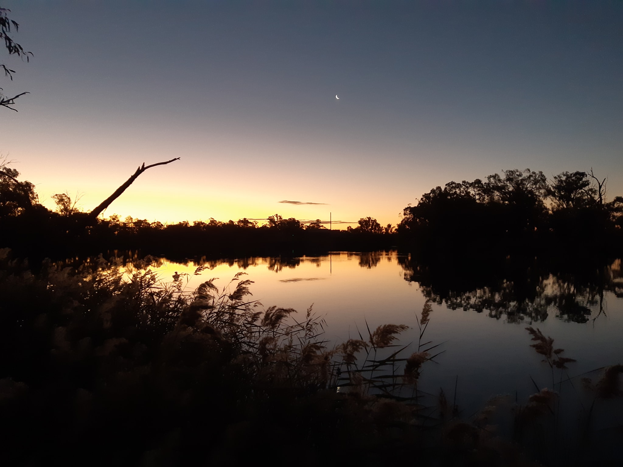 Day 28 of our adventure and most of our friends won't be surprised to hear that today is our 28th Wedding Anniversary. We are camped on a riverbank at Psyche Bend watching the sun set over the historic pump house, with hot drinks in our hands, and doing it our way.
So while we put our feet up and enjoy the evening. Please take a moment to support the charity for our paddle. Coast Shelter.
16 May 2021 - Day 29
Murray Paddle Day 29 of 48 - Psyche Bend to Mildura
Distance remaining 882 km
Total Bridges: 29
Total Locks: 3
Location: 34°9.208' S, 142°9.833' E
A short 18km as we paddled to the number 11 Lock in Mildura, and then on to our second and last resupply cache at the Apex caravan park below the weir.
We started out with plenty of time to make the locks downstream cycle which is on the the hour. We called ahead when we were 30 minutes and 3.5km out to let the lockmaster know we were coming. He said we'd be going through at the same time as one of the paddle steamers so we should just follow them into the lock and hang onto the boat once we were inside. No problems.
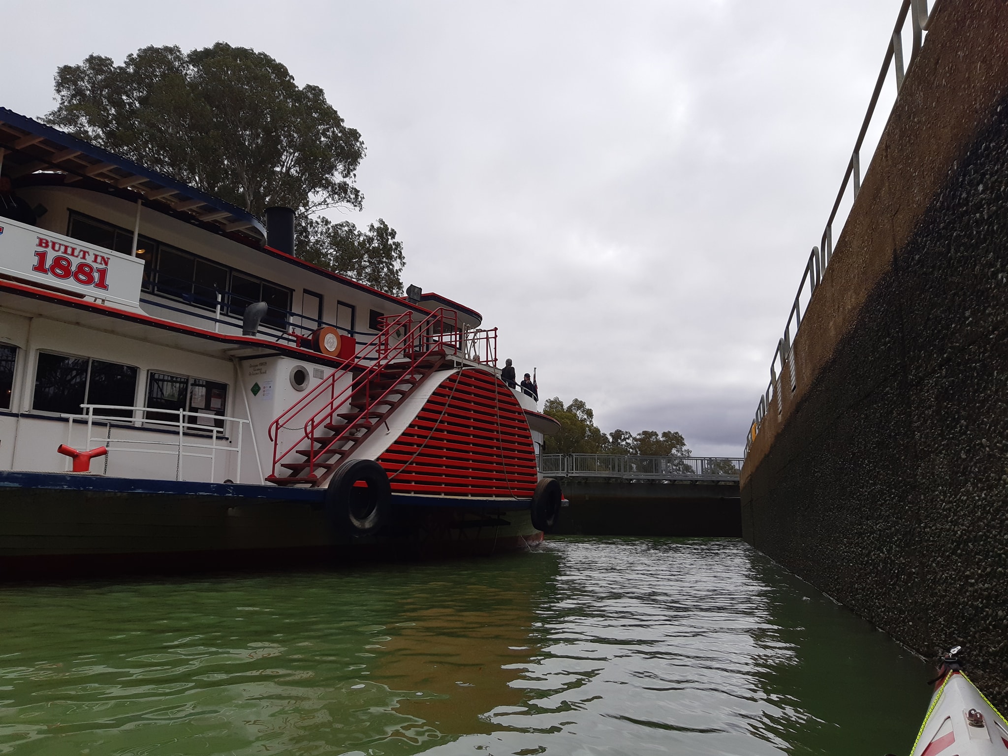
Then the current died away, a head wind appeared and our speed dropped noticeably. Kate was particularly concerned that we'd miss the 11 o'clock and would have to wait until 12 to go through, although some locks close for lunch which would leave us shivering at the approach until 1pm. I decided to push ahead so that at least one of us would be on the approach and then I could dawdle a bit until Kate caught up. As the lock came into view I realised that the paddle steamer going through was the one we'd passed back at a dock a kilometre from the lock. They turned up promptly on the dot of 11:11.
We attracted lots of attention from passengers on the paddle steamer as well as onlookers at the lock. A few chatted to us as we descended to the lower river level, keen to know where we'd started. Almost nobody knows where Bringenbrong is located so it becomes a cycle of naming increasingly larger towns until eventually we get to "bottom of the Snowies" which everybody recognises, or at least they think they do. I'm sure some of them picture us saddling up the kayaks at the edge of the snow line on Mt Kozisousco and setting off.
We got to go first out of the lock and we were off and out of sight before the big paddle wheeler got back underway. We could afford to put in a bit of exertion as our campsite for the next two nights was only a few kilometers downstream. We've decided to have a rest day in Mildura, partly because we have a couple of courier packages arriving and partly because its the last major town we will pass through where we can effect repairs and resupply.
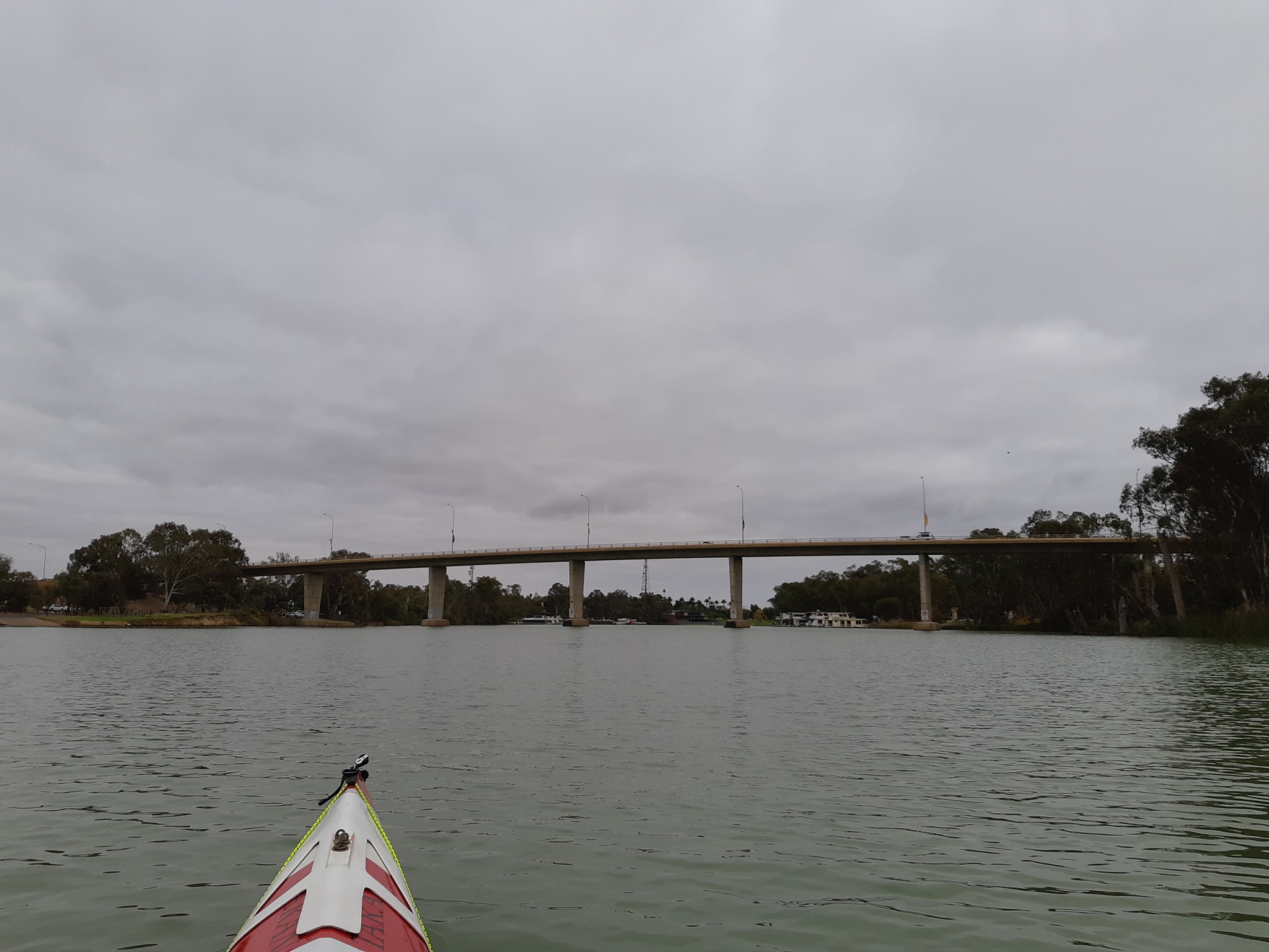
The list has been growing for a while
- Two MSR dromedary bladders punctured
- One sleeping mat with a slow leak
- The hatch rim on my Taran's day hatch has started to come loose and needs some sealing
- A leak in Kates glovebox hatch needs a dab of silicon too
- Our USB charger blew up in Robinvale
- One of our LUCI solar lights has been punctured
- My spray deck has torn from the constant torsion and needs replaced.
- Kate's battery is not charging off the solar panel and might be dying
- ...and I broke my reading glasses.
We took a walk into town to pick up some fixings and get some cafe food. After 28 days on the river with a largely fixed daily menu shop-bought is seriously tempting, although the reality rarely measures up to the craved taste in my imagination.
Tomorrow will be a busy day of sealing and repairing and then we'll have a wander around Mildura for the day. And another shower.
17 May 2021 - Day 30
Rest day in Mildura has been good. Fueled, rested, repaired, and refreshed. Ready for the river again tomorrow.
18 May 2021 - Day 31
Murray Paddle Day 31 of 48 - Mildura to Wallpolla Island
Distance remaining 825 km
Total Bridges: 30
Total Locks: 4
Location: 34°7.735' S, 141°52.087' E
Rest days are supposed.to leave you rested and relaxed but for some reason we ended up feeling more disorganised as we repacked our boats on the beach in front of the caravan park in Mildura. The park is across a public road from the beach so when we arrived we had to unpack everything from our boats into big shopping bags to make the boats light enough to carry across to our allocated site. Then we loaded everything back into the boats because that's our weatherproof storage. On Monday we unpacked them again, distributed the food and fuel we were picking up, then packed them up again for the night.
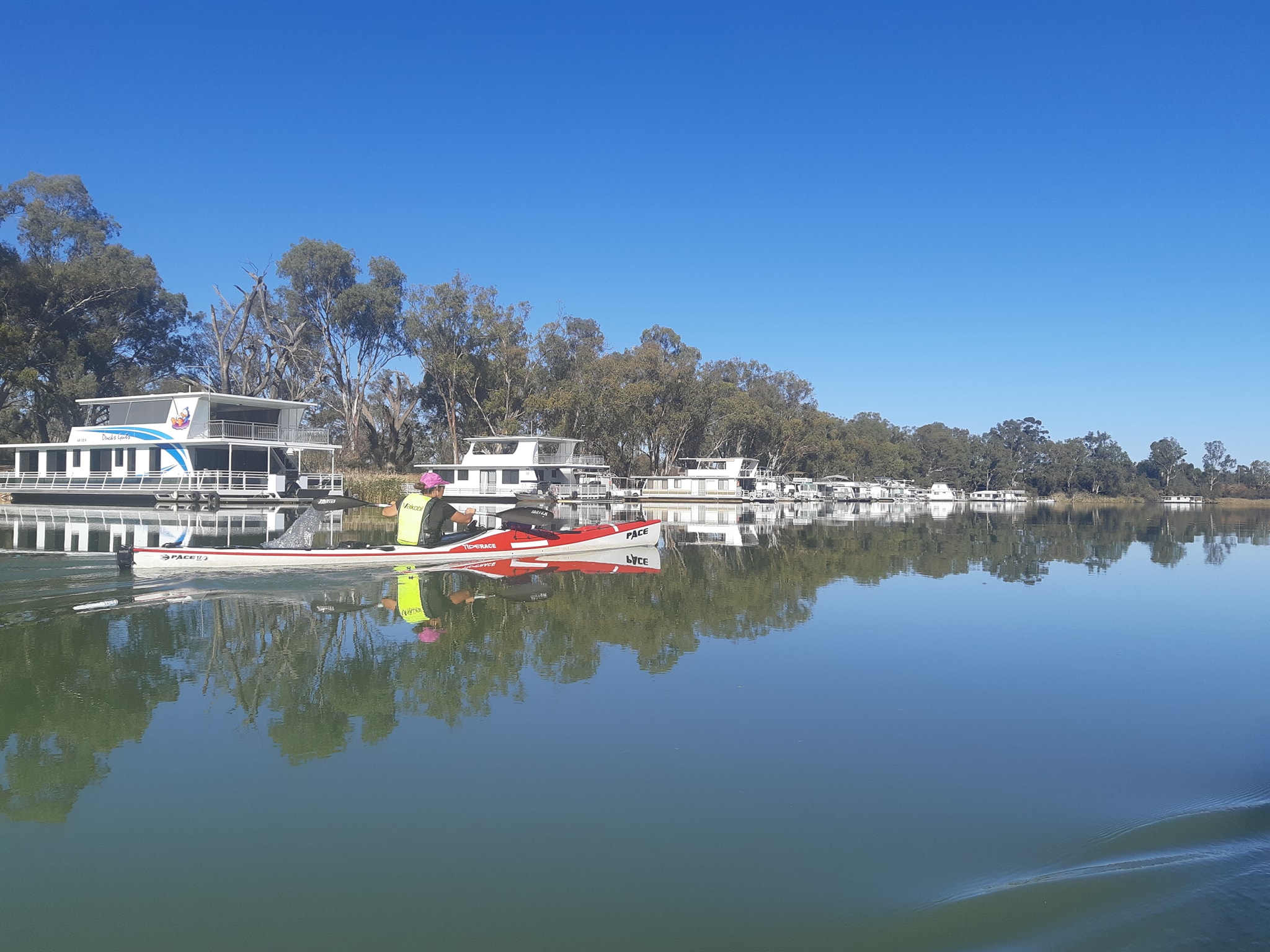
This morning, we unpacked them back into the shopping bags, carried everything back down onto the beach and repacked them again, before we could leave. Our neighbors in the caravan park have been fascinated by how much stuff comes out of the boats and how it all fits back in when we're done. (This is from people who travel in 30ft apartments on wheels.)
Each of our kayaks has over 200 litres of storage volume. That's three times the volume of the 65 litre backpacks Kate and I hiked with in Tasmania over summer. So more than six backpacks of stuff. But the cool part isn't actually the volume they can hold. It's that they are nearly impervious to weight.
From our hiking, we've built up a collection of light to ultralight gear which is great, but often lacks durability. For this trip we left the ultralight down sleeping bags behind and packed some seriously warm and waterproof synthetic bags. Same with our tent. We left the two person ultralight in favour of a three person lightweight with some serious weather resistance. Clothing, more of the same.
One change we've made in Mildura is to add some steel tent pegs and a hammer to our equipment roster. The camp sites we've been using have started taking their toll on our lightweight alloy tent pegs. The beaches have been ok and we've been using sand pegs, but the bush camp sites are either so rocky that you can't push an alloy peg deep enough, or so soft that they just pull out of the ground. The worst sites are often the caravan parks where the ground is either free draining roadbase gravel or it's been compacted by vehicle and caravan traffic.
So we added 2kg of long steel pegs and a big hammer to our base weight. (Now Kate's asking for an axe so we can cut wood for our campfire.)
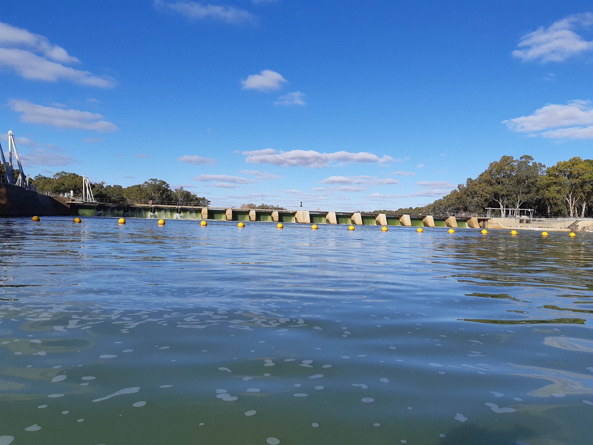
Because my fuel calculations being a little pessimistic, we now have 28 days of gas for the 18 days remaining. Don't light a match near my kayak. Because Kate doesn't read my posts, I'll also admit that I've squirrelled away a pack of ready mixed Gin and Tonics for celebrating our finish in Goolwa. I'm figuring that keeping it cold will not be a problem.
So we set off this morning in our newly laden boats full of all the food, fuel, and stuff we need to get us to Goolwa. And the current was gone. For most of the trip we've had 1.5-2.5kph of current helping us along even as we drifted midstream having lunch. Today, it was barely 0.5 and when we stopped for a mandarin, that wasn't enough to keep the wind from stopping us altogether.
We guess that it's the effect of the weir at Wentworth, stopping the flow and backing the waters up behind it. With the larger weirs upstream you can feel the current dropping off as much as 50-100km up stream as you approach. The Wentworth weir is barely 50km below it's counterpart at Mildura.
So we ground out the day as best we could. Deep strong strokes with a slow cadence and let the boat glide as much as possible, using its momentum. On the bright side, the sun was out, the sky was mostly clear except for a few white puffy clouds and we were able to paddle in shorts and t-shirts again.
The other bright side was a big short cut at Cowanna Bend which trades 9km of river for a 150m shortcut. Peter Davies had briefed us on the cutting and told us that the river level might not be high enough to paddle through and maybe we'd have to get out and drag our boats through a dry creekbed to make the shortcut. We thought about our approach to shortcuts at the start of the trip and what we would consider to be a legitimate shortcut and what might be considered cheating. Talking it over as we got closer, we concluded that as long as our asses stay in the boat and the boat stays in the water, it's paddled. There have been plenty of spots where we could have portaged the boats over a short isthmus to avoid a long paddle around an oxbow. It wouldn't have been fun with all the gear, but on some of the larger ones, we would still have saved hours.
Thankfully the Cowanna Bend cut was open with enough water to slip over the rocks that threatened to block it if the water level was slightly lower. It did involve some laying on of hands, and we blazed our trail with some white gelcoat to mark the rocks for those who might be following us.
We picked up two other short shortcuts for the day, saving a kilometre each. It all adds up in the end. The cuts also helped us make the 3pm downstream cycle of the Wentworth lock with 10 minutes to spare. Again we had a good chat with the lockmaster about where we'd come from and where we were going. And again, some sightseers stopped to watch a couple of small kayaks being cycled through a giant lock.
As we were unpacking, moving and repacking our boats this morning it occurred to me that if we had to portage all of the locks along the river, it would probably add a good two days to our overall trip. Once we were clear of the lock we decided to start our campsite search early, both feeling the effects of a long day pushing heavy boats through dead water to a 3pm deadline at the lock.
The good news was that the current below the lock was back to 2.5kph.We found a nice spot 7km downstream which has plenty of space, kangaroos, and a seemingly endless parade of pelicans taking off and landing on the river in front of us. Which begs the question... how are they landing when it's pitch black on the river and we can only hear them, not see them?
Tomorrow we proceed towards lock 9 which is 55km downstream from our campsite. We'll decide tomorrow whether we try to make the lock in the afternoon, or first thing on Wednesday morning.
19 May 2021 - Day 32
Murray Paddle Day 32 of 48 - Wallpolla Island to Lock 9
Distance remaining 770 km
Total Bridges: 30
Total Locks: 4
Location: 34°11.413' S, 141°36.273' E
Today we saw a platypus! For the non-Australians, that's a rare thing as they are notoriously shy and usually appear around dusk and dawn.
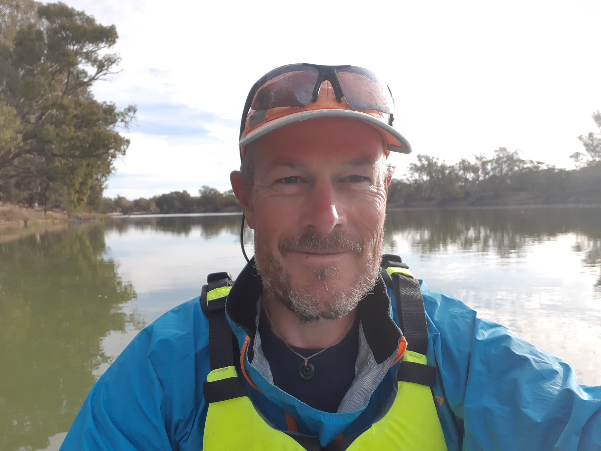
We also paddled 55km to make it to Lock 9 for the 4pm downstream cycle only to be thwarted by a pile of rubble which had been dropped into a crucial shortcut, leaving us with 14km to cover in 80 minutes. With limited flow between the locks. That was never going to happen. It's been a pleasant day on the water. The sun has been out for most of the day and the wind hasn't climbed above a light breeze.
We discovered an obscure shortcut around marker 789 which followed a small creek into a shallow lake full of waterfowl, through another creek to another lake which exited back into the main channel. The first lake was so shallow that our rudders were dragging in the mud and we were stirring up fish in the mud of the lake bed. I think one of them might have concussed itself as it tried to escape and smacked very hard into the bottom of my kayak. Hopefully it was a carp.
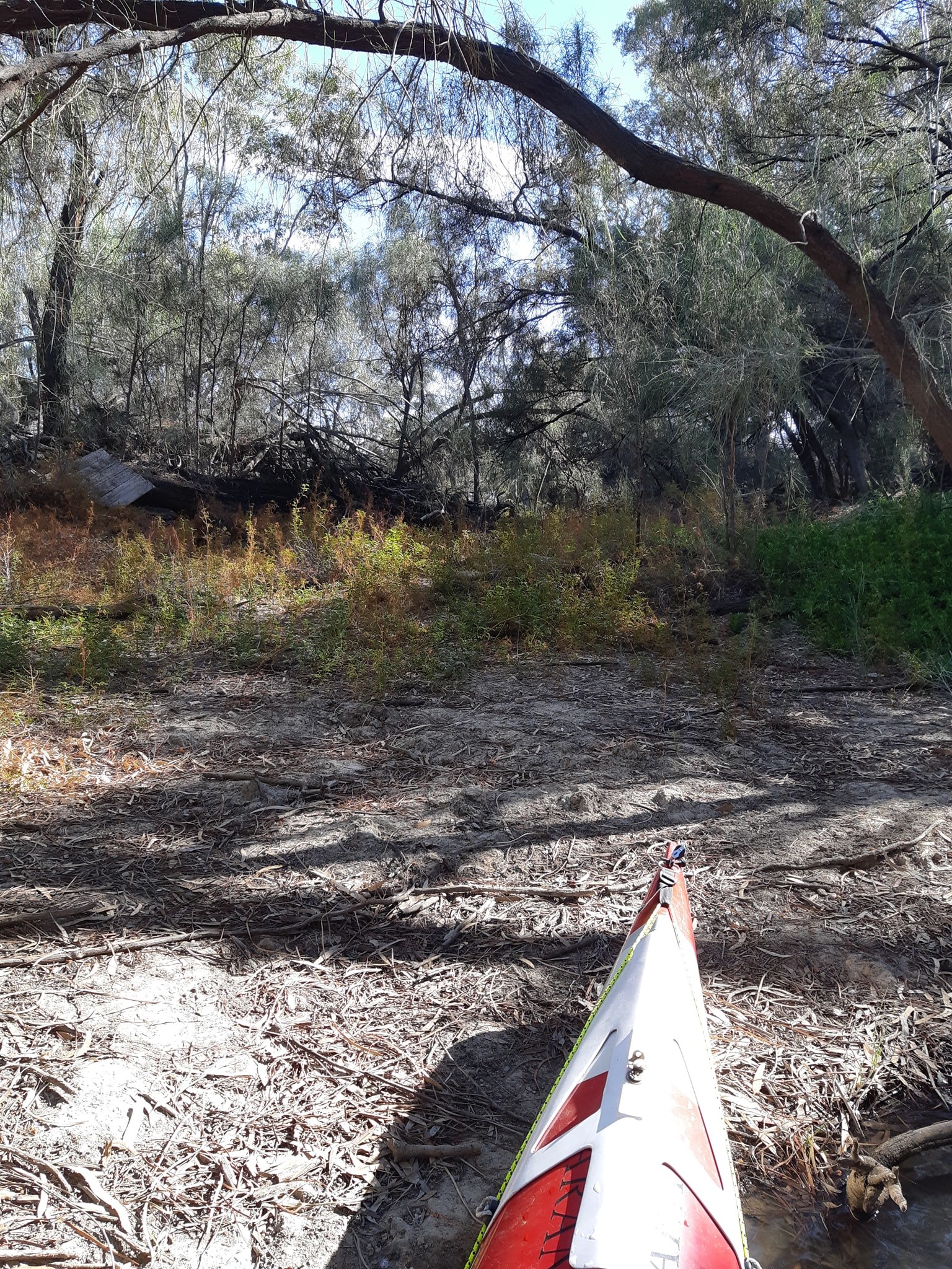
Anybody following that shortcut will need to be looking hard for the entrance. It wasn't obvious. The exit back to the main channel is much easier to find, but by then its too late.
Because we'd literally sprinted to the lock, before finding the shortcut blocked, we had passed all of the decent and semi-decent bush camps leaving us with tall riverbanks backed by wetlands or low lying ground that was only barely clear of the water and covered in a lattice of tree roots. We finally changed on a riverbank spot within sight of the lock which has some flat ground, but very deep water on the bank. It will be a cautious start in the morning.
We're camped 600m above lock 9 trying to work out what it means when the lock goes downstream at 9am but the lock operates on South Australian time so it's 30 minutes behind. Perhaps a call to the lockmaster at 8:30 tomorrow morning will clear that up.
We think it means that it will go upstream at 9am VIC time and down at 9:30am VIC time. Water quality seems to be deteriorating as we progress. The water is green with algae and we are thinking we will have to start carrying water from the locks with us rather than relying 100% on our filter.
20 May 2021 - Day 33
[No reception! FB dumped the post]
21 May 2021 - Day 34
Murray Paddle Day 34 of 48 - Mulcra Island (722) to Kulkurna Cliffs (666)
Distance remaining 666 km
Total Bridges: 30
Total Locks: 7
Location: 34°2.998' S, 141°3.917' E
We've been out of mobile coverage for several days now and Facebook seems to have dumped at least two of my daily updates after failing to upload. Grrrr
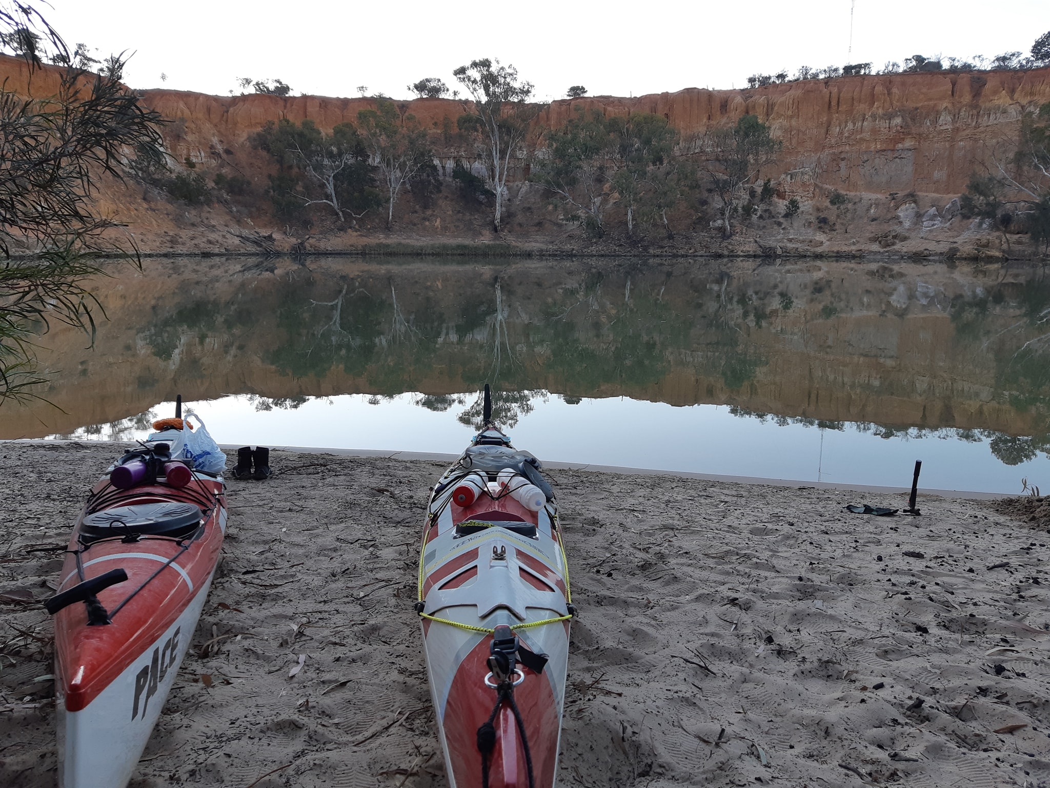
We've passed through three locks (9, 8, & 7) in two days which has meant some determined paddling to make the operating hours. There's been some confusion over when the locks are operating based on what our River Access Guide says. Turns out that after Mildura, the locks are happy to put you through whenever you want as long as it's not lunchtime.
There have been some great camp sites a long the way. Some of them were in places we wanted to stop. We are still averaging 50km a day or there abouts. It gets a little tougher when there's a half hour process to pass through each lock. The lock operators have been getting progressively faster about dropping the water level. Back up at Torrumbarry and Robinvale they were quite gentle. Now it's a much faster drop.
The current has died away and we are resigning ourselves to the remaining kilometers being all but unassisted by current. At lock 7 today we dropped down to about 20 metres above sea level with 700km to go. That's not very much gradient for the distance.
Between locks 9 and 8, the water quality took a major drop with blue-green algae at red alert levels. We were using our platypus gravity filter which seemed to be working ok, but as the algae got more prevalent, we opted to pick up water at the locks as we passed through. Locks 8 & 7 were happy to give us bottled water. Apparently liability prevents them from letting people drink their tap water. Lock 7 might prefer to look the other way if you ask to fill your own containers...
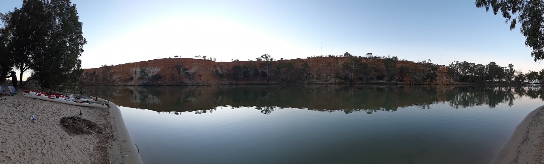
Based on the advice from one of the lock operators we have started collecting water from as deep as we can to avoid the algae which mainly floats as a layer on top of the water. To make it easier, I've been using my hand operated bilge pump to suck water up from 2ft down.
Having seen warning signs around algae blooms in the past which advise against drinking, swimming, fishing, letting your pet near it, and avoiding skin contact, we are wondering how good our filter system is. Fortunately the algae doesn't seem to have made it past lock 7, and we're back to mud, clay, and sand as the main contaminants.
We've also found a few shortcuts, some better than others. On the advice of the lock operator at lock 9 we took a right into Cattite Creek, which meets Carrs Creek before returning to the main channel. He though it saved 14km, but it was 10km of winding creek with lots of trees to dodge. We zigged, zagged, limboed, and boofed our way through. In hindsight, it would have been quicker to have stuck to the main channel, but much less entertaining.
We are now about 15km from the border between New South Wales and South Australia, when we will finally be able to look at camping on the right hand riverbank. It will be nice to see a lot less PRIVATE PROPERTY TRESPASSERS PROSECUTED signs. 12 km later we cross the Victoria-South Australia border making the transition complete. At this stage we expect to arrive in Renmark on Sunday afternoon.
22 May 2021 - Day 35
Murray Paddle Day 35 of 48 - Kulkurna Cliffs (666) to Unnamed bend below lock 6 (614)
Distance remaining 614 km
Total Bridges: 30
Total Locks: 8
Location: 34°0.897' S, 140°52.210' E
Today we woke up in Victoria, paddled in New South Wales and then got really confused about state borders and time zones as we entered South Australia twice. For the first 1776km of our journey the Murray River has followed the border between NSW and Victoria, or more correctly the border has followed the river. There are a few spots where the river and the border diverge but those are changes in the course of the river since the border was agreed in 1841.
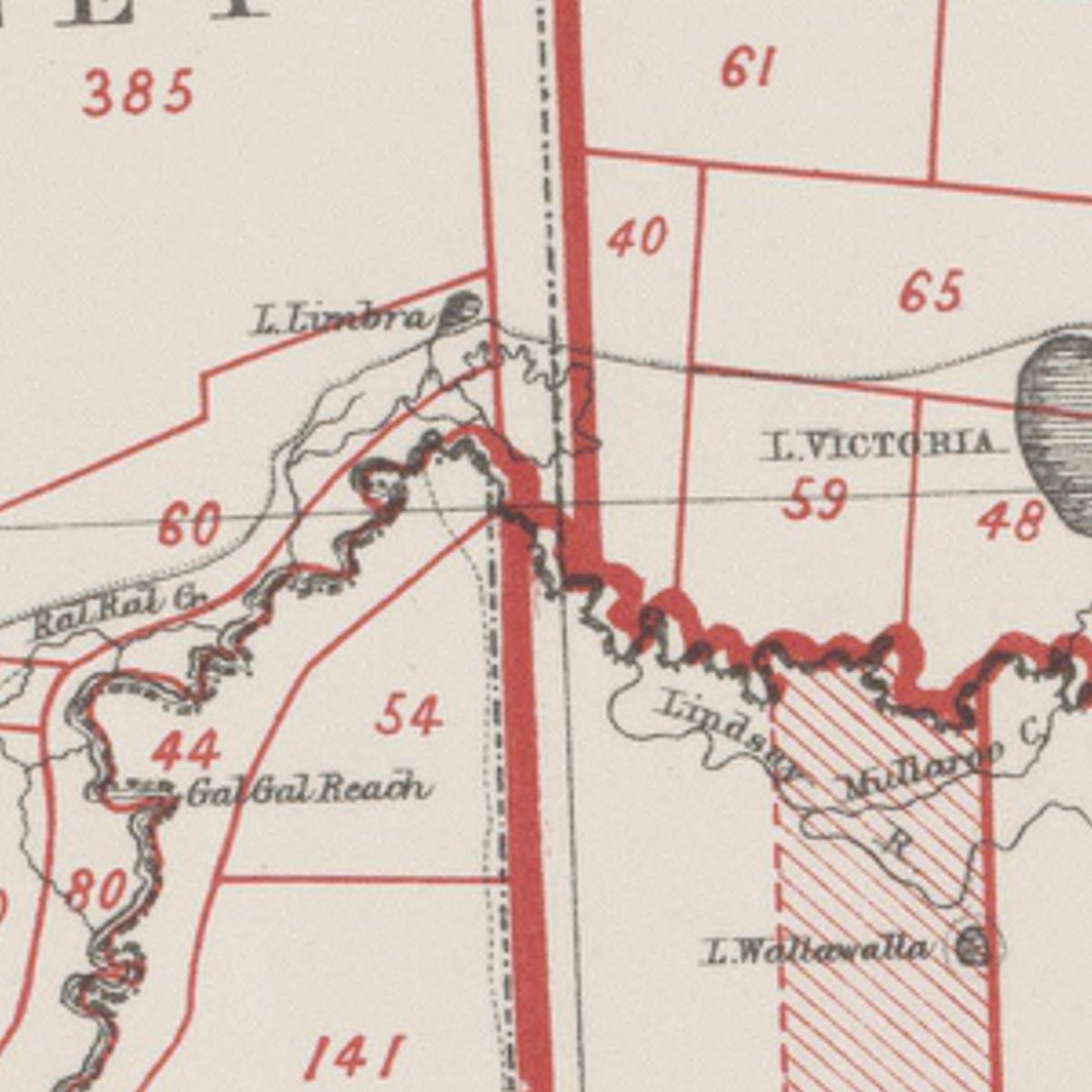
Normally, you'd expect that the border would follow the middle of the river, but that's the first twist in today's tale of borders and disputes. Victoria was originally created as the NSW South Wales region of Port Phillip and her borders were drawn up to limit the authority of her colonial superintendent, part of that border being northwards "to the Murray River", which suited the NSW government as it was intent on collecting all of the taxes and duties for the riverboat traffic along the river.
The precise definition of where the border actually ran was disputed until 1986 when the High Court ruled on an appeal against a murder conviction for a man who stood at the top of the Southern river bank and shot a man who was at the rivers edge. Victorian police tried him and found him guilty of murdering the victim who's body had fallen on the Victorian bank. His lawyers appealed, claiming the bank was actually NSW, where they hoped he could be charged with involuntary manslaughter. The High Court agreed ruling that it's NSW all the way the top of the bank.
The accused was retried in NSW and got a life sentence for murder. (If you want to read the novella which is the High Court judges interpretation of 140 years of border definitions it's all here... https://eresources.hcourt.gov.au/showbyHandle/1/11488)
So each day for the past 34 days. We've woken up in Victoria, where you can camp on the riverbank, paddled in NSW and then camped again in Victoria, and each day we've moved closer and closer to South Australia and another disputed border.
In 1836 South Australia's eastern border with Victoria, NSW and Queensland was defined as following the 141 meridian of longitude east of Greenwich. A surveyor mapped it all out neatly with a theodolite and some survey pegs and all the colonies started selling off land to settlers and happily raising revenues.
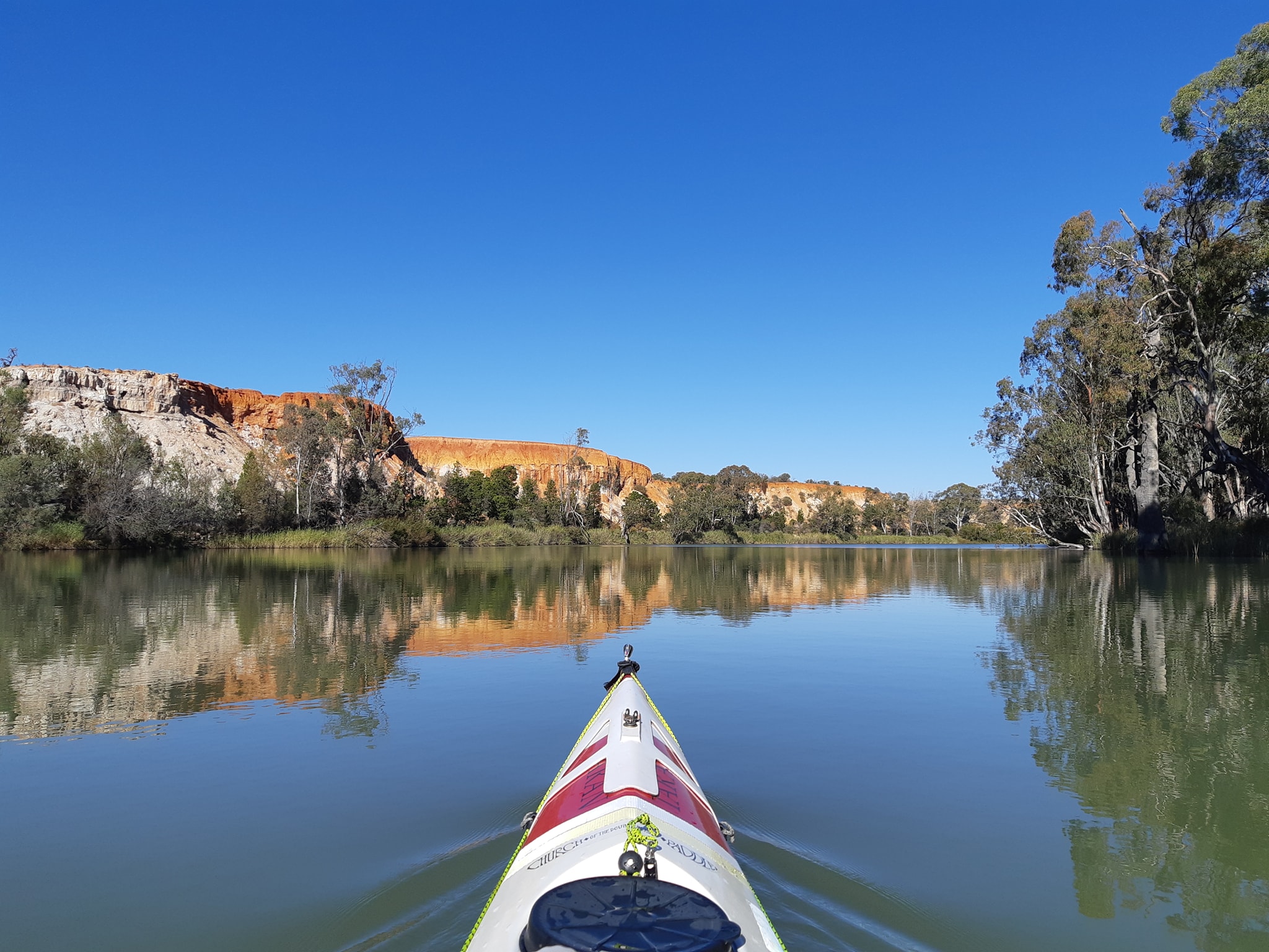
Everybody was happy until somebody pointed out that the border wasn't where it was supposed to be. Because of the primitive equipment, the original surveyor was off to the west by 3.6km. In 1868 NSW, Queensland, and South Australia got together and resurveyed the border, realigning it to the correct position. Victoria who by this stage were probably having a real sense of deja vu put their fingers in their ears and sang La La La La... as loud as they could, ignoring the whole inconvenient survey, which avoided having to deal with the fact that they'd sold 1295 square kilometers of South Australia to Victorian settlers.
South Australia in turn sent some 70 strongly worded letters to Victoria over the next 10 years. Eventually in 1914 the matter went to court and South Australia lost. Victoria got to keep its extra bit on the side. There's a picture of the resulting border below.
So as we paddled downstream today, just after our 10:30 morning tea break (where we didnt have any fresh fruit because you can't take fruit across the SA border) NSW disappeared on our right, at the point where river marker 649 would be if there weren't only even numbered river markers, and half of them weren't missing. It's a spot known as MacCabe Corner after Surveyor Francis MacCabe who wasn't the one who got it wrong but somehow got his name attached to another surveyors botched job.
From MacCabes Corner, NSW stops having any interest in the Murray, and authority over the river is sensibly split down the middle between Victoria on the left and South Australia on the right as it heads North West towards the next border change at marker 637.
At 637 the river crosses the other 141st meridian and it's South Australia all the way to the sea. So Victoria has responsibility for half the river for just 12km. Sounds a bit like the Bolivian Navy doesn't it? But South Australia is in a different time zone to NSW and Victoria. They're 30 minutes (and the wags would say 30 years) behind.
So as we paddled away from our 10:30 break, Kate following the inside of the corner down the right bank (SA) and me running wide on the left bank (VIC) looking for deeper water, we were in two different time zones, which suited me fine when 30 minutes later my watch alarm went off for second morning break. By this time Kate had also strayed into South Australian time space so she was right there to tell me that she hadn't packed a second snack.
This sense of temporal displacement lasted into lunch time when we decided that even if it wasn't 12:30 in SA, it was still 2 hours since we'd last eaten and we'd just have to adapt our timings for the day.
By the end of lunch time we were 17km from lock 6 and happy that we had plenty of time to reach it before closing time. For reasons I can't explain, I took my phone off flight mode which is how I keep the battery from going flat when I know there's going to be no signal. And there was full strength 4G! It turns out that we had picked a spot, which would be literally in the middle of nowhere if it wasn't 400m from a cell tower. We spent the next 30 minutes downloading messages, checking mail, tracking parcels, and generally confirming to friends that we were still alive before packing up and pushing on to lock 6.
I'm sure we've left a trail of fishermen and houseboat owners behind us who are confused by these two people in kayaks that float past on the current, eating and not paddling. Lock 6 was another straightforward affair. The gate was open for us when we arrived and the green light was on for us to enter.
We were hoping to pick up some more water but the locks rainwater tanks had run dry. So we're back to filtering our own again. When we arrived at a suitable beach for a campsite tonight, Kate suggested we could have an extra hot drink to celebrate our arrival in SA. I asked if she'd prefer a gin and tonic and after several expressions of disbelief that I'd carried booze for 300km without her knowing, we were sipping a suitably cold G&T while we watched the sun go down.
One odd thing we've noticed. There hasn't been a single pelican since we crossed the SA border(s). Tomorrow we arrive in Renmark where we will be catching up with more friends from Sydney and having a shower.
- this history of the borders is not intended to be too accurate. After all it took one judge 7000 words to explain what the phrase "whole river" meant.
23 May 2021 - Day 36
Murray Paddle Day 36 of 48 - Below lock 6 (614) to Renmark (564)
Distance remaining 564 km
Total Bridges: 30
Total Locks: 8
Location: 34°10.575' S, 140°46.093' E
Our first day waking up to South Australian time with the sun rising at 6:30 instead of 7:00. Our plan for the day was to get to Renmark where we had a waterfront spot booked in the caravan park. Time for hot showers and a load of laundry, the first since Mildura, six or seven days ago. We also had friends from Sydney meeting us at the caravan park.
Knowing we needed time to get cleaned up, get laundry hung out to dry and get into Renmark for some fresh fruit, we hustled through our morning routine and were on the water just after 8am. The river continues to be sluggish in its flow, providing us with little assistance. Kate, who's ultimately setting our speed downriver is making just over 8kph with no assistance, not as fast as we'd like but she does hold that pace relentlessly for the entire day.
Sticking to our target of 50 river kilometers has been getting harder by the day. Theres a short range weather forecast for Tuesday thats predicting 50kph head winds. We may just take a rest day rather than burn ourselves out battling a headwind that will batter us to a crawling pace.
Pressing on towards Renmark our paddling day started on mirrored water reflecting red cliffs against a blue sky. We spotted our first South Australian Pelicans who were perched in a tree, trying to pretend they were cockatoos.
We had some odd experiences paddling past river camp sites and fishermen where they seemed intent on not making eye contact or giving us an opening to engage in conversation. I was starting to wonder if there was some history of kayakers murdering people in South Australia that I'd missed in my background reading. And then we heard the howl of an outboard with the throttle open to the limit.
The sound came to us through the trees from the channel on the other side of the U-bend we were entering. Getting louder as it approached, it also multiplied with the harmonics of another engine, and another. A small aluminium dingy blasted around the bend in front of us, hull barely touching the water, two occupants crouched low and wearing full face helmets. Five seconds later another tinny emerged, two more helmeted pilots, going just as fast.
The first tinny carved a wide arc around the bend and one of the pilots gave us a quick wave. There was plenty of room on the river for them to pass us safely, even though they appeared to be travelling at near terminal velocity. Because we were paddling corner to corner, we turned harder towards the opposite bank as we made our cross, exposing our side profiles and making it clear which way we were intending to move to the approaching kamikaze pilots. They read our intentions correctly and blasted a path across our wakes.
By the time the third tinny had passed us, another two had emerged from the bend, followed by another 15 or 20 over the next five minutes. Friends had warned us about increased boat traffic around major towns over the weekends, but I'm sure their warnings hadn't included stumbling into the middle of some kind of race tuned midget powerboat event.
While the tinnies continued to scream past, another slightly larger boat with three passengers in safety vests emerged from the bend. They'd been on the same course as the racers initially, but veered off as they spotted our kayaks.
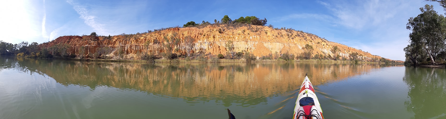
Now we've been paddling around Sydney for a long time and we're generally not bothered by power boats as long as they maintain a safe distance. Too close and we're more likely to respond with short anglo-saxon expletives than panic at their wake, but these drivers were giving us plenty of room, and despite their velocity, we weren't in any danger.
As the boat approached we could see SWEEP BOAT written along it's side. Obviously race officials. They told us that we were in the midst of an event and that the racers would be looping back downstream via a creek on river right for the next hour or so. We were about 4km from the dowstream end of their circuit. We thanked then for letting us know and assured them we were fine sharing the river with them as they were clearly disciplined and following the river navigation rules.
More tinnies barreled past as we continued downstream towards the turn they'd indicated was the end of their course where another official boat was tied up on the downstream side of a narrow creek entrance. As Kate cut across the river on a 45 degree angle, I turned sharper to have a chat with the official, curious about the large contingent of high performance tinnies.
My angle of approach must have made it look like I was intent on paddling into the creek because he was quicklt on his feet and making motions to wave me away. I eased my angle and pulled in downstream, with his boat between me and the creek mouth.
I asked him lots of questions about the event, the classes of boats, and how they structured their racing. The boats are all fairly standard small aluminium tinnies with engines ranging from 10HP to 30HP with some of the engines having trim controls as well. The slowest could reach 40kph, while the fastest, an example of which was just about to exit the creek, would be capable of over 100kph.
The lead boat chose that moment to erupt from the creek. See photo below. If I had been heading into the creek, my encounter with the boat would have been very brief and most likely terminal. Important warning for other Murray River Expeditioners. This was a practice weekend for a full race next weekend (29-30th May). There were 75 boats on the course today in the Amazon Creek to Woolshed Bend area. Best to avoid the area, and definitely stay out of the creek.
Sunday continued to be an active day for boat traffic with a half dozen houseboats of various shapes and styles passing us on their way upstream. Closer to Renmark we encountered a few ski-boats who could take some boating etiquette lessons from the young tinny drivers we encountered earlier.
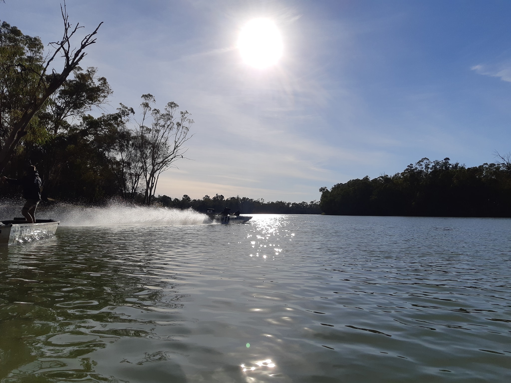
Our final destination was the caravan park just past the Renmark town centre. We'd booked a site on the river front having specifically asked if they had a gentle sloping frontage down to the water so we could land our kayaks, which are still quite heavy with gear. Yet again a park receptionist should probably take a walk along their parks water frontage and and spend time pondering the meaning of the words gentle and sloping.
We've had another good night catching up with friends over dinner with a few adult refreshments. It's great to hear that people are following our adventure and want to know more about the experience of paddling the river through all it's aspects.
Tomorrow we head out through Lock 5 (562) which is just a few kilometers around the corner. From there, we may take a shot at getting all the way to Lock 4 (516) before it closes at 4pm. It will probably depend on the wind and current being in our favour, or at least not against us.
24 May 2021 - Day 37
Murray Paddle Day 37 of 48 - Renmark (564) to Causeway Campsite on Katarapko Creek
Distance remaining 513 km
Total Bridges: 32
Total Locks: 10
Ferries: 3
Location: 34°20.933' S, 140°33.163' E
We were late getting away from Renmark this morning because we needed to collect some packages from the Post Shop. It was 9:30 before we got on the water and it was going to be a long day.
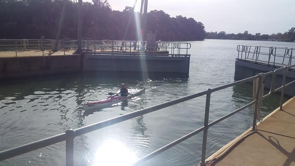
Lock 5 (562km) was just around the corner from the caravan park, but we also wanted to get through lock 4 (516km) which meant we needed to put 46km behind us on a day where the wind was expected to increase throughout the day and the flow between locks has dissipated to almost nothing. Bob, Tracey, Jeff, and Deb who met us in Renmark came down to watch us depart and then drove around to lock 5 to watch us go through.
We've become old hands at the lock process now and today's lockages were both done in under 15 minutes. We were out of the first lock and on our way just after 10am but head winds and slow flow meant it was almost 4pm before we reached lock 4.
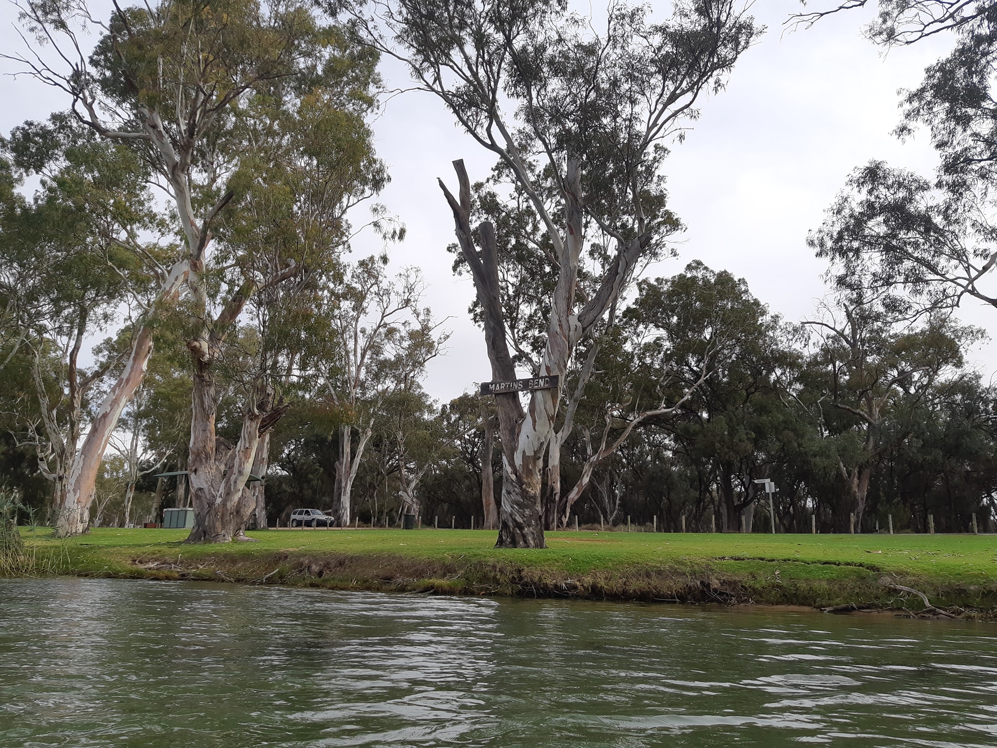
Normally we'd be off the water between 3pm and 3:30 which gives us plenty of daylight. Getting to the lock after 4 meant we were only just starting to look at campsites at 4:30. Light is starting to fade by 5pm. Max at the lock told us there was a campsite 4.5km downriver at Whirlpool Bend describing it as clean sand and a shallow beach. He also recommended Katarapko Creek as a detour as it would shelter us from the winds that are forecast to hit tomorrow. The entrance to the creek was only 2.5km past the lock. With light fading, it was an easy choice.
We've paddled this section of the Murray from Berri, just above lock 4, to Morgan previously while racing the Riverland Paddling Marathon (RPM), an event the organisers refer to as rhe "Coolest Race in Australia" (and for a good reason).
We ended up pitching our tent in the half light and the tarp, which is pitched in readiness for the rain expected early morning was pitched in the dark. It will be interesting to see how they look in the morning light.
Tomorrow we are going to slide our boats over a rock weir which is only just peeking above the waterlevel on the upstream side and down about a foot into Katarapko Creek. Partly because it's a shortcut. Partly because it promises to be more sheltered than the main channel. Partly because we want to check out some of the many campsites that are marked along the Creek. But mostly because we've paddled the main channel twice in the RPM and want to see something different.
Tomorrow, we will make a call on whether to push out into the forecast 50kph winds, or sit it out where we are for a day.
25 May 2021 - Day 38
Murray Paddle Day 38 of 48 - Causeway Campsite on Katarapko Creek to Milich Landing on Katarapko Creek
Distance remaining 482 km
Total Bridges: 32
Total Locks: 10
Ferries: 3
Location: 34°26.752' S, 140°30.498' E
14kms paddled today. Our shortest day on the water since we started.
We've been eyeing the weather forecast for today for nearly a week, knowing that the predicted 40-50kph NW winds were going to coincide with a long push NW from Loxton to Moorook, Kingston on Murray, and Lock 3. In other words we were going to be throwing ourselves at a wall of wind for no real progress.
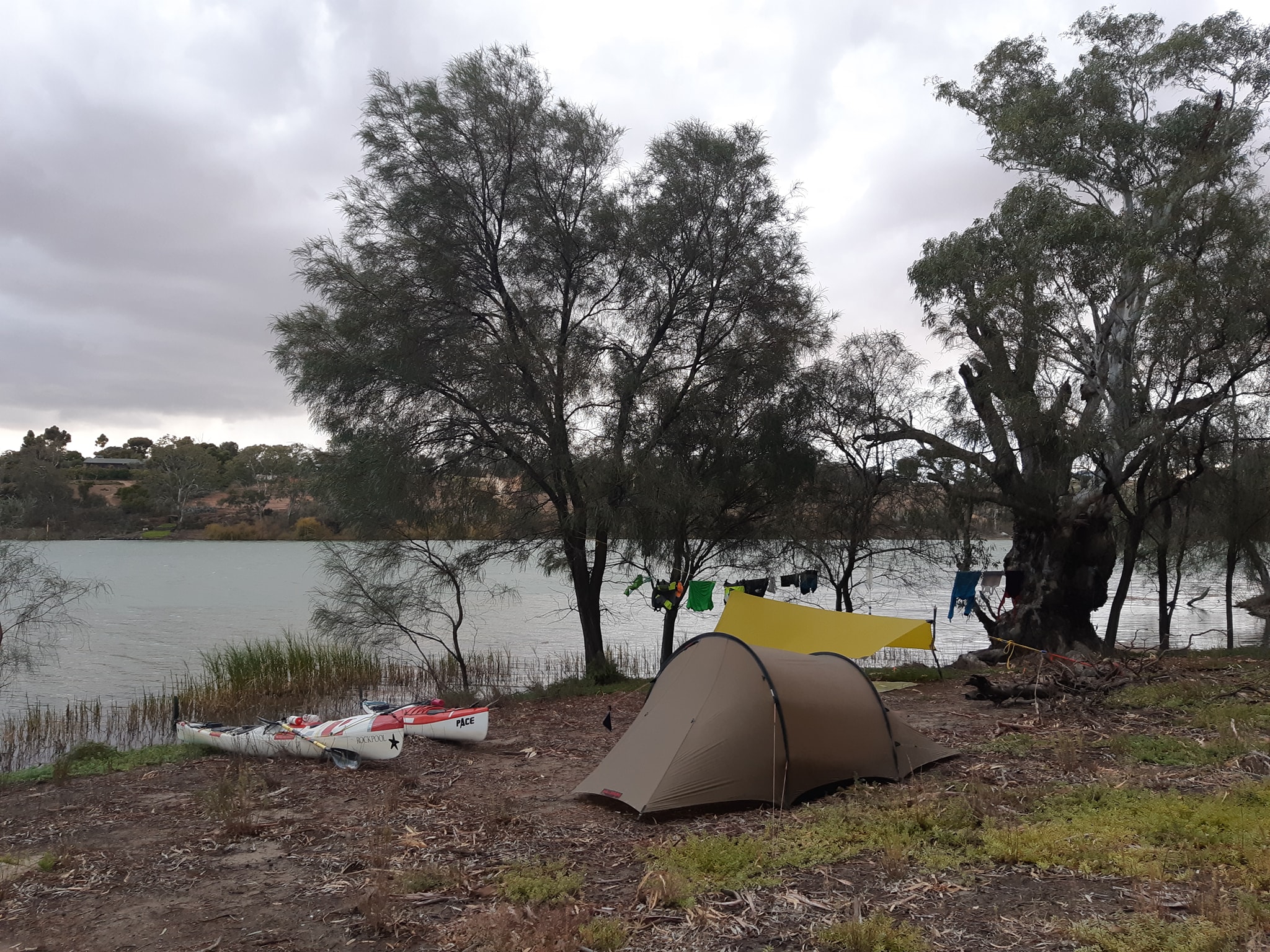
We'd ducked out of the main channel last night after Lock 4 and into Katarapko Creek which is part of a River Murray canoe trail. Our campsite was just above a small rock causeway which spans the creek, while allowing some water to filter through and over the wall.
We had a surprisingly warm night and had our sleeping bags zipped open until 5am when the predicted wind and rain arrived. The rain never graduated from incessant to torrential but the wind was making up for the shortfall. Even in our we'll sheltered campsite, screened by trees, the wind was shaking the tree tops and swirling across the water in front of us.
We had a long debate about just staying put for the day and resuming tomorrow when the wind is supposed to have died back. Several times during the discussion I got accused of changing my mind when all I thought I was doing was exploring alternatives out loud.
I'd been very tired last night when we'd arrived late to set up camp in the fading light and I was having a very bad time trying to peg out first the tent and then the tarp. The ground was soft sand for a few inches and then impenetrable below that. There's a word for explosive outbursts directed at inanimate objects, I can't remember it, but it would have come in very handy last night.
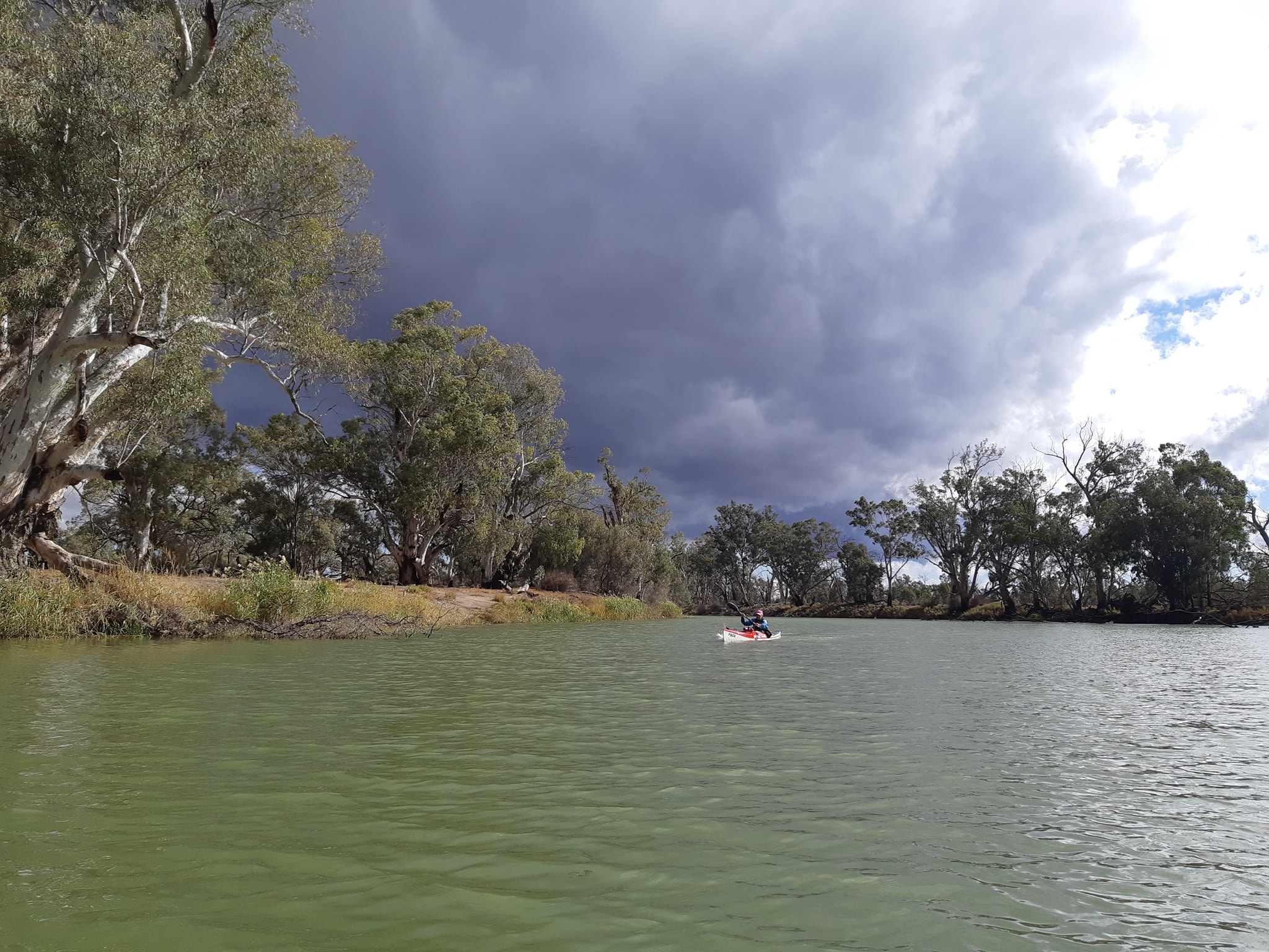
It was probably not the night to try out my new blue screw tent anchors which claim to be able to easily screw into almost any sort of soil. I'm going to take a couple of days before posting my product review. I'll take a moment to add another plug for cheap, simple steel tent pegs and a good hammer.
After a good nights sleep, I was feeling much better and surprisingly open to the idea of staying in my warm dry sleeping bag until at least lunch time, but Kate wasn't having that, so we sat under the tarp and watched the rain splash dust up off the ground onto all of our gear while we continued to discuss options.
This is one of the downsides of campsites which are accessible by road. Over summer, they get thrashed by campers, the grass is killed by vehicles and every branch and twig that can be burned in a campfire is industriously converted to ash which then blows around and mixes with the dust.
Our tent is coated in dust and ash, and gets worse when we have to roll it up and pack it away wet. Give me a nice leaf strewn riverbank site any day.
In the end the plan that came out on top was to wait until the rain stopped at noon, have lunch while the tent and the tarp dried out, then make a short tactical move to the other end of Katarapko Creek using the high creek banks to block out most of the wind. Hopefully we'd get some assisting tail wind as the course of the creek is generally South.
From the end of the creek (482), we will be in a much better position to make a 50km push to Lock 3. Then another 50km takes us to the town of Waikerie. Other combinations would have left us trying to camp in areas which are paid campsites or in one area, aboriginal land.
We did manage to get our boats over the rock causeway without the need for a portage (The top of the causeway is about 2 metres wide at most). There was a small channel of water flowing over the top and a couple of the rocks mysteriously rolled out of our way as we passed through.
The creek paddle was quite nice for the 15km of it's length and we even managed to find a couple of shortcuts within the shortcut.There are stacks of campsites along it's right bank, the left bank effectivelt being an island without road access. I'd guess that about a quarter of the sites have easy river access.
Almost as soon as we'd set off, dressed against the cold wind in jackets and thermals, the clouds began to part and we began to broil in our clothes. Every turn of the river would alternate between hot sun and cold win like a five year old playing with the thermostat. By the half way point though, we had a wall of dark cloud being blown in from the northwest, looking like the sort of cloud that might carry at least the chance of a lightning storm.
As we approached the end of the creek, where it rejoins the Murray, the campsites we were finding were less and less kayak friendly. 2km out from the end and we hadnt seen a good site for the last 5km. 1km out and there was a good site with a powerboat already pulled up on it.
We got almost to the corner, where we could see ghe wind pushing white capped waves down the Murray, and decided that there was a site that was as good as we were going to get today. We've managed to snuggle ourselves down below a high bank which is blocking most of the wind and we'll just ride out the rest of the night, hoping for a calm day tomorrow.
Oh! Just remembered. Only 10 days to go...
26 May 2021 - Day 39
Murray Paddle Day 39 of 48 - Milich Landing to Ball Island
Distance remaining 429 km
Total Bridges: 33
Total Locks: 11
Ferries: 3
Location: 34°10.683' S, 140°20.415' E
Today's plan was a 50km push from our camp, through Lock 3, and on to camp on a sand bar just a few kilometres beyond the lock. A solid 52km day. As is the way when you've got a big push ahead and the conditions aren't favorable, we were slow to break up our camp. In good weather, we just use a ground sheet, a couple of Helinox Chair Zeros and our tent, which all packs and unpack relatively quickly.
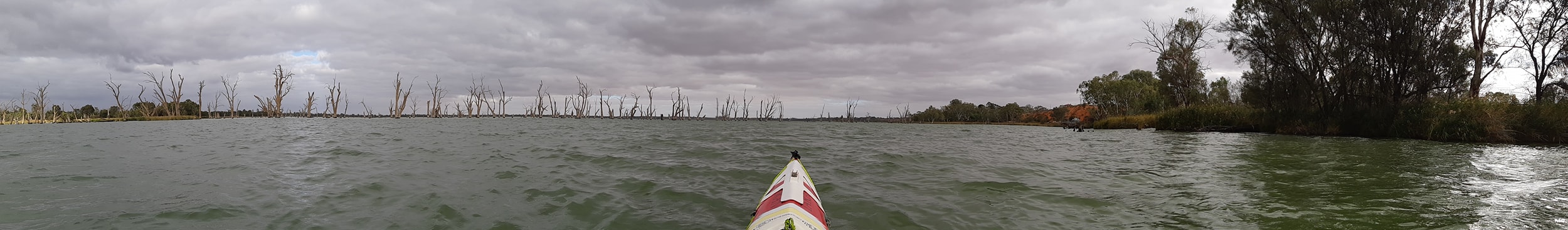
For winds and rain we also put out our tarp as a wind and rain shelter. Using it as a wind break usually involves stringing a taut ridgeline using our mooring rope and a couple of caribiners, angled up between whatever trees I can find. Last night we were short on adjacent trees so I used a couple of fallen logs as an anchor on the low end. Generally the longer it takes to set up, the longer it takes to tear down. There was also heavy dew this morning which meant pulling the tent down in two atages, inner first, then the fly which goes wet into a drybag.
We managed to break our second shovel this morning so the current score is toilet holes 2, shovels 0. We have another one on order.which we will pick up in Cadell on Friday if the courier gods smile upon us. The weather hadn't improved much overnight, but we were better positioned for the SW wind having moved down Katarapko Creek to the start of Pyap Reach which runs North West.
Not perfect but we managed to either have a quartering wind behind us, or tuck in under the western riverbank where there was no wind at all. When we did get caught out on a bend, Kate was beaten down to about 7.5kph. It would be a long paddle to the lock at that speed.
The biggest wave of the day award went to the wake from a twin hull cabin cruiser powering down the river. The skipper kept his throttle open as his passengers took photos of the kayakers bouncing around on his wake. From Pyap Reach we turned North into Seven Mile Reach which would have been miserable yesterday if we'd tried to push headlong into the wind. Today we had some breezy sections, but also managed to surf some small waves along the reach when the wind was swinging favourably.
Today is the last day of NW travel before we swing briefly West, then begin an almost continuous southward run to Goolwa, the South Australian coast, and the end of our journey. Kate's beginning to think too much about the crossing of Lake Alexandrina.
My win for the day was my Vaikobi pogies which finally got a run. For the past week my hands have been so cold by lunchtime that I've lost fine motor control and can't squeeze my peanut butter slugs into my taco shells (don't knock it till you've tried it). Today my hands were nice and warm despite being wet.
For the record, neither of us wear gloves when we paddle and we both prefer wet hands to dry. For some long distance racing we've used things like Vaseline or Hydropel to stop our hands getting saturated and wrinkled up, but wet works better for us, and hey 2000km with no blisters is a fair argument in our favour.
One of the things that I've been thinking about on the water is how you can start to obsess about small things going on in the boat. With 6-7 hours of paddling each day, there's lots of time for your mind to wander into the dark alleys of obsession.
For a couple of days my nagging obsession has been that might right rudder pedal is stiffer than my left. The left turn is loose and easy while the right is tight. I started out thinking that my rudder pedals weren't adjusted to the same angle when the rudder is neutral, my right pedal is back towards me more so I adjusted the pedals with the straps down the side of my seat. Then I thought my rudder might be bent. But no. Then I noticed that my left foot was further up the pedal than my right... giving it more leverage. As the hours went by I went through all the iterations of was my left foot bigger than my right? Are my footrest rails not at the same height? Maybe my footrests aren't on the same notch of the rail on either side? Maybe my seat isn't in straight? Could one leg be longer than the other? Maybe one butt cheek is swelling up causing me to twist in the seat?
Today I solved the mystery when I put my spray deck on and noticed that one knee pumps up into the spraydeck more than the other. In other words my left leg is a little straighter than my right when I'm leg driving the boat.
Probably worth an explanation at this point... while we are paddling sea kayaks which have thigh/knee braces under the cockpit rim to allow you to lock into the boat, we are both paddling race style with our knees in the centre, pumping up and down as we transfer the force of the paddle stroke into the footrest. Greg Barton describes this as kicking the boat down the river which is pretty close.
About the only time we will lock in to the thigh braces is coming out of the locks as we cross the currents coming over the weir. It gives us a little more stability and control. The rest of the time, we just let the boat roll where it wants to. Now that obsession is gone, i wonder what tomorrow will bring?
We reached lock 3 at 3pm and got some tips on downstream campsites from the lock master. He recommended one at Banrock Bend which we'd picked out as our likely stopping point but as we passed Ball Island a ilometre short, we found a low beach sheltered amongst a copse of young river gums which would give us good shelter from the Westerly wind.
We've settled in and pitched the tarp against the Westerly which will give it a chance to dry out overnight as long as it doesn't rain. The laws of irony are still in effect as the wind has since turned 180° to an Easterly and the tarp is now set up as a giant wind scoop rather than as a deflector. Cest la vie.
Still, I'm not going to complain about the wind. If it stays easterly, we will have a tail wind all the way into Waikerie tomorrow night. 9 days to go... Tomorrow we will pass a point where we have paddled 2000 kilometres. Not so long ago, that sounded like crazy talk.
27 May 2021 - Day 40
Murray Paddle Day 40 of 48 - Ball Island to Potross Landing 2km past Waikerie
Distance remaining 381 km
Total Bridges: 33
Total Locks: 11
Ferries: 4
Location: 34°9.993' S, 139°58.370' E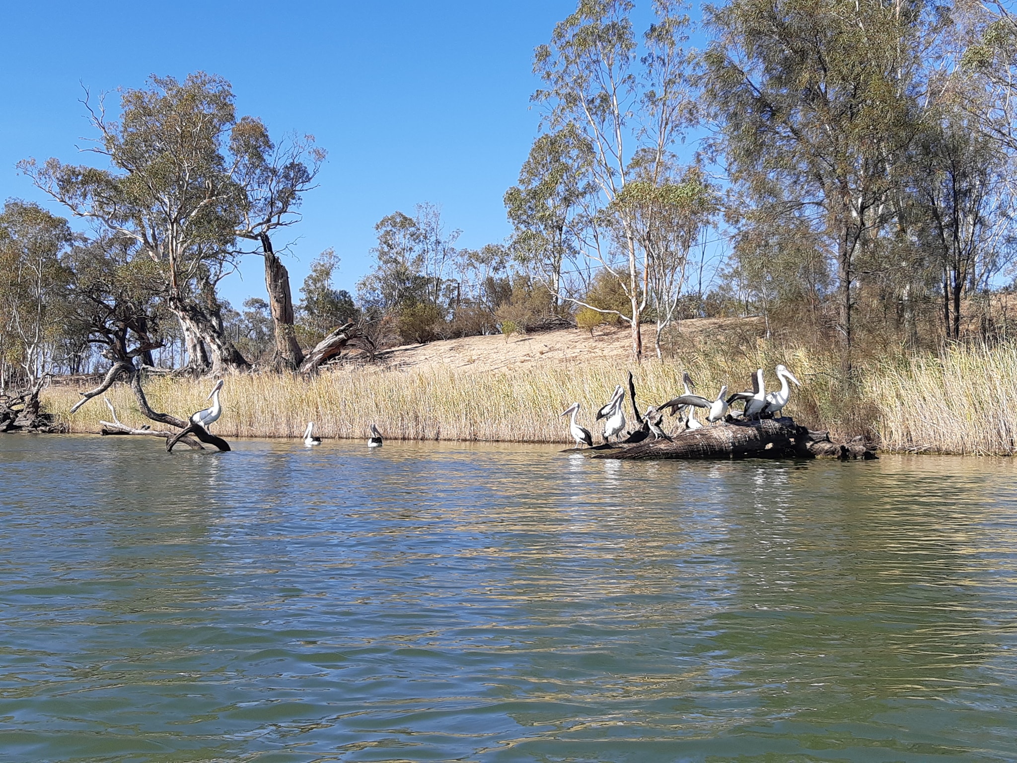 Well it's been a day of long straights, head winds, and lots of paddling. It's a day where there really isn't a lot to say. So now I'm going to prattle on about nothing like a year 2 student recounting their "News" from the weekend.
We left camp early knowing we had almost 50km to our next campsite just past Waikerie. We'd have stayed at the caravan park in Waikerie but it's fenced off and across the street from the water, so we carried on a few km to a free camp just beyond the town boundary and the lineup of houseboats hibernating on the shoreline. Low light of the day, I stopped to check some distances on my phone map app, while Kate carried on. While I wasn't paying attention I drifted into a patch of river weed, so I flicked up my rudder to clear it, but instead of dropping the weed, it lifted it up and jammed my rudder in the up position, still tangled in the weed.
So now I'm tangled in weed by my rudder. I can't tear away from the weed because it's too dense. I can't get out of the boat to clear it because the water under me is 6ft deep, and Kate is now 500m away disappearing around the bend. What followed was a delicate balancing act where I attempted to turn 180 degrees in the seat and reach across to bang my rudder down with my paddle extended at arms length. All while the wind continues to blow rippling waves across the water at me. The operation was a success, although definitely not enjoyable.
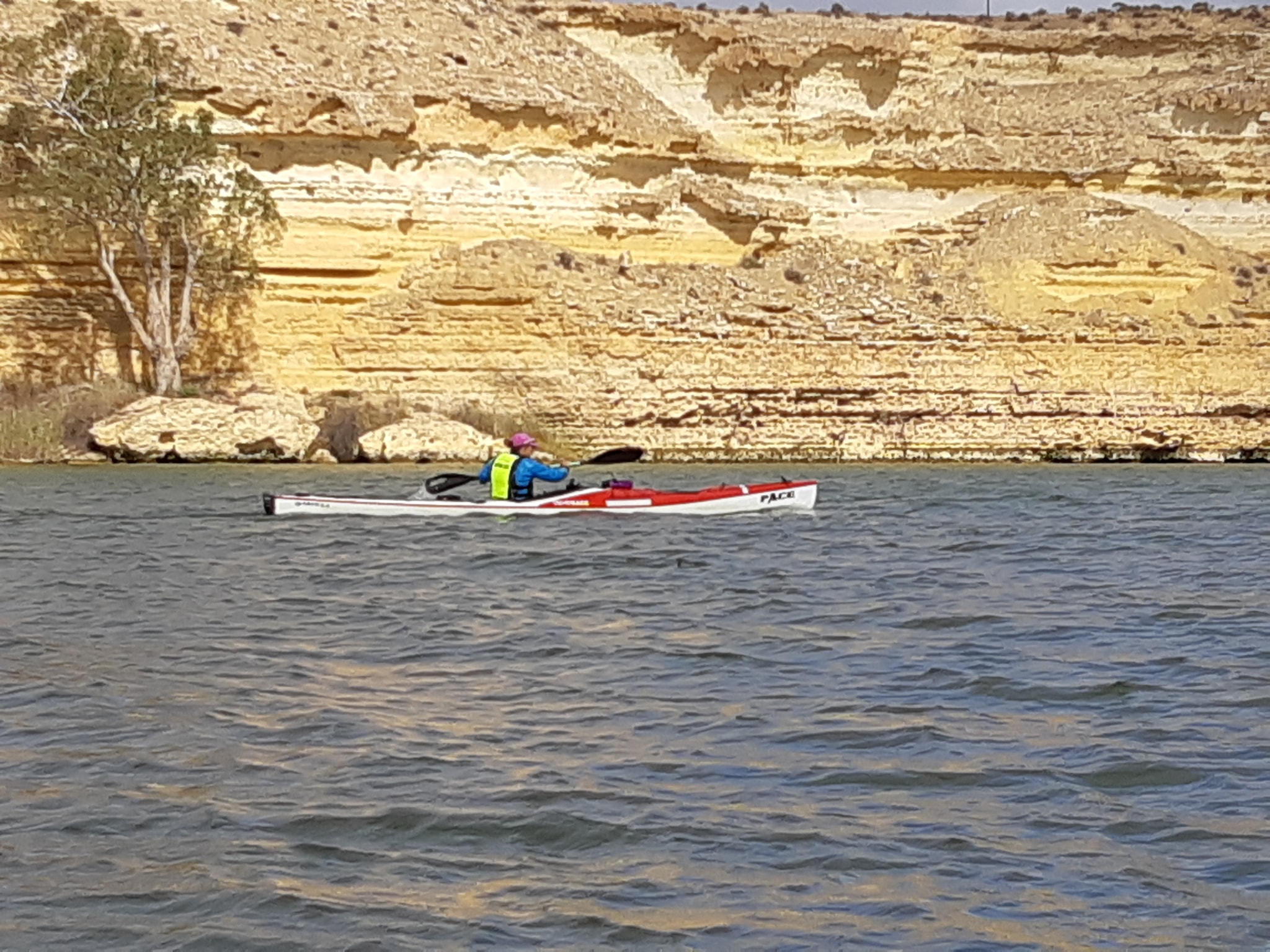
High of the day was getting a short surf on the wake of another twin hull cruiser. It's amazing the difference a day of zero current makes to your perspective. I got up to 12kph riding on the wake.
Somewhere along the way we passed the 2000km mark for the 2400km version of the river length although we think that it's really 2425 from Bringenbrong bridge, so that 2000km would have been just after we started this morning. But then there's some bits of the marked river that are no longer passable so maybr its tomorrow? We won't know exactly how far we've paddled until Kate totals up her daily GPS tracks. Mine missed 10 days when my watch died.
Regardless of how much is behind us, there is now less than 400 in front of us. Eight days is the target, although 50km days are still getting tougher by the day as the wind blows and the current slows. Our campsite tonight is a narrow strip of grass which has probably been too small to accommodate a caravan, so it was vacant when we arrived. Since then six other campers have pulled in from the road access looking to occupy the site, I'm surprised nobody has asked to move in beside us. It's nice when people define "too close" as "I can see you through the trees".
Lastly, spare a thought for the other Murray River expedition paddlers behind us in Victoria as the state goes into a 7 day circuit breaker lockdown. They're now stuck in whatever location they are in, unable to move on. It must be very frustrating and potentially uncomfortable. Imagine having been 6 days without a shower and having to hold out for another week...
For our part, we have just 8 days to go and then we have to wonder how we get back to our vehicle which IS stuck in Victoria at Tintaldra where we started our trip. We were planning to catch a train back via Melbourne so here's hoping the lockdown is over by the time we finish. Finally, as we get closer to the end, we are still hoping to hit our fund raising target of $5000 for Coast Shelter. (see link at top of page!)
28 May 2021 - Day 41
Murray Paddle Day 41 of 48 - Potross Landing to Craigs Landing just before Cadell
Distance remaining 333 km
Total Bridges: 33
Total Locks: 12
Ferries: 4
Location: 34°2.248' S, 139°46.963' E
Leaving the Waikerie area today we were a little haunted by all of the advice we've been given that campsites get harder to find once you're beyond that point in the river. Remember a few days ago how I said you had plenty of time on the river to obsess about things? Campsites became todays obsession.
We had a plan to paddle 33km today which would take us through Lock 2, and on to Hogwash Bend, a conservation reserve that would position us a day away from a caravan park downriver. Showers and laundry are starting to beckon again. After a number of days flogging into head winds and being chilled, we didn't need a rest day, but an easier day was arguably due.
Once we got moving we found that there was no wind and the temperature was amenable so we had an on the fly plan revision to go back to 50km and push on to Cadell, which has a camping reserve on the edge of the river. According to Wikicamps which is our bible for caravan parks, its a small reserve with only 4-5 sites (maybe more if you have a small tent sized footprint). The catch was that you can't book a site, its on a first in best dressed basis.
And it's a Friday, so everybody is heading away for the weekend and their away is possibly our here. Friday signals the change to weekend traffic on the river with fishermen, powerboats, and jetskis turning out in numbers. By Monday, they're all back at work and the river quietens down to just a few houseboats and the odd retired fisherman.
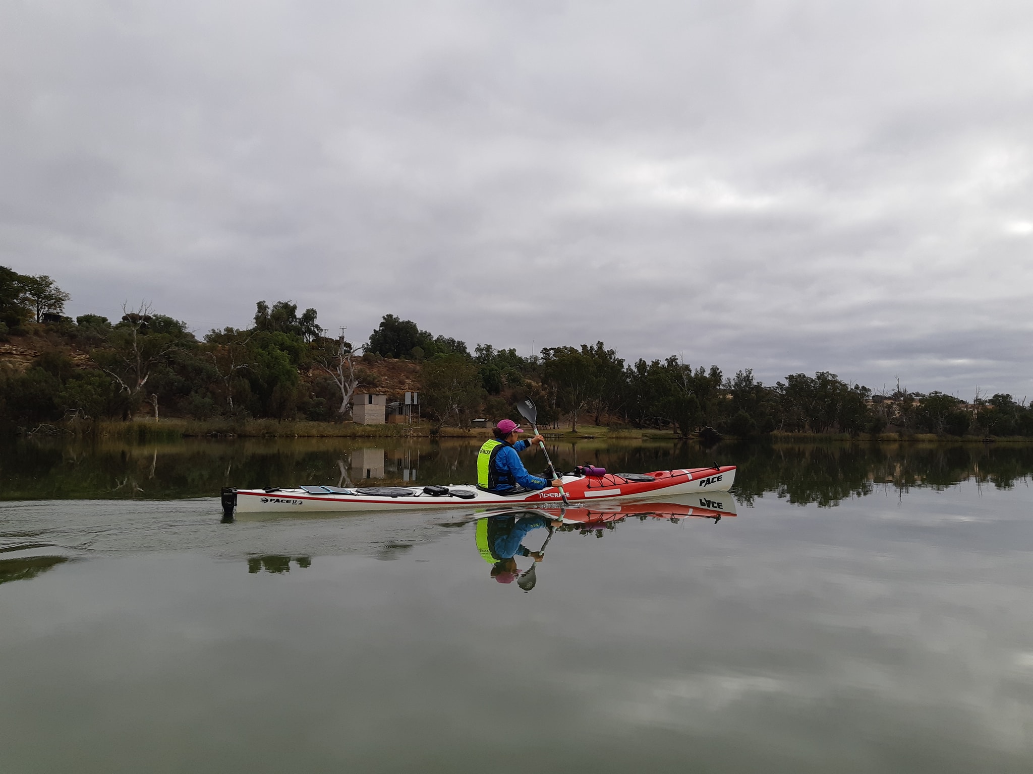
Fridays also mean that people are heading for the riverbank campsites, the same ones we are hoping to finish our day at. It's one thing turning up at a river campsite, finding somebody else in residence and driving on to somewhere else. It's a whole different problem when the campsite is at the ragged end of a 7 hour day of paddling. Continuing on to another site is much less attractive, especially as we don't know when we will come to another. It might be 10 minutes, it might be an hour. The next one might also be occupied. Especially on a Friday.
Our strategy for these days is to have a few options worked out both before and after our best case option. Worked out means looking at the maps, finding reserve areas and then looking for bends in the river which match our learned criteria for what indicates a likely good site.
If we find that our early one is above average,we grab it, a bird in the hand and all that. If we are pushed to our late campsite, the good site bar is much lower. So far we haven't been pushed to go beyond our late option.
As we approached Hogwash Bend, I was struck by the height of the cliffs on the side where we had been expecting to find sand bars. Luckily the cliffs dropped away as suddenly as they appeared and we found the sand bars we were hoping to find. Each one had a caravan parked on it. The fishermen were out in numbers and it was only 12:30.
Continuing around the bend, I was overcome by an itch I couldn't reach because it was in between my bum and the seat, so while Kate continued on, I pulled over into some reeds, climbed out of the boat, stood up, pulled the back of my shorts down and had a good ole scratch. It was then that I noticed the fishing lines scattered along the beach in front of me and the half dozen fisherpeople who had been hiding back in the shadows of the river gums. Another moment of ambassadorship for the sport of kayaking right there. It didn't seem appropriate to ask them how their fishing was going, so I just climbed back in my boat and paddled off after Kate, the itch no longer bothering me.
To assuage our concerns that we might not find a campsite, we started paying more attention to the riverbank spots along the way which might have been suitable if they were in the right spots. There were some which had steep banks, but as the boats are now getting lighter as we eat our way to empty, that's less of an issue. There was one nice big sandy beach on a point, with s big private property sign at the treeline. Another site further along had a gentle grassy bank and a nice clearing around another private property sign.
More signs adorned potential sites as we continued towards Cadell. They had two things in common...
1) they were all posted by the same landowner; and
2) they were all posted close to the water giving the impression that it was all private property.
There are some exceptions, but generally the crown owns all the land on either bank of the river and harbours in South Australia for between 30 and 50 metres. Even if the adjacent kind owner has been allowed to make improvements such as extending their lawn, building a jetty, or a retaining wall to stop erosion, nothing gives them exclusive access to public lands. That doesn't stop some of them acting like they own it.
Back in NSW, they do in fact own it, but in Victoria there were also a few which had encroached so much on the riverbank, that camping on that section of bank would be like camping in a strangers back yard. Weird. There have also been a really surprising number of squatters camps set up on the banks of public reserves and even regional parks. Small structures, seemingly permanent caravans, docks, stairs down to the water. All giving off a very strong "This is MY place" vibe.
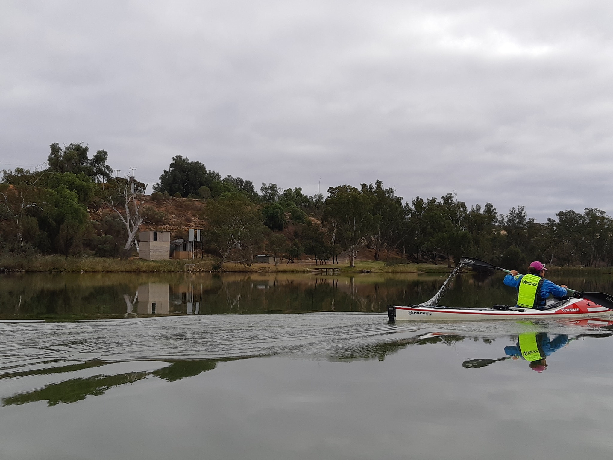
A couple of times we found a spot that had been overlooked by the sign posters, probably not desirable for somebody with a caravan or a houseboat, so they'd escaped attention.
We checked put a few others that were marked as reserve areas on one of our maps, even though we couldn't be sure if it was correct because no other maps showed them as reserves. Nearing Cadell, we had our sights for an early site pinned to a 2km stretch of reserve at the bottom of cliff on the approach to town. We'd been tracking along the opposite bank where we'd found some good candidates except there were already Houseboats moored on them. Friday strikes again.
Beyond the houseboats, the bank became too steep and tall so we crossed to our green reserve, noting that it had vehicle tracks criss-crossing it just beyond the top of the riverbank. Maybe a reserve frequented by vehicles isn't such a prize on a Friday night in the country? Kate's comment that there's nothing mucb to do in Cadell, sealed it for me.
Glancing across the river to a spot which no longer seemed so tall and steep we decided inaccessible by road was a good Friday night campsite criteria. We've pulled the boats up sasmall bank and set up the tent for the night. As we sat having dinner, we watched a group of cars driving around the reserve we'd avoided. The sound of music and teenage voices, floating across the river. Friday night in the country with not much to do..
Tonight is supposed to get down to 2°C which should be good practice for Saturday night which is forecast as -2°C. I just hope it's sunny and not overcast. The solar charger are not keeping up with demand and we will need a night in a caravan park to top up the batteries.
Please donate to our charity if you haven't already. Currently our total is $2800. Our target is $5000 which is just a dollar for each kilometre Kate and I will have paddled between us by the time we reach Goolwa. Tomorrow we grab a package from Cadell - A new poo shovel - and then continue on to somewhere near Blanchetown. Only one week left to go. Unless we get delayed by weather.
29 May 2021 - Day 42
Murray Paddle Day 42 of 48 - Cadell to Woods Flat Landing
Distance remaining 298 km
Total Bridges: 33
Total Locks: 12
Ferries: 5
Location: 34°10.352' S, 139°39.102' E
So first of all, a big thank you to everybody who messaged me with tips on campsites we were approaching today. It turns out that the forecast cold snap for the weekend (-2°C tonight) has seen almost everybody staying home and we've had the river almost entirely to ourselves for the day. Only two powerboats and one jetski disturbed our serenity all day.
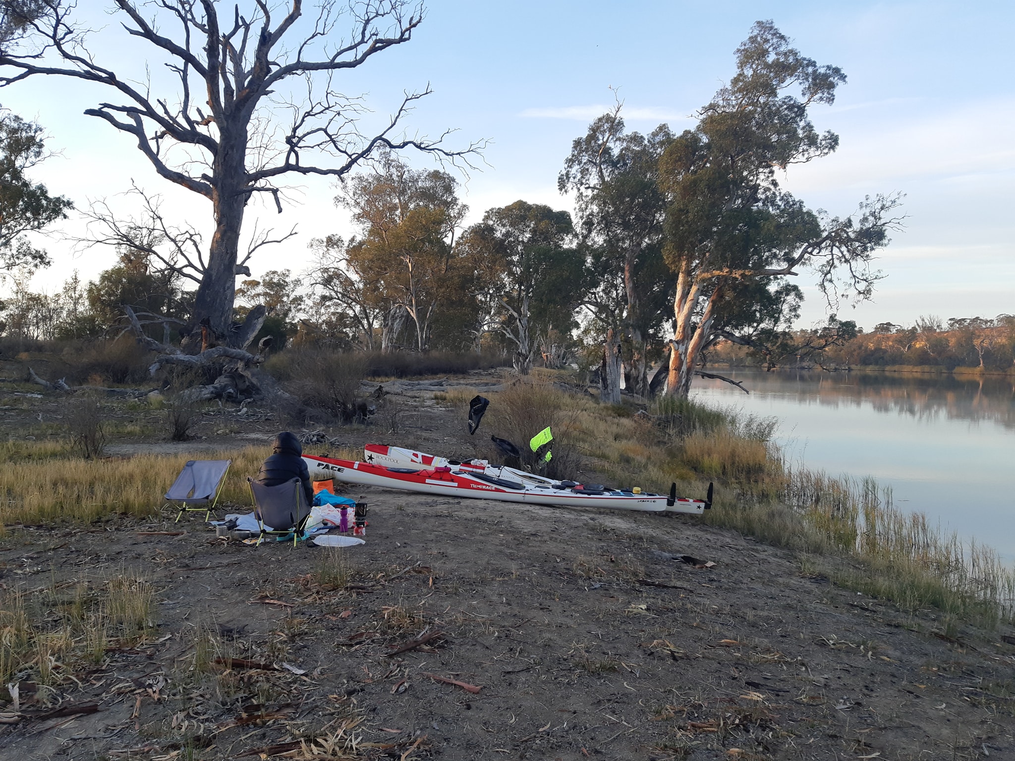
Do you notice how jetskis always seem to home in on kayakers? I'm convinced its because they are subconciously turning towards whatever catches tgeir attention so as soon as they see a kayak, they just careen towards it like a moth to a light. I call it my Tiny Brain theory of personal water craft.
Our first task for the day was to stop in at Cadell and pick up another camping shovel from the Post Shop. This time we went for a more substantial steel shovel which will never be the one we take on a hiking trip, but if we keep breaking shovels, the courier costs will bankrupt us.
You really don't get to see the best face of a town when you pull up in the riverbank behind the water treatment plant and take a dirt track through a trucking depot to the general store and back. We probably owe Cadell another visit when this trip is over. It's supposed to have a very nice fruit cannery too.
Back on the water with our new improved shovel and having injected two meat pies, some candy bars, an iced coffee, and a packet of cashews worth of revenue into the local economy, we passed through the Cadell Ferry and set off for Morgan. Morgan is the finish line for the 200km, 3 day Riverland Paddling Marathon which is due to start back upstream in Berri about the time we finish our adventure in Goolwa. It's a great event, well attended by some good friends and colourful characters from all over Australia. Kate and I have both been struck by how different our experience of the last 200kms has been at touring pace rather than race pace.
Approaching Morgan, we were pleased to see vacant camp sites along the way and WOW are there a lot of holiday homes along the river front after Morgan, they just seem to go on forever. Following on from yesterday's theme of waterfront encroachment. The landscaping is nearly continuous for 10km, and some of the buoldings are so close to the water that another coat of paint would see them encroaching on crown land. But they're all empty. We saw probably four groups of people in 10km and one of those was mowing the lawns.
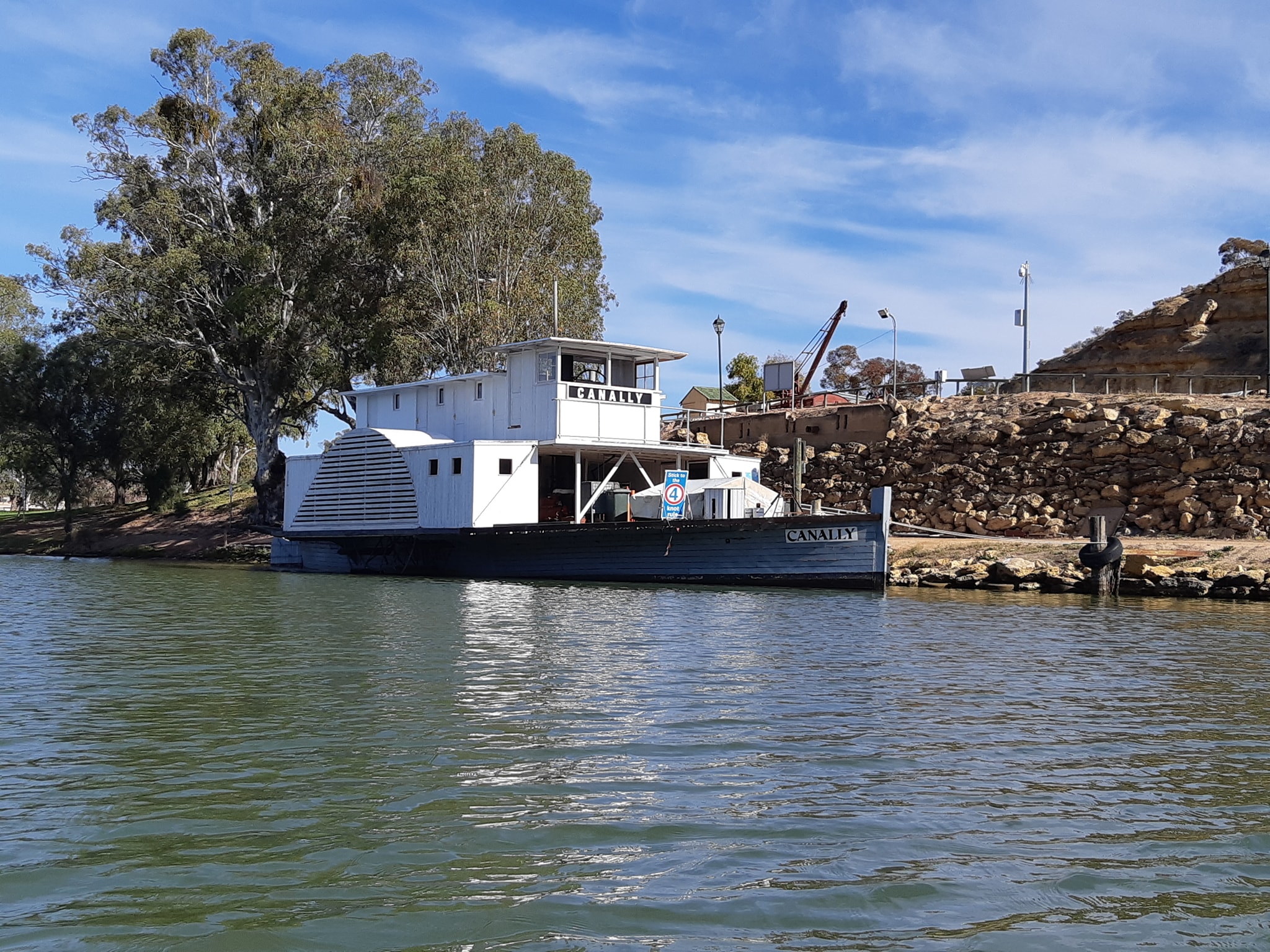
We had started the day with a plan to get to the 289 marker and a campsite we'd been told about, possibly a few kms further, then push on to a caravan park at Punyelroo tomorrow for a shower and laundry stop. By the time we got to Morgan it we were behind schedule and it was apapparent that Kate was having a problem with her shoulder. The long windy days since Katarapko had put some strain on her and today was a cold start with after 500m to walk into Cadell then another cold start from there. The cold was making my shoulder ache as well but while a little ibuprophen got me loosened up. It wasn't enough for Kate. After we cleared the houses beyond Morgan, Kate was determined to push the last 17km to the campsite, but doing the pace maths, we'd have been arriving after 4:30 and if the campsite was occupied we would be giving ourselves a real headache.
We'd just passed a string of landings and clearing when we decided to call it for the day and grab the next usable opening on the riverbank. Naturally we rounded the corner to see a string of moored houseboats hibernating on the right bank, but we spotted an opening on our left which had a clearing snuggled in behind some tall grass.
As far as we saw as we paddled downriver, there wasn't anybody camped in the last kilometre and yet since the birds stopped chirping and squawking, we've been hearing the strains of music blaring down the river... first it was a couple of hours of what sounded like Chinese traditional music and i was wondering if there was a monastery or something nearby.
I've discarded that theory as they've just switched to Queen and We Are The Champions. Although one of my favourite authors had a theory that eventually any CD left in the player long enough would transform into Queens Greatest Hits in some sort of elemental decay. Now we are back at what sounds like Tibetan Nose Music.
Hopefully the short day, an afternoon in the sun with a book, and a good nights sleep will all Kate needs to shake off the shoulder gremlin she's picked up. If not, we'll just have to slow it down and take more time to finish the paddle. It's not like there's any urgency, and it's supposed to be fun, not a death march. Tomorrow will be a new day and we will simply see how far we get.
30 May 2021 - Day 43
Murray Paddle Day 43 of 48? - Woods Flat Landing to Blanchetown
Distance remaining 274 km
Total Bridges: 34
Total Locks: 13 (and done)
Ferries: 5
Location: 34°21.247' S, 139°37.043' E
No plan survives first contact - a saying popularly attributed to Colin Powell because Helmuth van Moltke who originally coined the phrase sounds a little too German for most people. *
Our plan to do 50km a day had survived pretty well for the first 41 days, depending on how you measured it. We cleared at least 50km by river marker count almost every day. We had good days at the start on the fast flowing sections of river from Bringenbrong to the top of Lake Hume.
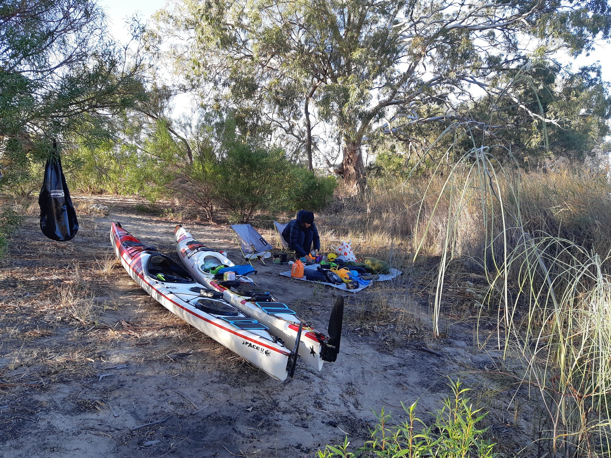
A short day into Albury barely made a dent in the buffer we'd built ourselves. Then we made the most of shortcuts from Albury to Lake Mulwalla. Yarrawonga to Swan Hill was corner cutting country from the Murray Marathon, and we kept it up through the unfamiliar reaches from Swan Hill to Renmark in South Australia, taking a whole rest day in Mildura. We were almost at Loxton before the wind and the drop in current speed finally took its toll on us.
Kate's shoulder seems to be OK after a couple of shorter days. We had our first deeply cold night last night with an overnight temp of -2°C. Our water bottles had ice in them this morning, and Kate slept the night fully clothed inside her sleeping bag. It's tough on her as she doesn't seem to generate as much body heat as I do. It doesn't matter how much you try to insulate with clothing if you aren't generating any heat inside the insulation.
The frost drew in a thick blanket of fog over rhe river which kept the sun from bringing us any warmth until it had burnt away, but not before depositing a layer of dew over all of our exposed gear, which was pretty much everything. It was 9:30 before we finally got the last of the icicles shaken off the tent fly and things dry enough to pack away properly. Kate was nearly in tears as she walked down the still frozen riverbank in bare feet to keep her wetsuit booties dry for the day.
The forecast is for another night of below zero before we reach warmer temps downriver. Once we were on the water we quickly realised that everybody's advice about there being no campsites between Morgan and Blanchetown was well meaning but not accurate for the river in front of us. Once we were past Pelican Point, there were literally kilometers of riverbank campsites on both sides the river. Nobody was camped and there were very few houseboats.
We saw a handful of fishermen and a single houseboat which was on it's way to Blanchetown. We continued to see private property signs and even what appeared to be a 4kn speed restriction sign that somebody had put across the front of their own mooring, presumably to protect their super-yacht from being bumped. As a silent protest, I've taken to emptying my waste bottle upstream of the water intakes of properties displaying the signs.
By lunchtime we were approaching Blanchetown which is the location of Lock 1, the first lock built on the River Murray in 1922, and the last lock of our trip 99 years later. In keeping with the wisdom of Helmuth van Moltke we decided to apply his second guiding principle... as long as you are achieving your objectives the details aren't important**
A quick check of Blanchetown showed us that there was a caravan park on the river 200m below Lock 1. A call to the park confirmed they had a grassy sloping approach suitable for kayaks and a grassy tent spot near the water available for us to use.
Doing our sums on distances, we worked out that if we continued on, we'd be in Mannum, 150km and three days further downriver before our stops lined up with another caravan park (discounting the option of Younghusband after friends told us that the park manager gave them chains to lock up their kayaks for the night). The desire for a hot shower and laundry had already evolved into a more immediate need and three more days wasn't going to work for us.
This might be the last civilisation stop before we cross Lake Alexandrina, but that will depend on the weather when we get there. So after 23km, we passed through the lock having had a good chat with Tommo the lock master on the way down our last 3m drop.
We started our journey 2100km back at an altitude of 266m above sea level (Australia is a very flat country). Passing through Lock 1, we descended to 0.5m above sea level with 274km left to run. For the metrically challenged that's just 19 inches over the next 170 miles. It's flatter than your average pub pool table. By comparison, the Hawkesbury River in Sydney drops 6m over 110km of the Hawkesbury Canoe Classic and everybody thinks that's against the tide.
The water salinity back at Torrumbarry was 90 parts per million. At lock 1 we are up to 270, it has been as high as 500 when water was being discharged from the Darling river system which joins the Murray back around Mildura. We haven't noticed any saltiness in our tea and coffee yet so we are still happy with filtering our water from the river (which isnt going to stop salt).
The water at this point in the river is pretty clear. I can see the end of my paddle in the water, which is a distinct improvement over many sections through the locks as we crossed from VIC/NSW into SA. Incidentally, during border lockdowns SA Water closes Lock 6 and it's manned by police to catch people trying to sneak across the border.
So we pulled up in Blanchetown, described in Wikipedia as "a strange mixture of historic buildings and temporary shacks built by holidaymakers on the banks of the river" which is not far off the mark. It's been dying a slow death since the railway bypassed it in 1876 and probably won't rise from the dead until the waterfront developments from Morgan finally stretch the extra 30km downriver. There's a property investment tip for you, free of charge.
We've had a relaxing afternoon. We've visited every shop in town and bought food at both of them which would put an unsupervised five year old to shame. I felt I had to explain to one shopkeeper that we'd been on the water longer than Noah and had to address some food cravings which had evolved while we'd been out in the wilds.
My final craving is for an Eggs Benedict, but that will wait until Goolwa. I have however started to contemplate what Pelican might taste like.
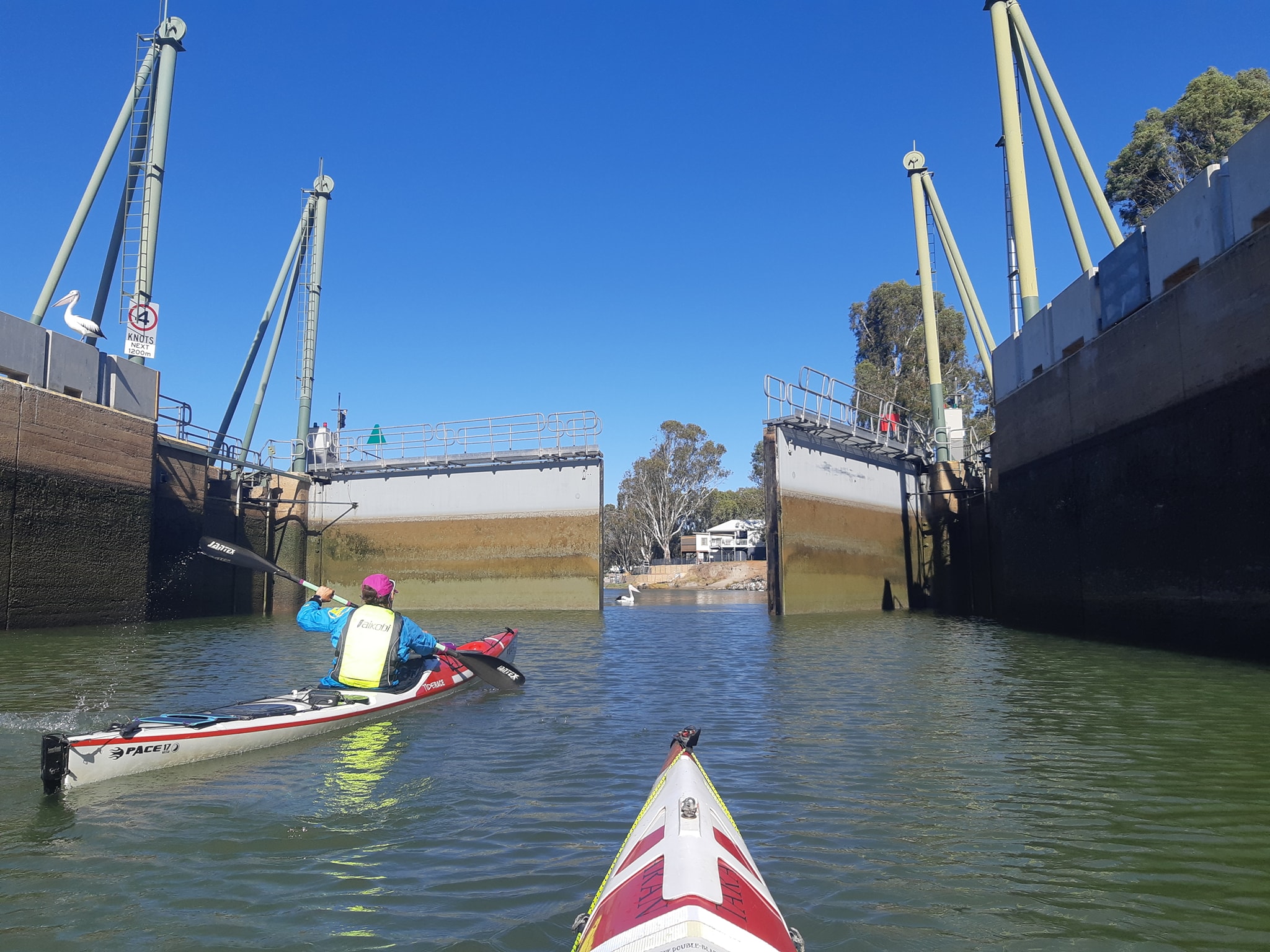
It's now clear paddling out to Lake Alexandrina at around the 64km marker. Not that the locks have been delaying us since we passed through Mildura, the only one that worked on a scheduled half hourly cycle. All the others have been very flexible and and fast. We are usually through in around 10 minutes (Now spare a thought for the poor racers of the RPM next weekend who usually wait more than an hour to get a lockage***). We will probably modify our daily distances from here until the end, paying more attention to how long we are on the water and what sort of resistance we are facing. At least the boats are beginning to get noticeably lighter as the food and fuel diminishes.
As Kate has said to me several times, she's only counting the paddling days and we're still ahead in her books. 48 days was our starting estimate and only really ever applied to how much food, fuel, and toilet paper we packed into our boats and drops along the way. We already had reserves for three days over and we've saved another two along the way. We still have enough fuel for 15 days and the toilet paper should probably see us to the end as long as we fold rather than scrunch.
At this point with 274km to go, 40km a day still gets us to Goolwa in 7 more days. Maybe we will get held up waiting for weather on the lake, maybe we'll sneak around the edge over a few days.
It's the objective that's important, not the details. And speaking of objectives, our fund raising is at $3426 of our $5000 target so please help it along by following the link below.
- it's a very popular quote with management coaches who like to equate business with war. The world's most hated billionaire spent a considerable sum of money teaching me this stuff, and this is what I do with it.
** This one wasn't hijacked by Colin Powell.
*** They also have to wait in the cold of early morning. It's a race for masochists.
31 May 2021 - Day 44
Murray Paddle Day 44 of 48? - Blanchetown to Big Bend Landing
Distance remaining 274 km
Total Bridges: 34
Total Locks: 13 (and done)
Ferries: 6
Location: 34°38.310' S, 139°36.905' E
After going over the top with yesterday's post, today needs to be a little more succinct. Ive got a good book calling me - Erebus, The Story of a Ship by Michael Palin.
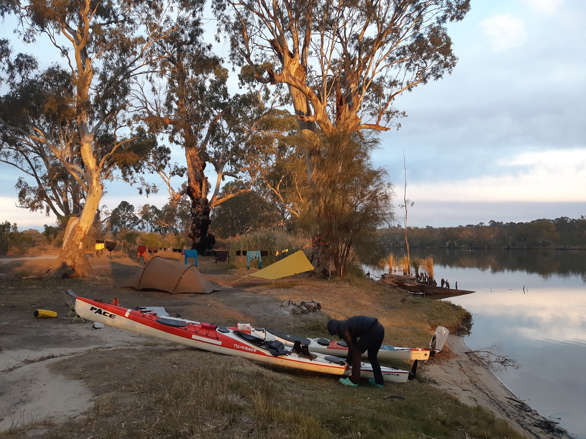
1°C overnight in Blanchetown which was a 3 degree improvement on the night before. The caravan owners with their air conditioners running were very sympathetic to the two scruffy kayakers with the tent pitched in their midst. One offered the suggestion that we should paddle it in summer when it's warm.
On that point, Blanchetown has a permanent population of 250 souls. Are they still souls these days? Perhaps I'm reading too many history books. What if some of them are atheists? Does that still count? Anyway 250 permanent residents call Blanchetown home. In Summer it swells to 2,500 and according to the local store owner, they come for the fishing, the boating, and the drinking. The last two are not so great when you're a kayaker. I've also got a few friends who can turn your average fisherman into The Son of Sam just by paddling past.
The caravan cohort stood at the top of the bank with their hot coffees and watched as we packed our boats, pushed them down into the water and set off into gray overcast day. It's nice to have an audience and share some of the paddling experience with them. Less nice when your boat sucks into the mud at the waters edge and you have to shuffle and scrape to get away from the bank.
The whole day has been overcast. One of those days where you can never really intuit the time of day because there's no sign of the sun peeking through the clouds. A perpetual 5pm day. We've had a light Northerly breeze blowing at our backs as we progress almost exclusively Southward. We are grateful for the slight push its giving us, but it comes at the expense of wind chill on hands and faces. We broke out the pogies again, and they stayed on all day.
For the first hour we tried to see how we'd go if Kate sat on my wash for a while. She was tracking at 8kph by herself and we managed to lift her up to 8.5kph. By morning break she was bored of looking at my rear end and went back to doing her own thing, which was a bit of a relief as I was spending all my time focussed on my GPS trying to hold my speed just right for her.
We made Swan Reach just after lunchtime and passed through Punyelroo shortly afterwards. With the huge number of empty docks and pontoons through this section of the river, it must be a madhouse in summer. Somewhere along the way our River Access Guide Maps have started to deviate from the posted kilometres. Coming into Swan Reach we passed the 248km marker right where our GPS distance said it should be, 26kms from Lock 1 at 274. But the map has that marker reading 151. That's a 3km discrepancy.
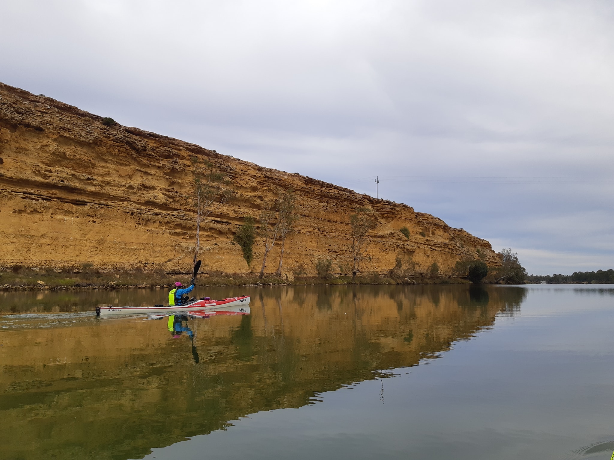
We are now wondering if all of the campsites and towns we've plotted out ahead of us are going to be 3km off, which is around half an hour of paddling when it's late in the day and you're looking for somewhere to camp. We'd earlier planned to stay at the caravan park in Punyelroo, but the change of plan and adoption of a new daily distance had us heading for one of three campsites which we expected to be between 38 and 42km downriver from our start.
Still confused by the misaligned river markers when we arrived at the first camp, we checked the others. Because we'd sourced them from a number of maps, the distances were actually between 38 and 46km. The first was Big Bend Landing. The second was Big Bend Lookout which sounded suspiciously like the top of a cliff and the third was Greenways Landing which Kate was quick to note was directly across the river from a nudists camp. Its probably closed for winter right?
We decided that a good landing spot and a vaguely grassy tent spot in front of us was preferable to a cliff top view 4km away or a goosebumped naturist 4km beyond that. Since arriving, the caravan 100m along from us has started up their petrol generator and we are on the verge of having our food raided by a small marsupial which has just run across my foot on his sixth or seventh attempt at finding a way into our dinner. His first attempts were directed at my bag of toiletries where all he was likely to get was a bar of soap. It's time to eat our dinner before his accuracy improves.
Tomorrow we will push on for somewhere near Purnong. Hoping for a warmer night, less dew and an earlier start. Sometimes it seems that we are as solar powered as our phone chargers and electronics.
1 June 2021 - Day 45
Murray Paddle Day 45 of 48? - Big Bend Landing to Alex Brunacci's favourite campsite at Chukka Bend
Distance remaining: 186 km
Total Bridges: 35
Total Locks: 13 (and done)
Ferries: 9
Location: 34°53.143' S, 139°37.840' E
Whoever produces the Private Property signs for this area must be making a fortune. Fortunately we could ignore 90% of them as we were aiming for a spot 42-48km further downriver which would put us in range of Mannum by the end of tomorrow. From Mannum it's a day to Murray Bridge and another day to Wellington, the gateway to Lake Alexandrina.
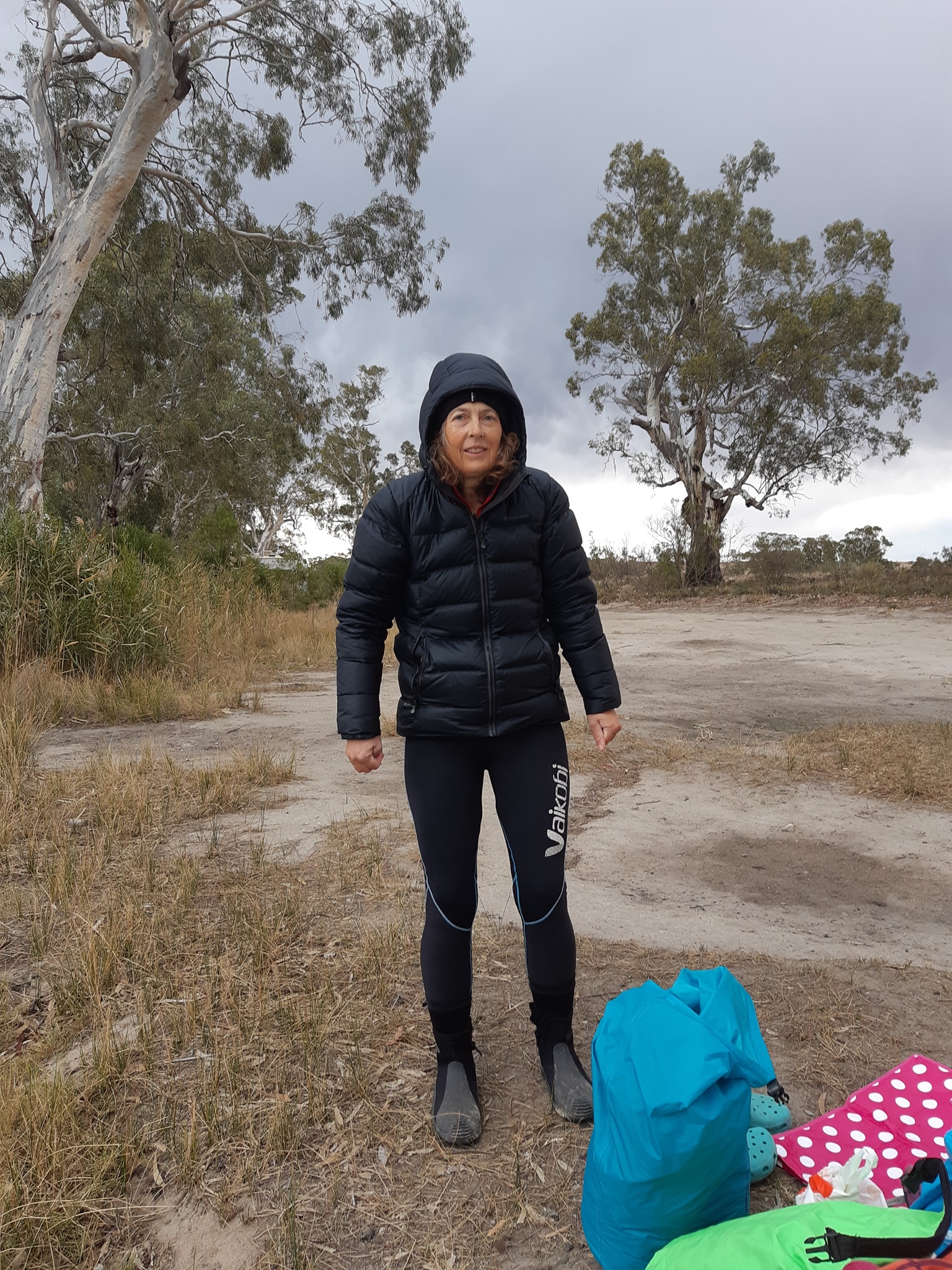
It was another cold morning start. Kate is definitely struggling to overcome the cold. She's switched to warmer gear but it's still lunchtime before she's feeling anything close to warm.
As we started this morning a boat loaded with about 20 schoolkids, probably 8-12 year olds, pulled up across the river from our campsite. So curiosity got the better of me and I went over for a chat. They were on a nature camp. The driver/leader was talking to them about the habitat and conditions on the river so we talked about how the river has changed as we've travelled down from the Snowy Mountains.
The kids wanted to know if we had somebody following us with our suplies and a caravan. They were very impressed when I told them that we had everything in our two kayaks. One boy asked if we slept in our kayaks at night. He'll probably grow up to be a politician. They roared past us a couple more times during the morning and gave us a big cheer each time.
Now I know that after Tasmanians, the residents of South Australia are prone to getting a bit of a hard time from the other states for being a bit strange. They missed out on the convict settler thing, then they received a lot of their immigrants from Germany, who turned out to be resourceful, hard-working, and honest, so you can see how the rest of Australia might think they're a little different. Despite that, I've got quite a few South Australian friends who seem perfectly normal. I can think of a few odd ones (you know who you are) but not disproportionate to the rest of the country... maybe less than Queensland.
That leaves me wondering why, since we've entered South Australia, we been completely ignored by fisherman, river bank campers, and boaties. Boaties just drive by with this blank thousand yard stare on their faces. Fishermen stare intently at their lures, or the bottom of the boat, and campers turn away to stare at some fascinating tree.
I'm seriously starting to wonder if there's something sinister going on. It hasn't been all of them, but it would be 90%. One couple in a boat waved and slowed for a chat as they went past today. Turns out they're from Victoria. I did get recognition from one couple who were parked on the riverbank with a caravan when I asked if they were on private property or a public campsite. The bloke informed me that it was private, they knew the owner, and you had to have a key to camp there. He looked completely befuddled when I said I wouldn't be coming through the gate. His wife was laughing and I could hear her explaining it to him as we paddled away.
Further down rhe river when we had started seriously looking for campsites I spotted a likely looking site and a pair of fishermen in a boat just before it. I decided I'd ask the fishermen if they were local and if the site was private.
As I paddled towards them, they pulled in their lines, started the boat and hared off into a stand of riverside willows where they proceeded to pull the boat backwards into the foliage as I drew closer until only a foot of the bow was left poking out. It was a bright orange boat and I saw them drive it in, so they're not the world hide and seek champions. They were practically parked in front of the spot I'd been going to ask about, but it was so bizarre that after a minute of sitting there awkwardly looking at the bow of their boat, I just shook my head and paddled away.
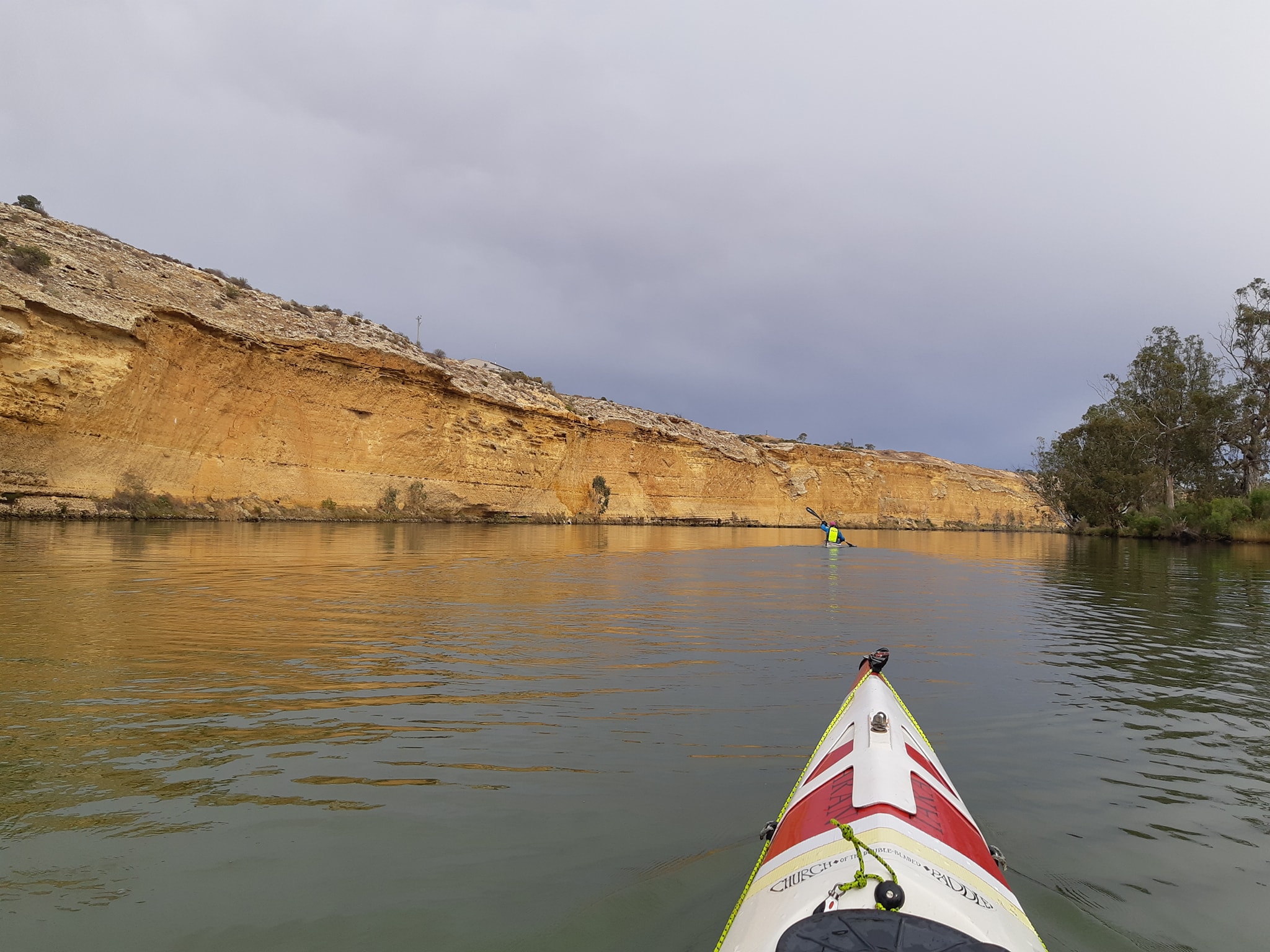
Along with all the changes to the landscape and character of the river, the other change we are noticing is the return of constant mechanical noise. Over the past weeks, we've been in places where the only sounds were birds, wind, and the water. Occasionally we would run across an irrigation pump, but paddle a few kilometres on and it would be forgotten. For the last few days, there's been constant road noise and farm machinery as well as irrigation pumps. The world just buzzes endlessly. I miss the silence.
Last night was also the first time we could see light pollution from a nearby population centre. I don't know what it was but somewhere to the west of us. Of the three camps we'd had preselected today, the encoubter wirh the hide and seek champions put paid to the first one, then Kate vetoed the next one which was beside rhe ferry crossing at Purnong as too much like a carpark, leaving us with our last option that had been suggested by Alex. Alex had given me a GPS location for a site where he used to moor his houseboat.
Now I may have taken Alex's location a little too literally and when I scanned the satellite photos I probably should have paid more attention to the terrain contour lines. His pinned location was on a cliff, not a beach. They look remarkably similar from 100 miles up.
By the time we worked out that he probably meant the Hide n Seekers landing at the entry to Chukka Bend, rather than the exact spot he'd given me, we were so committed to the bend that we either had to grab the next scalable river bank or risk carrying on towards Box Hill as the sun went down.
Fortunately we are becoming quite adept at carving a campsite out of a scrub topped river bank. As it did last night, the sky has cleared after the sun went down and we have a clear view of the stars. Our overnight twmperature outlook is for 5°C which is positively balmy after the last few nights. We might get some rain tomorrow, but just a little.
We should reach Mannum mid afternoon tomorrow. We may push on a little if we can find a likely campsite 5 to 10km downstream.
2 June 2021 - Day 46
Murray Paddle Day 46 of 48? - Chukka Bend to Mannum
Charity total $4100 of $5000 target
Distance remaining: 151 km
Total Bridges: 35
Total Locks: 13 (and done)
Ferries: 9
Location: 34°54.468' S, 139°19.043' E
We woke this morning to the sound of light rain on the tent, which was the encouragement we needed to get up and get moving early. We had a 35km paddle to Mannum where we had planned to free camp on the left bank, but after a few days of being wrapped up in jackets and spraydecks for warmth, I successfully lobbied Kate for a night in the Mannum Caravan Park with showers and a chance to wash our paddling gear.
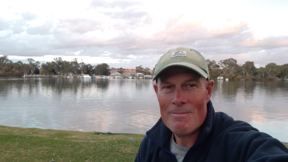
After many days closed up and paddling reasonably hard, my kayaks cockpit could do with soaking from a bucket of bleach. I think I'm going to bury my surf shoes on the beach at Goolwa when we are done. When we set off from our rugged little perch on the top of the river bank, we found ourselves suddenly at Bow Hill where there's a store and a kilometre or so of holiday homes on the waters edge. No private property signs for this stretch, which was surprising.
The whole stretch must be almost vacant for winter as we would have been looking at any house lights from where we spent the night. Continuing down river we spotted a dozen or more campable sites within 5km of our overnight stop. We wouldn't have made them before dark and might not have spotted them in the fading light if we'd been earlier. Yesterday had been a 53km day which is hard work on the flowless drudge water we now find ourselves paddling.
Again, it's a case of taking the campsite you can see rather than hoping for another one that might not be there. But for those that follow, there are plenty of sites in the 5km after Bow Hill. The section of river from Bow Hill to Mannum is essentially one long westward straight with a few slight bends, so the ENE wind behind us had plenty of fetch along the river to push up some small wavelets, giving us a gentle push.
We were cruising along quite nicely, relaxed by the short distance and the sun which had finally decided to come out and do some work. We were even moving fast enough that we were closing slowly on a houseboat in front of us and staying ahead of another small cabin cruiser and a larger houseboat coming downstream behind us.
When we stopped for our morning snack, the cabin cruiser closed up on us and slowed as they got close. I gave them a wave and gestured that they could just throttle up and continue past. Their wake at 9kph wasn't going to bother us. Instead, their bow hatch popped open and a woman emerged with a camera to take some photos of us and have a chat.
Annie and John, from Goolwa have been tracking down the river with us since Lock 6. Some days they've been in front, some days they've struggled to catch us. They were quite perplexed that they've been leapfrogging a couple of kayakers for more than 500km. They're likely to be crossing Lake Alexandrina on Saturday around the same time as us. I had a good chat with them while Kate kept chasing after the houseboat in front.
It's been like that for the whole trip. Kate keeps up a steady relentless pace, like something out of a Terminator movie, while I scurry around like a Fox Terrier* on amphetamines taking photos of things and then putting on the gas to catch up again.
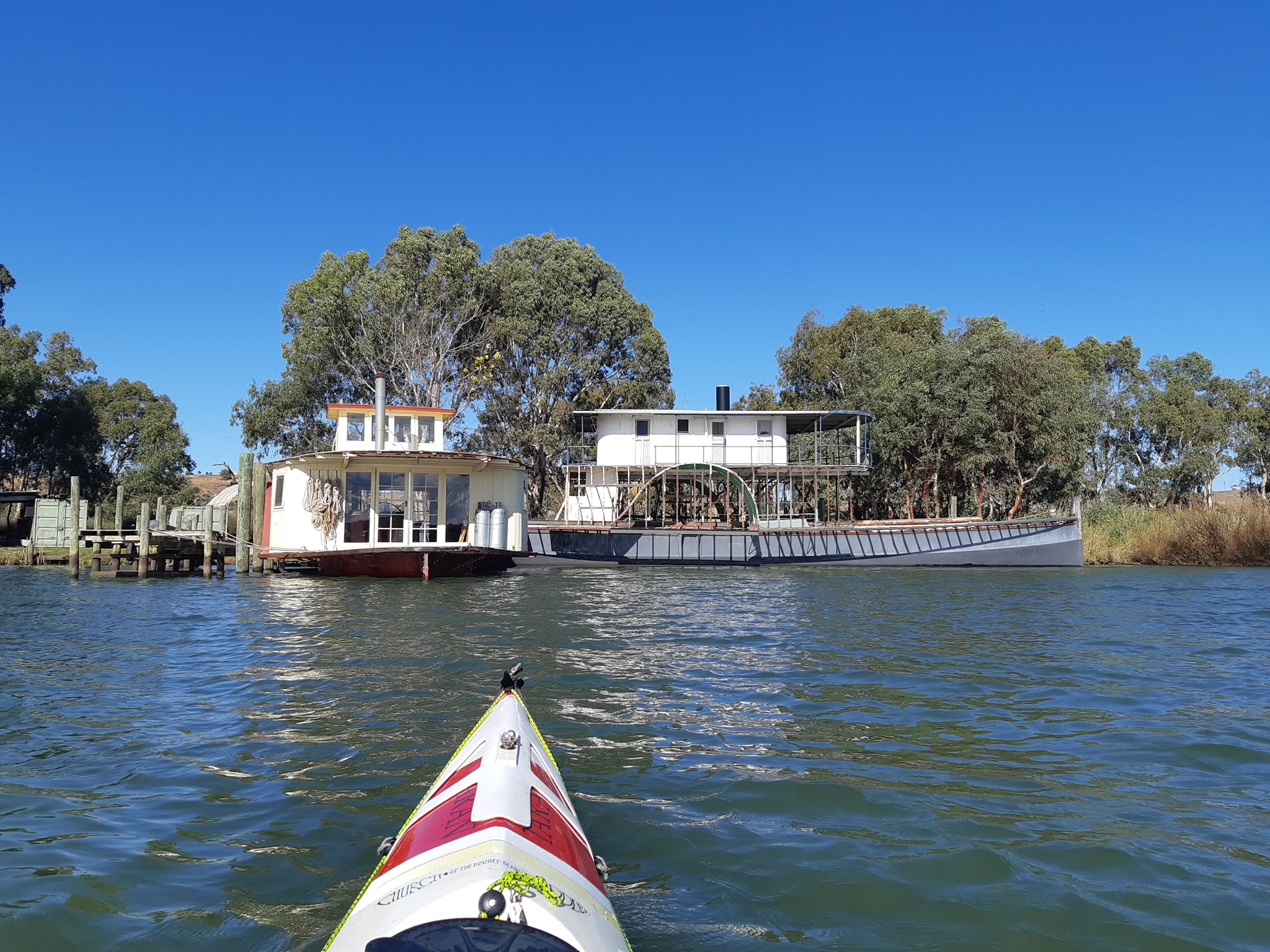
Now that my boat is being emptied of food and extra fuel, it's lighter and faster (I'm also a lot lighter and faster after 6 weeks of paddling). Each day I've done a few sprint sessions to see what top speed would be on that section of the river, a way of measuring what the current speed is compared to the faster flow upstream. The boat getting lighter has actually got me going faster than I was upstream with more current. 11.5kph for a few hundred metres. It hasn't been above 10.5 for a couple of weeks.
By the time we finished chatting about our respective trips, Kate had about a 1.5km lead on me, giving me a good opportunity to stretch out and warm up. As I caught up with Kate, one of the houseboats started to slip past, giving me an opportunity to harvest a little energy from their bow wave. The passengers seemed surprised as a kayak slipped in beside them and fairly effortlessly kept pace with them for a few kms. They were only doing 9kph so it wasn't really a strain.
After the couple of kms, the gap back to Kate was getting a little long, so I gave it some gas and pulled up past the houseboat, just to emphasize that I could go faster, then dropped off to wait for Kate. We've talked about renting a houseboat, but i honestly don't know how the drivers stay awake as they womble down the river at such a soporific pace. I suppose they don't want to slosh their glass of chardonnay.
Annie and John have offered to send through some of their photos, so we should finally have some photos that haven't been snapped from arms length. Predictably, when I called ahead to the caravan park in Mannum asking if they had a low grassy bank, they assured me they did, telling me the approach was via a creek into the wetland bird sanctuary. When we arrived, sure enough there was a low grassy bank, completely enveloped in a wall of reeds two metres high and 20 metres wide. Fortunately the reception staff were happy to move us into an alternative spot which was only 20 metres from the rivers edge across a gentle sloping lawn.
Tomorrow we continue on to Murray Bridge, possibly White Sands, then Wellington on Friday. As we get closer to Lake Alexandrina, we are starting to plot alternatives for the wind strength and direction. Will it be a straight shot across the lake? A scuttling multi day down the eastern shore? Or a series of hops to the west? Only the weather gods know.
- while I like to imagine myself as a lean fox terrier, the early part of the trip was more corgi - lots of enthusiasm and a bit of panting. The trip has had a dramatic effect on my paddle fitness.
2 June 2021 - Day 47 (after)
Murray Paddle Day 47 of 48? - Mannum to Murray Bridge
Charity total $4300 of $5000 target
Distance remaining: 111 km
Total Bridges: 37
Total Locks: 13 (and done)
Ferries: 11
Location: 35°7.943' S, 139°18.045' E
A sleepless night had preceded the decision to withdraw from the river and the combination of the two left us both feeling pretty deflated as we squared away our gear for the 40km paddle to Murray Bridge.
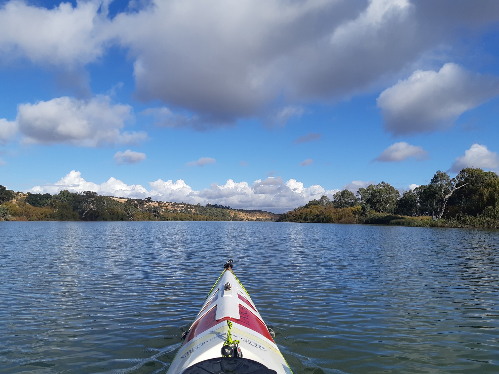
Dawn had broken with a fog so thick that we couldn't see the caravan parked beside us and making the walk to the amenities building and back was done mostly by memory. We'd thought it was raining before we got out of our tent, but the ground was dry, the noise had just been water dropping off the tree above us as the fog condensed, and a liberal splattering of Corella droppings. We hadn't noticed them in the tree last night and they seemed to be wanting some attention.
As the fog cleared on a sunny, calm day and clear blue sky, our decision to abort the lake crossing seemed quite ridiculous. We haven't had a better start to the day since we were back in Renmark. We launched off the beach and immediately came across the Mannum's double ferry crossing. I couldn't help thinking of playing Frogger as a teen and thinking we'd just made it to the next level as the two ferries crisscrossed the river in front of us.
We'd gone about 5km before the real weather came out to play. A southerly wind whistled up the straights at us making progress very slow. A good reminder of what we would have been facing on the lake if the wind turned against us.
For almost the entire day, we paddled alongside a small houseboat which was probably struggling even harder than us to make progress into the head wind.
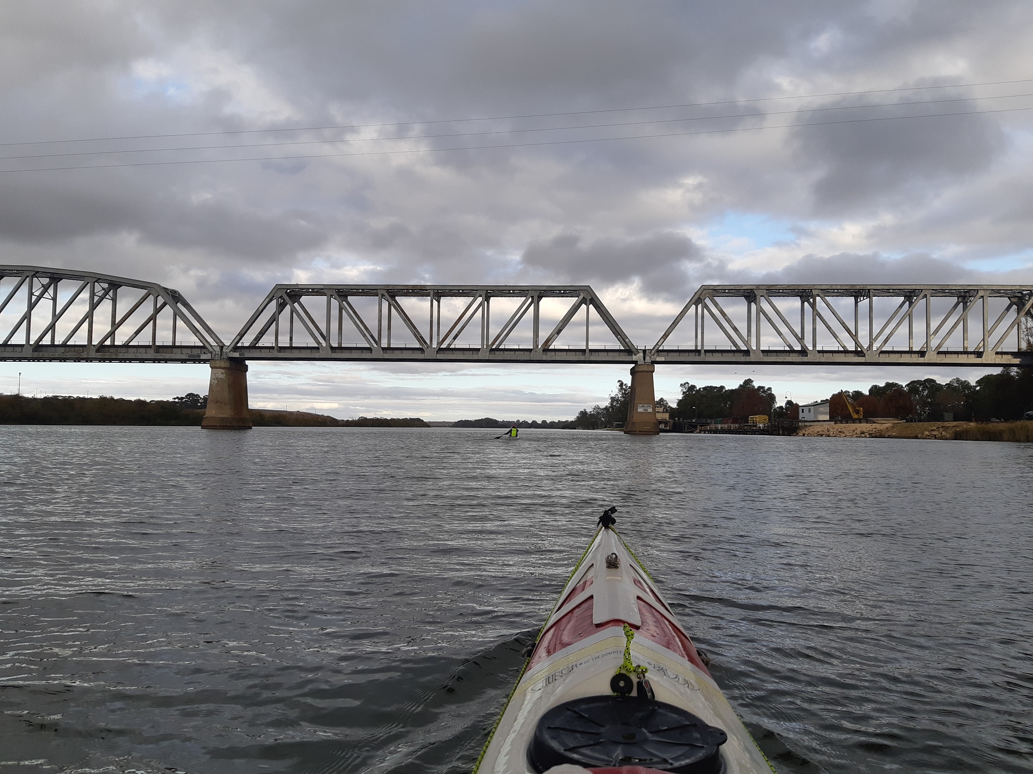
We finally arrived at our Murray Bridge accommodation at 4pm. Luckily we'd organised a cabin for two nights. We need to sort, dry, and stow gear before we head back up to Tintaldra to fetch out truck and camper trailer. We should be back in Murray Bridge in a week. Hopefully there's a viable forecast by then.
Until then, the daily posts will be taking a break with 2314km of the river paddled.
One last observation from the river for everybody who has been following us...
We've noticed that when swans take off from the water they run, one foot in front of the other. Pelicans by contrast flap both feet together as if they're jumping. The little native wood ducks are the funniest, they run like a road runner and can't seem to get off the water until they have reached full flight speed.
[[#Day47b
2 June 2021 - Day 47 (before)
Murray Paddle Day 47 early update.
Overnight we have made a tough decision that we do not have a safe weather window for our crossing of Lake Alexandrina on Saturday.
For the past few days as we have been approaching the lake, we've been scanning the weather forecast for the entry and exit points to the lake.
The accepted safe conditions for a crossing are a window of 10kph winds for a 30km crossing which will take 4 to 5 hours. The crossing is bookmarked by an approach leg and an exit leg making it a 50km day. The only window in the forecast is from 9pm on Friday night.
We would struggle to be in position in time to make that window. The forecast also has the wind speed increasing to unsafe levels if we were delayed in the crossing. The wind conditions are expected to continue to worsen out to the limit of the forecast on Wednesday, five days out. After discussing the conditions with other experienced paddlers, our decision is that we will continue on to Murray Bridge today and then withdraw from from the river.
We are very disappointed, but not defeated.
Hoping for a better opportunity when the current weather system passes, we plan to return to Tintaldra to collect our vehicle, then return to Murray Bridge and the kayaks which will take us maybe a week. If the forecast has improved to safe levels by then, we will return to the river and in the words of Sir Edmund Hillary "Knock the Bastard Off"
11 June 2021 - Day 54
Murray Paddle Day 54 of 48 - Murray Bridge to Wellington
Charity total $6533 of $5000 target
Distance remaining: 77 km
Total Bridges: 38
Total Locks: 13
Ferries: 12
Location: 35°19.805' S, 139°23.008' E
We're back on the river.
Last Thursday we pulled out at Murray Bridge after deciding that the weather we were headed towards on Lake Alexandrina was not safe for a crossing. The forecast worsened as far out as we could see, so there was no expectation that we could sit in Murray Bridge for a couple of days and wait for the weather to improve. It would have been a stop of at least a week with no guarantee that we would get back onto the water.
Because we'd left our truck at the start of the river, we figured that if we were stopping, we had to retrieve the truck and then drive back to Murray Bridge to pick up the boats. That would take 4-5 days and if we detoured through Sydney to see our kids, we'd be back in Murray Bridge about the time the forecast ran out.
If the weather was good when we got back, we'd resume the trip and we'd have moved our truck 1100kms and two state borders closer to our intended finish point in Goolwa. If the weather hadn't improved, we'd give it a last couple of days before packing the boats on the roof and heading for somewhere warm*.
Consistent with the rest of our trip planning**, our exit route back to collect the truck had consisted of checking that there was a bus service to Tintaldra and another one to Goolwa. The two of them connected by a rail service via Adelaide and Melbourne, with the option of flying part of the route.
Our decision to pull out at Murray Bridge had hinged on there being a bus service to Adelaide. If we'd continued 36km downstream to Wellington, we'd have been stranded. It all seemed so simple...
We found a bus service that went from Adelaide to Sydney via Murray Bridge and Albury, where we could connect to the local bus that stopped in Tintaldra. Perfect. We booked tickets and prepared to leave on Friday morning.
Then it all unravelled. Overnight we discovered that although the bus route was through Regional Victoria which had just been released from Covid lockdown, neither SA nor NSW would allow us to cross out of any part of Victoria without a 14 day quarntine stop.
And worse, the bus actually stopped in Regional VIC for passengers and dinner. So we'd fly, but that didn't work because the flights went through Melbourne which was in total lockdown. Ditto for trains.
Quickly cancelling our bus trip, we worked out we could catch a local bus to Mt Barker, transfer to a Metro Bus service to Adelaide, pick up a rental car, then drive around the outside of VIC to the NSW side of the bridge across the Murray to Tintaldra, where the guy who ran the caravan park where we left our truck offered to meet us with our truck so we didn't have to enter Victoria. Not so simple any more.
Two days and 1200km later we had learned that the local bus only took exact change and no credit cards. The metro bus doesn't take cash or cards, and we each had to buy a metro bus pass at the local shops, then catch the next bus at a different stop. The next metro bus driver was happy to let passengers without passes ride for free, until the ticket inspector boarded the bus and booked them for fare evasion.
We made it to Adelaide 2 hours late and 20 minutes before the rental car office was due to close. Then we discovered that they wouldn't accept my license paired with Kate's credit card.
The rental was a very nice Subaru Outback which had lots of vroom. It also had excellent cruise control with following distance sensors. Not so great were the lane assist sensors when combined with some of the narrow country connector roads that Google Maps sent us through as we determinedly stayed out of VIC.
If you've followed our journey you'll know that the NSW VIC border follows the Murray with many towns being twinned on either side of the river. Having now driven the roads along both the VIC and NSW sides of the border, the VIC roads are much, much, much better.
In the middle of all of this, the manager of our charity, Coast Shelter, called us to express her gratitude for all of the donations that have been received since we started our adventure. The fund raising total is now $6533, exceeding our target of $5000. Thank you to everybody who made a donation.
We arrived at our pickup point on Sunday afternoon to find that the refuel point we'd been banking on for the rental, which was now running on fumes, is closed on Sundays. The two nearest open service stations were in VIC, or we could head in the opposite direction to Tumbarumba for fuel that didn't come with a bonus 14 day quarantine.
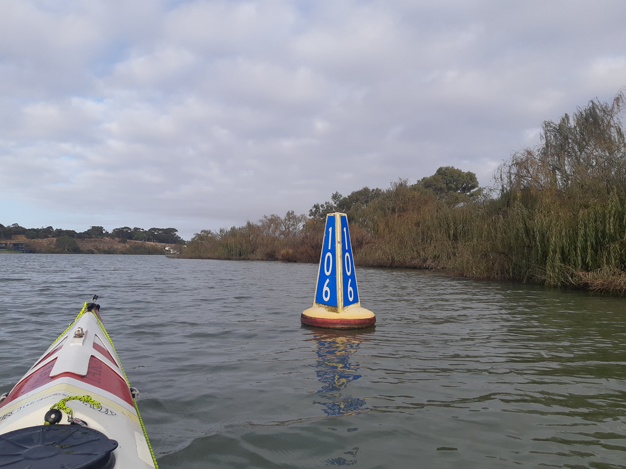
We dropped the rental off in Albury with about 20 minutes to spare. I think we may have seriously depleted it's supply of vrooms.
We finally arrived in Sydney on Monday afternoon after 3 days and 1200km.
Monday and Tuesday were a rollercoaster ride of picking up things we needed to continue our trip once the Murray paddle is over. We collected our double sea kayak, which we intend to race in this year's Hawkesbury Classic. We picked up some new roof racks, because the double means we will have three sea kayaks with us for the next few months. And we restocked the truck with food, because while it was parked up for seven weeks mice found their way in and eaten into all of our camping supplies.
We also stopped in at our storage unit and collected a bunch of gear which we hadn't thought we'd need until we found we were possibly crossing a large volatile lake in the dark***.
By mid day Tuesday, we had a message from Alexandrina weather watcher Brad Butler that there was a new weather window opening on Saturday.
Hitting that window meant we had to leave Sydney on Wednesday, drive 1200km, across two state borders, back to Murray Bridge to be back on the water on Friday morning. Friday would be a paddle from Murray Bridge to the final staging point at Wellington from where we would leave early and be at the entrance to Lake Alexandrina as the winds start to drop on Saturday morning.
We had a small moment of panic when we discovered that a Covid positive woman from Melbourne had passed through the Caltex service station in Narranderra on the same day we fuelled up there, but luckily we went to the BP. It's mind boggling to think how far a contact would spread from a chance encounter in one of these outback crossroad locations.
And that's how we find ourselves in Wellington on a Friday afternoon, with our boats pulled up in the lawn of the Wellington Hotel, contemplating an early start tomorrow for a lake crossing.
So we're back!
- based on Kate's response to more cold days, the surface of the Sun is a possible holiday destination.
** planning has generally consisted of "surely that will work" and "we'll worry about that when we get there"
*** flares, strobe beacons, chemlights, VHF radios, the sort of stuff you don't generally need on a river
12 June 2021 - Day 55
Murray Paddle Day 55 of 48 - Wellington to Hindmarsh Island\\
Charity total $6633 of $5000 target
Distance remaining: 11 km
Total Bridges: 38
Total Locks: 13
Ferries: 13
Location: 35°30.182' S, 138°48.827' E
We've spent a week waiting for safe weather to cross Lake Alexandrina. On Gayle Edith's advice, we even sacrificed a chicken to the weather goddess last night to ensure a safe passage.
Why is this lake such a problem? In a nutshell, because it's large and shallow, and surrounded by low terrain. So when the wind blows across it, there's lots of what meteorologists call wind fetch, or just "fetch", which is all about how far the wind can blow unobstructed across the surface of the water. The greater the distance, the more energy gets transferred to the water in the form of waves. On Alexandrina, the wind waves can be particularly nasty.
John and Annie who took photos of us last week from their launch described their crossing of the lake as... "...a rather rolley crossing with a north-west 12kn wind producing a half meter wave on our side for the first 3 hrs then a 20k westerly on the nose for the rest of the way to Clayton with 1m waves that washed all the river mud off the boat." They were crossing the lake in a launch that probably does 25kph. We paddle along at 8kph, so we'd have been out there for much longer.
Walking down to our kayaks this morning from the hotel where we spent the night, the sacrificial chicken had clearly been worth the investment. It was going to be a long day. Too long for head winds and bad weather.
The plan for the day was broken into three legs.
The first leg was 13km on the river from Wellington to Pomanda Island. We were on the water at 7:30 and progressed down the river at roughly the same speed as a pair of fishermen checking their nets. They were being pursued by a flock of about 30 Pelicans which would wait for any unwanted fish to be discarded before taking off and racing ahead of the fishermen so that they could jostle for the best position at the next net in the sequence. It was quite surprising to see the pelicans arrive at the nets a minute or so ahead of the fishermen. Obviously this is a regular event.
We got one final Murray River don't-trust-the-maps moment as we reached Pomanda Island to find that a) it's not an island, being connected to the mainland by a barrier of sand and marshlands; and b) it extends well to the east of where the maps place it.
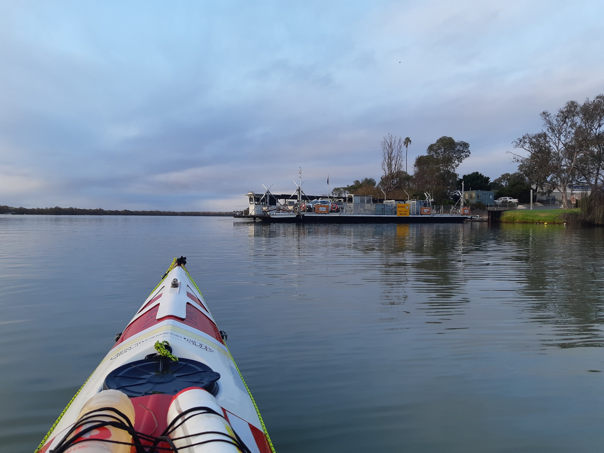
At one stage, we'd contemplated a night crossing of Alexandrina to take advantage of the last window of low wind speed before the front arrived**. It would have been a very dark night with cloud and almost no moon. I would almost certainly have plotted a course on my GPS with a waypoint at Pomanda Island. That course would have run us into a wall of two metre tall reeds which extended for a couple of hundred metres (further than a torch would shine) in either direction.
Brad Butler had suggested camping on Pomanda Iskand as a staging point for the lake crossing. It was outside our range yesterday against a head wind, which was why we stopped 13km back at Wellington, but it's definitely a good option for future paddlers. There's even an old abandoned homestead that might help break the wind for a night in a tent.
Approaching the second leg, the 23km crossing of Alexandrina itself from Pomanda to Point Sturt, we were greeted by an enormous mirror flat body of water with no land on the far horizon. The sky merged with its own reflection on the lake.
Our crossing under these near perfect conditions would take between 3.5 and 4 hours. For most of the crossing we saw no other boats, even though it's a long weekend. The two boats we saw were kilometers away near the shoreline on either side. We watched them pass, and then 10 or 15 minutes later a handful of waves would cross our path as thier bow waves travelled across the lake. It was seriously that calm out there.
With the boats gone, the silence out on the lake was broken only by the sound of our paddles. We used our GPS to project a bearing towards Point Sturt across the expanse of nothingness. While we had a shoreline 5-6km to our left and a distant shoreline to our right, our destination was so far off that we were aiming for an invisible point somewhere left of the middle of the nothing that was the horizon.
Normally, we would use the GPS bearing to line up on a distant point and then paddle to that point, checking the GPS every 10 minutes or so. It's not natural to paddle with your head down looking at a GPS positioned above your knees.
But our destination point was a big expanse of nothing for about 15 degrees either side of our heading. So we stared at our GPS screens for about half an hour, until thanks to the good visibility, we caught our first glimpse of Point Sturt on the horizon. it was still 22km away. But now we had a point we could paddle towards with our heads up.
We paddled towards that point for the next three hours. Three hours. It's a long time to paddle towards something that isn't getting appreciably larger. It's a long time to spend considering why you felt that bypassing the lake was somehow not in the spirit of the endeavour***.
We had lunch in the middle of the lake.
At various stages we wondered whether the clouds on the horizon were somehow ominous, and what we would do if a weather front suddenly materialised. Even our fastest route to the shore would have taken more than half an hour to cross to safety. At times we longed for a little wind and a few waves to break the monotony, then quickly decided that a little excitement would continue for a very long time out there.
We had a competition to see who could make a jelly bean last the longest. It was a draw at 25 minutes. We ate Kate's ginger travel sickness lozenges simply for something to do. We probably would have played I Spy if there was anything to spy.
The boredom-meter was seriously over in the red which is probably why we decided as we rounded Point Sturt, having already done 40km for the day, our third and final leg for the day would be another 20km to Hindmarsh Island rather than 10km to Clayton. The grind had worn us down and we wanted tomorrow as our last day to be a nice short 10km to the mouth of the Murray River then back to Goolwa for a celebratory lunch and adult beverage(s).
After the long straight bearing across the lake, we had several channels to navigate on our way from Point Sturt to Clayton. The distances across the water, the low terrain, and the narrow channels made visual navigation quite difficult. We had no trouble using our GPS maps to set course bearings for the various channels around the islands, but most times we would have been blindly searching for a passage where overlapping shorelines gave no hint of the open channel.
We reached our destination at 4:40pm, having called ahead from the water as we passed Clayton. We paddled 61km in 9 hours.
Tomorrow, after a bit of a sleep in, we will do an out and back run through Goolwa and the final lock to the mouth of the Murray River.
Hopefully tomorrow will instill some sense of completion in us that today's long crossing seems to have stolen. Or maybe it's just that we are reaching the end of our long intimate relationship with the river and this is a natural part of the separation that must now happen. Something to sleep on, I think.
 * I ordered a delicious stuffed chicken breast at the Wellington Hotel.
** sage advice from Rob Mercer... "never try to race a front"
** the people who keep the register of paddlers who have completed the full distance actually don't require you to cross the lake. You can portage from Wellington to Clayton and still get a certificate
13 June 2021 - Day 56
Murray Paddle Day 56 of 48 - Hindmarsh Island to Murray Mouth
Charity total $6666 of $5000 target
Distance remaining: 0 km
Total Bridges: 39
Total Locks: 14
Ferries: 13
Location: 35°30.182' S, 138°48.827' E
As we paddled towards Murray Mouth, where the river meets the sea I asked Kate how she felt after paddling 2425km from Bringenbrong to the sea. "Cold" she replied. Not quite the inspirational quote I was hoping for.
Our adventure ended today with a 13km paddle from Hindmarsh Island, past Goolwa, through the final lock in the barrage, and out along the sand spit to the narrow break in the dunes where the river meets the sea.
We paddled until we reached the narrow opening where the outgoing river met the incoming sea and stopped when the ocean waves touched our bows. We pulled the kayaks up on the sand. We had an energy bar each, then got back in our kayaks and paddled back to the caravan park where we are staying.
After so many days on the river, it feels like there should be some moment of joy at the end. A sense of satisfaction at the completion of a challenging task. Maybe a moment of sadness as we crossed the finishing line of our journey...
But no. Nothing.
Perhaps a sense of relief, or maybe even release from the self-imposed obligation to continue another day towards a goal that has lost its meaning now that we are close enough to finally touch it? A fictional character would surely be struck by an emotion or moved to a tear as they reached the end of their quest. Wouldn't they? Why not us?
The best part of today was seeing the bob* of seals playing at the river mouth and having one young seal try to climb onto the back of my boat. After weeks of being fascinated by the pelicans, they've been completely usurped by the seals.
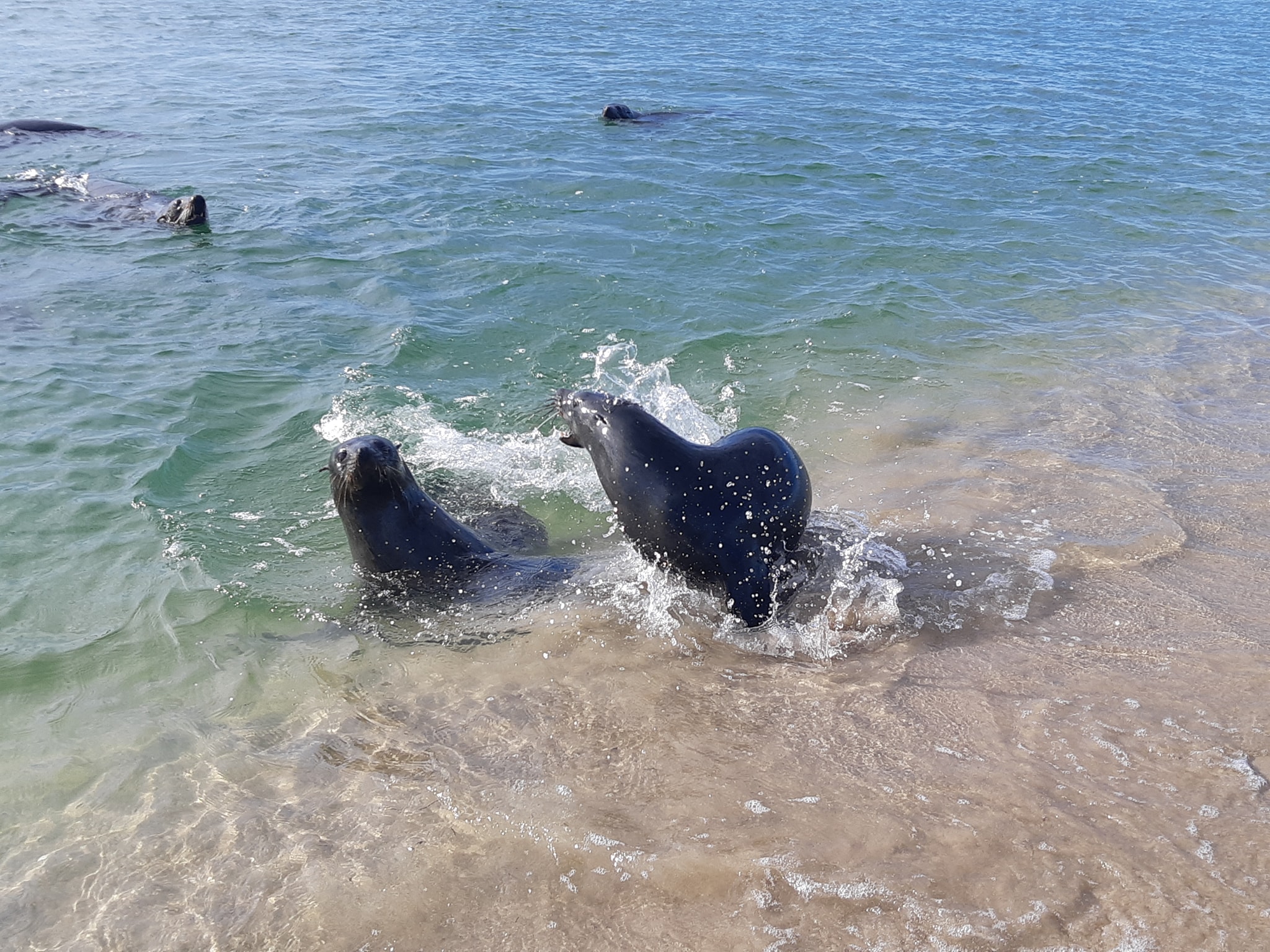
Reflecting on this tonight, I'm starting to understand that we've been too busy anticipating the full stop which merely punctuates the story we've been entwined in for the past eight weeks. Over that eight weeks, we faithfully executed our plan as a path to the sea, but it was the path rather than the destination that made it worthwhile. It's been a tremendous experience, and while I can't say we'd rush to do it all again, there are parts of the river which we would like to revisit.
The lively upper sections from Bringenbrong to the start of Lake Hume, and Albury to the top of Mulwalla were great fun with pace and twisting flows. And the multi-day section from Mildura to Renmark, through the Murray Sunset National Park and across the borders into South Australia would be as pristine, remote, and untouched as any part of the country can be these days.
The reservoir lakes and Lake Alexandrina, we'll leave those for somebody else.
Returning from the mouth of the river, we were formally greeted in Goolwa by Frank Tuckwell and the members of the Inland Rivers National Marathon Register. The IRNMR team maintain the official list of all those who traverse the River Murray between Goolwa and the South Australian border. The register has been running for 60 years.
Today we became the 411th party to be added to the register and the 10th for 2021.
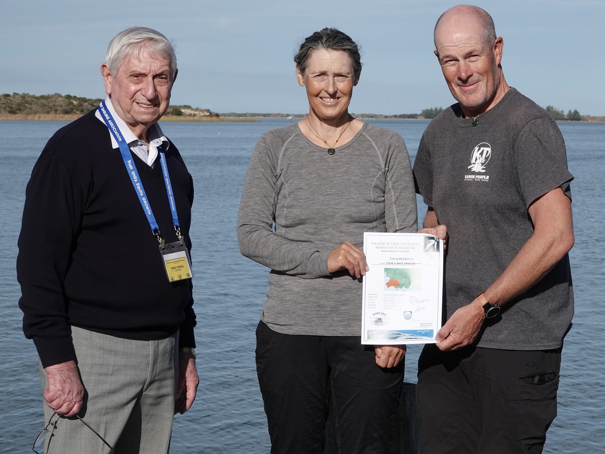
Thank you to everybody who has followed our progress, providing encouragement, advice, or motivation along the way. I hope that you've enjoyed the daily updates. Special thanks to Greg N Bernie Cairns and Bernadette Thompson Greg Cairns ** who pledged the donations that blackmailed me into raving like a lunatic every day for eight weeks. Thankfully the journey has ended before I had to venture into my emergency list of blog topics***
I did have one thought that I did want to end with...
Ian Wrenford sparked a conversation early in the journey about how I would document the trip. I know there are other river travellers who are packing GoPros and drones to capture video of their journey down the river. Without judging their approach in any way, I made a deliberate decision at the start of the trip to leave my cameras behind and be immersed in the experience of the river rather than trying to capture it through a viewfinder. A good number of people have commented on and liked my daily photos, but they were merely snatches of scenery with my phone camera at moments when the light was right, or the composition was balanced.
If you're contemplating a journey like this, my advice would be to allow yourself to be enthralled by the nature and the scenes around you and don't be distracted by the need to capture the perfect Instagram moment for people who aren't there to see it for themselves. Unless that's your thing. If it is, enjoy.
You can choose to spend 10 minutes trying to set your shutter speed and focus your camera on the dazzling azure kingfisher as it darts between the branches of a willow, or you can spend that same time marvelling at its agility and the way the light shimmers across its metallic blue wings. The photo will rarely match the experience if you pay attention.
While I shared some photos each day, they were just 8 to 10 seconds snatched out of a day. They almost always failed to do it justice and there was so much which you never saw.
The scale of the journey is probably the most difficult thing to convey. When I posted a photo of a clay cliff banded by seams of white, what you don't see is that we were still paddling beneath it an hour later.
So now, for the final time, goodnight.
 * a bob is the collective noun for a group of seals. So there you go, you've learned something today. Also a herd, pod, rookery, colony, or harem.
** our very good friends, Greg and Bernie Cairns. After knowing them for six years I still can't tell which is which on Facebook.
** it was always going to be difficult to communicate the difference between peeing in the boat and peeing in the boat.